TopoQuest Logo
Do you find TopoQuest useful?
Help keep TopoQuest running and adding new maps/features by donating!
Bitcoin:  19c7KJd3qBynnjoSw5npx9KScwjBe4ifkT
Litecoin:  LXs6TkuXGGXo1vDsWCkWVdjQX94eUKd6ui
Home View Maps Find Maps Find Places Resources & Links


Daisetta, Texas Topographic Map

USGS Map Title: Daisetta, TX
USGS Map MRC: 30094A6
DRG (GeoTIFF) Download: o30094a6.tif


Neighboring USGS Topographic Map Quads:


  Capers Ridge, TX  
30094B7
 

  Hardin, TX  
30094B6
 

  Thorson Gully, TX  
30094B5
 

  Liberty, TX  
30094A7
 

  Daisetta, TX  
30094A6
 

  Devers, TX  
30094A5
 

  Moss Bluff, TX  
29094H7
 

  Shiloh, TX  
29094H6
 

  Whites Bayou, TX  
29094H5


Map MRC Location:

N31°
W95°
N31°
W94°
H8 H7 H6 H5 H4 H3 H2 H1
G8 G7 G6 G5 G4 G3 G2 G1
F8 F7 F6 F5 F4 F3 F2 F1
E8 E7 E6 E5 E4 E3 E2 E1
D8 D7 D6 D5 D4 D3 D2 D1
C8 C7 C6 C5 C4 C3 C2 C1
B8 B7 B6 B5 B4 B3 B2 B1
A8 A7 A6 A5 A4 A3 A2 A1
N30°
W95°
N30°
W94°

Daisetta, TX USGS 1:24K Topographic Map Preview:
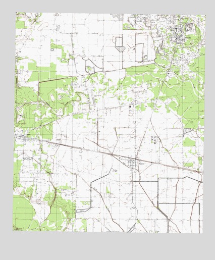
Daisetta, TX USGS Topographic Map
Click on map above to begin viewing in our Map Viewer.

This topographic map contains these locations and features:
Feature Name Type Latitude Longitude GNIS ID View Map
AmesPopulated PlaceN30.0538°W94.7435°1329493View Map
Ames CemeteryCemeteryN30.0463°W94.7494°1329494View Map
Ames City OfficeBuildingN30.0569°W94.7471°2753247View Map
Ames Community Volunteer Fire DepartmentBuildingN30.0540°W94.7433°2334799View Map
Berean Tabernacle Baptist ChurchChurchN30.0508°W94.7277°2470675View Map
City of AmesCivilN30.0451°W94.7373°2409698View Map
City of DaisettaCivilN30.1135°W94.6426°2410285View Map
Cow IslandPopulated PlaceN30.0113°W94.6627°1377125View Map
DaisettaPopulated PlaceN30.1133°W94.6430°1333877View Map
Daisetta City Municipal BuildingBuildingN30.1128°W94.6449°2753281View Map
Daisetta Police DepartmentBuildingN30.1128°W94.6449°2375822View Map
Daisetta Post OfficePost OfficeN30.1129°W94.6450°2731411View Map
Daisetta SwampSwampN30.1186°W94.6570°1333878View Map
Darrell Airport (historical)AirportN30.0474°W94.7252°1384044View Map
Davell Airport (historical)AirportN30.0502°W94.7419°1377140View Map
Frige SettlementPopulated PlaceN30.1127°W94.7169°1377126View Map
George W Maxwell LeveeDamN30.0019°W94.6469°1861948View Map
George W Maxwell ReservoirReservoirN30.0019°W94.6469°1861949View Map
Gillard-Duncan HouseBuildingN30.0819°W94.7402°2031116View Map
Hull - Daisetta Volunteer Fire DepartmentBuildingN30.1196°W94.6462°2655692View Map
Liberty County Constable's Office Precinct 2BuildingN30.1150°W94.6447°2751417View Map
Liberty County Emergency Medical ServicesBuildingN30.1181°W94.6459°2720871View Map
Liberty Municipal AirportAirportN30.0778°W94.6986°1387081View Map
Long Island CreekStreamN30.0772°W94.6274°1340478View Map
Magnolia Ridge Country ClubLocaleN30.0660°W94.7463°1384421View Map
Moore SettlementPopulated PlaceN30.0447°W94.6419°1377127View Map
Norman HouseBuildingN30.0819°W94.7402°2031816View Map
Oak Dale CemeteryCemeteryN30.0880°W94.6388°1342957View Map
RaywoodPopulated PlaceN30.0419°W94.6721°1344861View Map
Raywood Post OfficePost OfficeN30.0419°W94.6719°2732081View Map
Raywood Volunteer Fire DepartmentBuildingN30.0400°W94.6714°2334535View Map
Rock IslandPopulated PlaceN30.0688°W94.7010°1378967View Map
Sacred Heart ChurchChurchN30.0730°W94.6705°1345818View Map
Sam Houston Regional LibraryBuildingN30.0819°W94.7402°2014555View Map
Tri-County Air ServiceAirportN30.0459°W94.7058°1387382View Map
WoodsonPopulated PlaceN30.0724°W94.6744°1379293View Map

Note: Coordinates in the location and feature list above are referenced to NAD83 datum.


Copyright (C) 2008-2024 Ryan Niemi / Sunset Dynamics ... All Rights Reserved