TopoQuest Logo
Do you find TopoQuest useful?
Help keep TopoQuest running and adding new maps/features by donating!
Bitcoin:  19c7KJd3qBynnjoSw5npx9KScwjBe4ifkT
Litecoin:  LXs6TkuXGGXo1vDsWCkWVdjQX94eUKd6ui
Home View Maps Find Maps Find Places Resources & Links


Lastrup NW, Minnesota Topographic Map

USGS Map Title: Lastrup NW, MN
USGS Map MRC: 46094B2
DRG (GeoTIFF) Download: o46094b2.tif


Neighboring USGS Topographic Map Quads:


  Baxter, MN  
46094C3
 

  Brainerd, MN  
46094C2
 

  South Long Lake, MN  
46094C1
 

  Fort Ripley, MN  
46094B3
 

  Lastrup NW, MN  
46094B2
 

  Shephard, MN  
46094B1
 

  Belle Prairie, MN  
46094A3
 

  Freedhem, MN  
46094A2
 

  Lastrup, MN  
46094A1


Map MRC Location:

N47°
W95°
N47°
W94°
H8 H7 H6 H5 H4 H3 H2 H1
G8 G7 G6 G5 G4 G3 G2 G1
F8 F7 F6 F5 F4 F3 F2 F1
E8 E7 E6 E5 E4 E3 E2 E1
D8 D7 D6 D5 D4 D3 D2 D1
C8 C7 C6 C5 C4 C3 C2 C1
B8 B7 B6 B5 B4 B3 B2 B1
A8 A7 A6 A5 A4 A3 A2 A1
N46°
W95°
N46°
W94°

Lastrup NW, MN USGS 1:24K Topographic Map Preview:
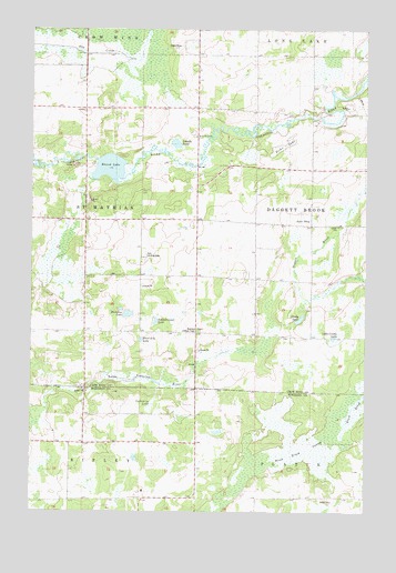
Lastrup NW, MN USGS Topographic Map
Click on map above to begin viewing in our Map Viewer.

This topographic map contains these locations and features:
Feature Name Type Latitude Longitude GNIS ID View Map
Ashenbrenner LakeLakeN46.1744°W94.2036°639473View Map
Black Brook SwampSwampN46.1414°W94.1436°640207View Map
Brainerd Lookout TowerTowerN46.1716°W94.1869°1815001View Map
Crody LakeLakeN46.1751°W94.1496°642445View Map
Crow Wing ChurchChurchN46.1861°W94.1672°642508View Map
District Number 112 and 148 SchoolSchoolN46.1530°W94.1878°642827View Map
District Number 19 SchoolSchoolN46.1852°W94.1661°642833View Map
District Number 39 SchoolSchoolN46.2216°W94.1450°642835View Map
District Number 49 SchoolSchoolN46.2372°W94.1889°642836View Map
District Number 84 SchoolSchoolN46.1858°W94.2047°642840View Map
Fuchs LakeLakeN46.2192°W94.1578°643983View Map
Hagen-Arnestad CemeteryCemeteryN46.2444°W94.1583°2071537View Map
Hampton LakeLakeN46.1762°W94.2141°644613View Map
Kohl Landing Strip (historical)AirportN46.1911°W94.2075°1815002View Map
Lake ShayLakeN46.2011°W94.1476°651928View Map
Little Crody LakeLakeN46.1701°W94.1372°646791View Map
Lodemier LakeLakeN46.1524°W94.2053°646995View Map
Mud LakeLakeN46.2419°W94.2106°648289View Map
Pond LakeLakeN46.2139°W94.2213°649625View Map
Pond Lily LakeLakeN46.1695°W94.2090°649626View Map
Riverside CemeteryCemeteryN46.2225°W94.1897°650121View Map
Round LakeReservoirN46.2200°W94.2253°1775973View Map
Round Lake DamDamN46.2200°W94.2253°1775972View Map
Sewells PondLakeN46.2205°W94.1964°651879View Map
Township of Daggett BrookCivilN46.1999°W94.1254°663912View Map

Note: Coordinates in the location and feature list above are referenced to NAD83 datum.


Copyright (C) 2008-2024 Ryan Niemi / Sunset Dynamics ... All Rights Reserved