TopoQuest Logo
Do you find TopoQuest useful?
Help keep TopoQuest running and adding new maps/features by donating!
Bitcoin:  19c7KJd3qBynnjoSw5npx9KScwjBe4ifkT
Litecoin:  LXs6TkuXGGXo1vDsWCkWVdjQX94eUKd6ui
Home View Maps Find Maps Find Places Resources & Links


Laneheart, Mississippi Topographic Map

USGS Map Title: Laneheart, MS
USGS Map MRC: 31091B3
DRG (GeoTIFF) Download: o31091b3.tif


Neighboring USGS Topographic Map Quads:


  Buck Island, MS  
31091C4
 

  Doloroso, MS  
31091C3
 

  Garden City, MS  
31091C2
 

  Lessley, MS  
31091B4
 

  Laneheart, MS  
31091B3
 

  Wilkinson, MS  
31091B2
 

  Pinckneyville, MS  
31091A4
 

  Woodville, MS  
31091A3
 

  Newtonia, MS  
31091A2


Map MRC Location:

N32°
W92°
N32°
W91°
H8 H7 H6 H5 H4 H3 H2 H1
G8 G7 G6 G5 G4 G3 G2 G1
F8 F7 F6 F5 F4 F3 F2 F1
E8 E7 E6 E5 E4 E3 E2 E1
D8 D7 D6 D5 D4 D3 D2 D1
C8 C7 C6 C5 C4 C3 C2 C1
B8 B7 B6 B5 B4 B3 B2 B1
A8 A7 A6 A5 A4 A3 A2 A1
N31°
W92°
N31°
W91°

Laneheart, MS USGS 1:24K Topographic Map Preview:
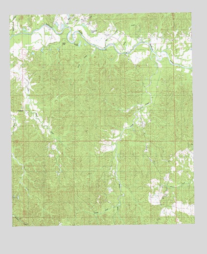
Laneheart, MS USGS Topographic Map
Click on map above to begin viewing in our Map Viewer.

This topographic map contains these locations and features:
Feature Name Type Latitude Longitude GNIS ID View Map
Allen SchoolSchoolN31.1577°W91.3121°666216View Map
Beaver LakeLakeN31.2327°W91.3296°666713View Map
Big Piney CreekStreamN31.2429°W91.3398°692608View Map
Brush CreekStreamN31.2296°W91.3168°667664View Map
Buffalo Volunteer Fire DepartmentBuildingN31.2350°W91.2830°2667864View Map
Corinth ChurchChurchN31.2354°W91.2801°668830View Map
Crosby Lookout TowerTowerN31.2129°W91.2879°711223View Map
Elliston SchoolSchoolN31.2432°W91.3640°669744View Map
Evening Star ChurchChurchN31.2368°W91.2957°669840View Map
Fords CreekStreamN31.2274°W91.2784°670081View Map
Fords Creek SchoolSchoolN31.2116°W91.2868°670083View Map
Hays CemeteryCemeteryN31.1760°W91.3540°671029View Map
Highway Village ChurchChurchN31.1952°W91.2871°671202View Map
Horseshoe LakeSwampN31.2413°W91.3232°671502View Map
J M Sessions Lake DamDamN31.2302°W91.3518°680624View Map
LaneheartPopulated PlaceN31.1935°W91.3684°691996View Map
Little Piney CreekStreamN31.2443°W91.3376°693776View Map
Mill CreekStreamN31.2304°W91.3146°693994View Map
Morning Star ChurchChurchN31.1555°W91.2665°673824View Map
Pioneer CemeteryCemeteryN31.2410°W91.3029°675926View Map
Pioneer ChurchChurchN31.2341°W91.2648°675927View Map
Saint Matthew ChurchChurchN31.1846°W91.2846°677163View Map
Sandy CreekStreamN31.2327°W91.2973°694709View Map
Sandy CreekStreamN31.1388°W91.3018°677382View Map
Steels CreekStreamN31.2382°W91.3743°694886View Map
Supervisor District 4CivilN31.2493°W91.3546°712142View Map
Webb LakeLakeN31.2299°W91.3446°679415View Map
Westberry CemeteryCemeteryN31.1985°W91.3118°679533View Map
Wilkinson CountyCivilN31.1611°W91.3109°695799View Map
Wilkinson County Correctional CenterBuildingN31.1387°W91.2767°2739814View Map
Wilkinson County Farm (historical)LocaleN31.1641°W91.2918°686184View Map
Wilkinson Oil FieldOilfieldN31.2238°W91.3034°691035View Map
Woodburn SchoolSchoolN31.2304°W91.3515°679837View Map
Zion Hill ChurchChurchN31.1305°W91.3201°680016View Map

Note: Coordinates in the location and feature list above are referenced to NAD83 datum.


Copyright (C) 2008-2024 Ryan Niemi / Sunset Dynamics ... All Rights Reserved