TopoQuest Logo
Do you find TopoQuest useful?
Help keep TopoQuest running and adding new maps/features by donating!
Bitcoin:  19c7KJd3qBynnjoSw5npx9KScwjBe4ifkT
Litecoin:  LXs6TkuXGGXo1vDsWCkWVdjQX94eUKd6ui
Home View Maps Find Maps Find Places Resources & Links


Lands End, Colorado Topographic Map

USGS Map Title: Lands End, CO
USGS Map MRC: 39108A2
DRG (GeoTIFF) Download: o39108a2.tif


Neighboring USGS Topographic Map Quads:


  Cameo, CO  
39108B3
 

  Mesa, CO  
39108B2
 

  Molina, CO  
39108B1
 

  Palisade, CO  
39108A3
 

  Lands End, CO  
39108A2
 

  Mesa Lakes, CO  
39108A1
 

  Juniata Reservoir, CO  
38108H3
 

  Indian Point, CO  
38108H2
 

  Hells Kitchen, CO  
38108H1


Map MRC Location:

N40°
W109°
N40°
W108°
H8 H7 H6 H5 H4 H3 H2 H1
G8 G7 G6 G5 G4 G3 G2 G1
F8 F7 F6 F5 F4 F3 F2 F1
E8 E7 E6 E5 E4 E3 E2 E1
D8 D7 D6 D5 D4 D3 D2 D1
C8 C7 C6 C5 C4 C3 C2 C1
B8 B7 B6 B5 B4 B3 B2 B1
A8 A7 A6 A5 A4 A3 A2 A1
N39°
W109°
N39°
W108°

Lands End, CO USGS 1:24K Topographic Map Preview:
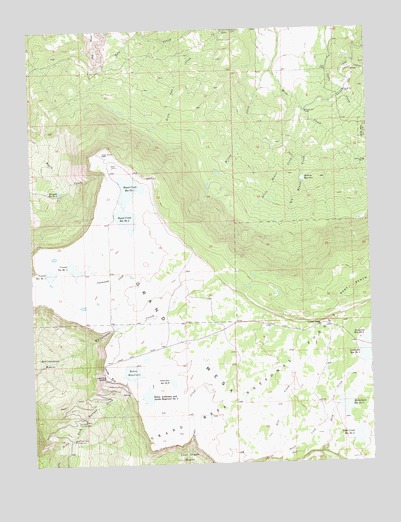
Lands End, CO USGS Topographic Map
Click on map above to begin viewing in our Map Viewer.

This topographic map contains these locations and features:
Feature Name Type Latitude Longitude GNIS ID View Map
Anderson Number 1 DamDamN39.0300°W108.1290°198306View Map
Anderson Number 2 DamDamN39.0350°W108.1273°198310View Map
Anderson Number 6 DamDamN39.0233°W108.2023°198314View Map
Anderson Reservoir Number 1ReservoirN39.0306°W108.1275°169476View Map
Anderson Reservoir Number 6ReservoirN39.0234°W108.1993°174653View Map
Big Beaver CreekStreamN39.0986°W108.1467°174662View Map
Bolen DamDamN39.0250°W108.2162°199666View Map
Bolen ReservoirReservoirN39.0266°W108.2142°174654View Map
Bolen, Anderson, and Jacobs Reservoir Number TwoReservoirN39.0195°W108.2085°199669View Map
Bolen, Anderson, Jacobs Number 2 DamDamN39.0180°W108.2092°199668View Map
Crater ViewLocaleN39.0400°W108.1445°174676View Map
Deep Creek Number 2 DamDamN39.0061°W108.1331°199672View Map
Deep Creek Reservoir Number 2ReservoirN39.0075°W108.1311°174652View Map
Hallenbeck Number 2 DamDamN39.0166°W108.1390°198336View Map
Hollenbeck Reservoir Number TwoReservoirN39.0164°W108.1354°174651View Map
Lands EndCliffN39.0264°W108.2229°174674View Map
Lands End Microwave HeliportAirportN39.0903°W108.2217°204545View Map
Little Beaver CreekStreamN39.1019°W108.1490°174663View Map
Palisade Reservoir Number 3ReservoirN39.0784°W108.2398°174667View Map
Phylcon Ranch AirportAirportN39.1222°W108.1490°2443902View Map
Powderhorn Ski AreaLocaleN39.0675°W108.1590°197547View Map
Rapid Creek Number 1 DamDamN39.0791°W108.2145°201180View Map
Rapid Creek Number 2 DamDamN39.0719°W108.2198°201182View Map
Rapid Creek Reservoir Number 1ReservoirN39.0795°W108.2141°174668View Map
Rapid Creek Reservoir Number 2ReservoirN39.0706°W108.2152°174675View Map
Robbins ReservoirReservoirN39.0818°W108.1498°174661View Map
Somerville-McCullah DamDamN39.0416°W108.2123°200066View Map
Somerville-McCullah ReservoirReservoirN39.0416°W108.2123°200067View Map
South Side CanalCanalN39.1097°W108.1315°174664View Map
South Tate CreekStreamN39.1244°W108.1779°174666View Map
Steamboat Rock CampgroundLocaleN39.0072°W108.2340°174671View Map
Vincent Number 1 DamDamN39.0566°W108.2473°201184View Map
Vincent Number 2 DamDamN39.0583°W108.2390°201186View Map
Vincent Reservoir Number 1ReservoirN39.0552°W108.2437°174670View Map
Vincent Reservoir Number 2ReservoirN39.0566°W108.2347°174669View Map
Vincent ReservoirsReservoirN39.0519°W108.2384°197546View Map
West Bench TrailTrailN39.0500°W108.1434°169405View Map
Whitewater BasinBasinN39.0300°W108.2451°174660View Map
Wild Rose Picnic GroundLocaleN39.0125°W108.2326°174672View Map
Willow CreekStreamN39.1130°W108.1604°174665View Map

Note: Coordinates in the location and feature list above are referenced to NAD83 datum.


Copyright (C) 2008-2024 Ryan Niemi / Sunset Dynamics ... All Rights Reserved