TopoQuest Logo
Do you find TopoQuest useful?
Help keep TopoQuest running and adding new maps/features by donating!
Bitcoin:  19c7KJd3qBynnjoSw5npx9KScwjBe4ifkT
Litecoin:  LXs6TkuXGGXo1vDsWCkWVdjQX94eUKd6ui
Home View Maps Find Maps Find Places Resources & Links


Hells Kitchen, Colorado Topographic Map

USGS Map Title: Hells Kitchen, CO
USGS Map MRC: 38108H1
DRG (GeoTIFF) Download: o38108h1.tif


Neighboring USGS Topographic Map Quads:


  Lands End, CO  
39108A2
 

  Mesa Lakes, CO  
39108A1
 

  Grand Mesa, CO  
39107A8
 

  Indian Point, CO  
38108H2
 

  Hells Kitchen, CO  
38108H1
 

  Cedaredge, CO  
38107H8
 

  Point Creek, CO  
38108G2
 

  North Delta, CO  
38108G1
 

  Orchard City, CO  
38107G8


Map MRC Location:

N39°
W109°
N39°
W108°
H8 H7 H6 H5 H4 H3 H2 H1
G8 G7 G6 G5 G4 G3 G2 G1
F8 F7 F6 F5 F4 F3 F2 F1
E8 E7 E6 E5 E4 E3 E2 E1
D8 D7 D6 D5 D4 D3 D2 D1
C8 C7 C6 C5 C4 C3 C2 C1
B8 B7 B6 B5 B4 B3 B2 B1
A8 A7 A6 A5 A4 A3 A2 A1
N38°
W109°
N38°
W108°

Hells Kitchen, CO USGS 1:24K Topographic Map Preview:
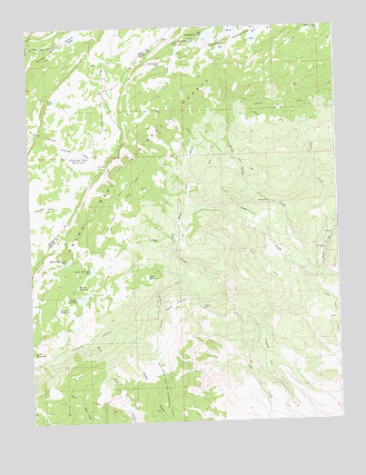
Hells Kitchen, CO USGS Topographic Map
Click on map above to begin viewing in our Map Viewer.

This topographic map contains these locations and features:
Feature Name Type Latitude Longitude GNIS ID View Map
Big Battlement DamDamN38.9950°W108.0523°198860View Map
Big Battlement LakeReservoirN38.9974°W108.0509°185269View Map
Blue Grouse TrailTrailN38.9739°W108.0081°203057View Map
Bull and Brown TrailTrailN38.9728°W108.0701°185302View Map
Camp CreekStreamN38.9208°W108.0012°185292View Map
Carson LakeReservoirN38.9968°W108.1066°185273View Map
Carson Lake TrailTrailN38.9933°W108.1034°197534View Map
Cedar Park DitchCanalN38.9128°W108.0031°203058View Map
Clara ReservoirReservoirN38.9205°W108.0773°197297View Map
Clark DamDamN38.9200°W108.0790°199044View Map
Clark ReservoirReservoirN38.9210°W108.0779°185289View Map
Clear LakeLakeN38.9957°W108.0653°185271View Map
Crane LakeLakeN38.9774°W108.1135°185274View Map
Delta Number 3 DamDamN38.8933°W108.1240°199200View Map
Delta ReservoirReservoirN38.8967°W108.1238°185282View Map
Delta Reservoir Number 3ReservoirN38.8933°W108.1240°199201View Map
Dirty George Creek and Doughspoon AqueductCanalN38.8889°W108.0715°203059View Map
Dirty George Creek AqueductCanalN38.9353°W108.0670°185294View Map
Doughspoon AqueductCanalN38.9011°W108.1006°203056View Map
Dugger DamDamN38.9158°W108.1076°199260View Map
Dugger ReservoirReservoirN38.9144°W108.1053°185280View Map
Eagle DitchCanalN38.9222°W108.0320°185298View Map
East Fork Doughspoon CreekStreamN38.8780°W108.0865°185284View Map
Fairview MineMineN38.9105°W108.0556°185288View Map
Flowing ParkFlatN38.9611°W108.1062°185276View Map
Flowing Park DamDamN38.9605°W108.1087°199674View Map
Flowing Park ReservoirReservoirN38.9586°W108.1042°185275View Map
Granby DitchCanalN38.9675°W108.0051°203060View Map
Granby Number 11 DamDamN38.9983°W108.0356°199478View Map
Granby Number 12 DamDamN38.9983°W108.0409°199476View Map
Granby Number 6 DamDamN38.9950°W108.0406°200718View Map
Granby Number 7 DamDamN38.9925°W108.0445°199474View Map
Granby Number 9 DamDamN38.9939°W108.0340°201578View Map
Granby Reservoir Number 11ReservoirN38.9991°W108.0359°169479View Map
Granby Reservoir Number 12ReservoirN38.9990°W108.0422°169478View Map
Granby Reservoir Number 6ReservoirN38.9950°W108.0406°200719View Map
Granby Reservoir Number 7ReservoirN38.9934°W108.0455°185304View Map
Granby Reservoir Number 9ReservoirN38.9957°W108.0327°185303View Map
Greenwood LakeLakeN38.9884°W108.0701°185272View Map
Hells KitchenValleyN38.9110°W108.0655°185287View Map
Hogchute DamDamN38.9950°W108.1123°198338View Map
Hogchute ReservoirReservoirN38.9950°W108.1123°198339View Map
Hoosier DitchCanalN38.9119°W108.0728°185295View Map
Little Battlement DamDamN38.9936°W108.0548°198862View Map
Little Battlement LakeReservoirN38.9944°W108.0564°185270View Map
Morris ReservoirReservoirN38.9182°W108.1063°185279View Map
Pitcairne Number 1 DamDamN38.9100°W108.1156°199288View Map
Pitcairne ReservoirReservoirN38.9109°W108.1144°199289View Map
Point Camp TrailTrailN38.9405°W108.0898°185301View Map
Point TrailTrailN38.9300°W108.1106°185300View Map
Porter Number 1 DamDamN38.9233°W108.1023°199292View Map
Porter Number 4 DamDamN38.9264°W108.1084°199294View Map
Porter Reservoir Number 4ReservoirN38.9262°W108.1097°185277View Map
Porter Reservoir Number OneReservoirN38.9233°W108.1003°185278View Map
Rollins MineMineN38.8814°W108.0976°185286View Map
Sanburg DitchCanalN38.8958°W108.0287°185297View Map
Sand CreekStreamN38.9233°W108.0062°185293View Map
Tomahawk MineMineN38.9291°W108.0056°185299View Map
West Fork Doughspoon CreekStreamN38.8780°W108.0865°185283View Map

Note: Coordinates in the location and feature list above are referenced to NAD83 datum.


Copyright (C) 2008-2024 Ryan Niemi / Sunset Dynamics ... All Rights Reserved