TopoQuest Logo
Do you find TopoQuest useful?
Help keep TopoQuest running and adding new maps/features by donating!
Bitcoin:  19c7KJd3qBynnjoSw5npx9KScwjBe4ifkT
Litecoin:  LXs6TkuXGGXo1vDsWCkWVdjQX94eUKd6ui
Home View Maps Find Maps Find Places Resources & Links


Lancer, Kentucky Topographic Map

USGS Map Title: Lancer, KY
USGS Map MRC: 37082F6
DRG (GeoTIFF) Download: o37082f6.tif


Neighboring USGS Topographic Map Quads:


  Paintsville, KY  
37082G7
 

  Offutt, KY  
37082G6
 

  Inez, KY  
37082G5
 

  Prestonsburg, KY  
37082F7
 

  Lancer, KY  
37082F6
 

  Thomas, KY  
37082F5
 

  Martin, KY  
37082E7
 

  Harold, KY  
37082E6
 

  Broad Bottom, KY  
37082E5


Map MRC Location:

N38°
W83°
N38°
W82°
H8 H7 H6 H5 H4 H3 H2 H1
G8 G7 G6 G5 G4 G3 G2 G1
F8 F7 F6 F5 F4 F3 F2 F1
E8 E7 E6 E5 E4 E3 E2 E1
D8 D7 D6 D5 D4 D3 D2 D1
C8 C7 C6 C5 C4 C3 C2 C1
B8 B7 B6 B5 B4 B3 B2 B1
A8 A7 A6 A5 A4 A3 A2 A1
N37°
W83°
N37°
W82°

Lancer, KY USGS 1:24K Topographic Map Preview:
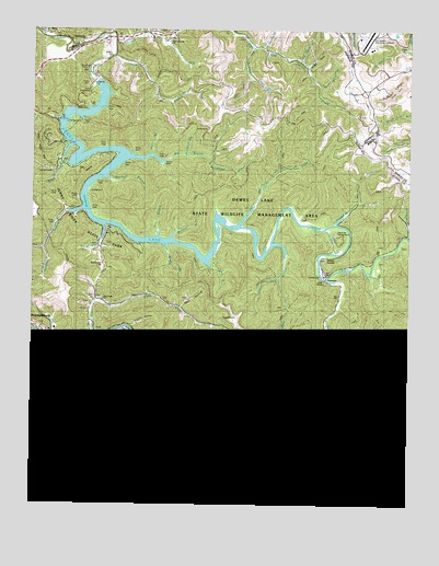
Lancer, KY USGS Topographic Map
Click on map above to begin viewing in our Map Viewer.

This topographic map contains these locations and features:
Feature Name Type Latitude Longitude GNIS ID View Map
Akers BranchStreamN37.7179°W82.7099°485805View Map
AlvinPopulated PlaceN37.6368°W82.6949°485919View Map
Ax Handle BranchStreamN37.7448°W82.6738°486161View Map
Bear Water BranchStreamN37.7357°W82.6549°486579View Map
Benedict ChurchChurchN37.6423°W82.6749°510167View Map
Big BranchStreamN37.6704°W82.7240°487115View Map
Big BranchStreamN37.7165°W82.7179°487120View Map
Big BranchStreamN37.6579°W82.7354°487141View Map
Big Sandy Regional AirportAirportN37.7480°W82.6390°517476View Map
Brandy Keg Boat DockLocaleN37.6957°W82.7260°487825View Map
Brandy Keg DikeLocaleN37.6876°W82.7263°487826View Map
Brushy ForkStreamN37.6593°W82.6538°488122View Map
Buffalo CreekStreamN37.6843°W82.6524°488317View Map
Bull CreekPopulated PlaceN37.6668°W82.7277°507616View Map
Bull CreekStreamN37.6665°W82.7321°488354View Map
Burchett BranchStreamN37.7109°W82.7249°488404View Map
Calf CreekStreamN37.6357°W82.6974°488600View Map
Clarks BranchStreamN37.6882°W82.6893°509970View Map
Copperas CreekStreamN37.6990°W82.6490°490084View Map
Corn ForkStreamN37.6684°W82.7296°510062View Map
Corn Fork ChurchChurchN37.6787°W82.7260°509971View Map
Corn Fork HollowValleyN37.6773°W82.7005°490117View Map
Cow CreekStreamN37.6362°W82.6963°490187View Map
Cow Creek Volunteer Fire DepartmentBuildingN37.6346°W82.6634°2636765View Map
Crooked BranchStreamN37.6959°W82.6252°490372View Map
Daniels CreekStreamN37.7470°W82.7227°490576View Map
Dewey DamDamN37.7368°W82.7288°490848View Map
Dewey LakeReservoirN37.6990°W82.7236°490849View Map
Dial BranchStreamN37.6595°W82.7007°490857View Map
Dicks CreekStreamN37.6987°W82.6813°490881View Map
Dodson BranchStreamN37.6548°W82.7360°510084View Map
Dog ForkStreamN37.7462°W82.7051°490978View Map
Dwale Census Designated PlaceCensusN37.6254°W82.7277°2629606View Map
EmmaPopulated PlaceN37.6354°W82.7002°491764View Map
EndicottPopulated PlaceN37.6665°W82.6385°507940View Map
Endicott ChurchChurchN37.6584°W82.6307°491775View Map
Flax BranchStreamN37.6957°W82.7082°492231View Map
Gobel BranchStreamN37.7195°W82.7371°492929View Map
Hayden BranchStreamN37.7494°W82.7480°493902View Map
Home BranchStreamN37.6687°W82.6504°494463View Map
Home Branch School (historical)SchoolN37.6607°W82.6504°510107View Map
Jenny Wiley State ParkParkN37.6973°W82.7296°495217View Map
Johns BranchStreamN37.6562°W82.6257°495342View Map
Knottly HollowValleyN37.6717°W82.7166°495854View Map
LancerPopulated PlaceN37.6670°W82.7368°495950View Map
Left Fork Daniels CreekStreamN37.7484°W82.7127°496209View Map
Left Fork Home BranchStreamN37.6604°W82.6490°496225View Map
Lockhart CemeteryCemeteryN37.6932°W82.7284°2097306View Map
Long BranchStreamN37.7432°W82.7229°497042View Map
Long BranchStreamN37.6312°W82.6974°497083View Map
Marshall BranchStreamN37.6833°W82.7421°2097305View Map
Mayo CemeteryCemeteryN37.6690°W82.7404°497738View Map
McGuire BranchStreamN37.6954°W82.7035°497876View Map
Moss Canif BranchStreamN37.6345°W82.6740°498667View Map
Mutton ForkStreamN37.6376°W82.7474°499142View Map
NeroPopulated PlaceN37.7484°W82.7435°508689View Map
Old Home BranchStreamN37.7420°W82.6613°499833View Map
Philadelphia ChurchChurchN37.7473°W82.7329°500523View Map
Pleasant Home ChurchChurchN37.6545°W82.7360°510180View Map
Prophet HollowValleyN37.7076°W82.7318°2097303View Map
Right Fork Home BranchStreamN37.6615°W82.6507°501889View Map
Sand BranchStreamN37.6487°W82.7118°502894View Map
Sandy Valley Girl Scout CampLocaleN37.7170°W82.7410°502986View Map
Shade Branch Johns CreekStreamN37.6932°W82.7060°503206View Map
Shady BranchStreamN37.7205°W82.7399°2097302View Map
Shawnee CampgroundLocaleN37.6959°W82.6490°510164View Map
Slick Rock BranchStreamN37.6395°W82.6810°503681View Map
Souders BranchStreamN37.6937°W82.6704°503887View Map
Spicewood BranchStreamN37.7162°W82.6910°504070View Map
Still House BranchStreamN37.7358°W82.7293°2097300View Map
Stonecoal BranchStreamN37.7170°W82.6988°504467View Map
Stratton BranchStreamN37.7026°W82.7332°504571View Map
Sugarloaf BranchStreamN37.6554°W82.7143°504701View Map
Sycamore BranchStreamN37.6362°W82.6799°504868View Map
Sycamore CreekStreamN37.7454°W82.6768°504875View Map
Tailings PondLakeN37.7340°W82.6309°504918View Map
The Old Log ChurchChurchN37.7476°W82.7049°510125View Map
Thompson ForkStreamN37.6845°W82.6677°505207View Map
Tom Sellers BranchStreamN37.6340°W82.6457°505338View Map
Toms BranchStreamN37.6679°W82.6379°505349View Map
Trans Star Ambulance ServiceBuildingN37.6691°W82.7424°2636290View Map
Trimble Chapel (historical)ChurchN37.6345°W82.7488°510177View Map
Twin BranchStreamN37.6348°W82.6610°505704View Map
WatergapPopulated PlaceN37.6365°W82.7457°509322View Map
Whiskey HollowValleyN37.7405°W82.6589°506560View Map
Wills BranchStreamN37.6407°W82.7446°506873View Map
WoodsPopulated PlaceN37.6357°W82.6527°509403View Map
Woods BranchStreamN37.6362°W82.6818°510094View Map

Note: Coordinates in the location and feature list above are referenced to NAD83 datum.


Copyright (C) 2008-2024 Ryan Niemi / Sunset Dynamics ... All Rights Reserved