TopoQuest Logo
Do you find TopoQuest useful?
Help keep TopoQuest running and adding new maps/features by donating!
Bitcoin:  19c7KJd3qBynnjoSw5npx9KScwjBe4ifkT
Litecoin:  LXs6TkuXGGXo1vDsWCkWVdjQX94eUKd6ui
Home View Maps Find Maps Find Places Resources & Links


Lake Koronis, Minnesota Topographic Map

USGS Map Title: Lake Koronis, MN
USGS Map MRC: 45094C6
DRG (GeoTIFF) Download: o45094c6.tif


Neighboring USGS Topographic Map Quads:


  Lake Henry, MN  
45094D7
 

  Paynesville, MN  
45094D6
 

  Richmond, MN  
45094D5
 

  Hawick, MN  
45094C7
 

  Lake Koronis, MN  
45094C6
 

  Eden Valley, MN  
45094C5
 

  Atwater, MN  
45094B7
 

  Grove City, MN  
45094B6
 

  Litchfield North, MN  
45094B5


Map MRC Location:

N46°
W95°
N46°
W94°
H8 H7 H6 H5 H4 H3 H2 H1
G8 G7 G6 G5 G4 G3 G2 G1
F8 F7 F6 F5 F4 F3 F2 F1
E8 E7 E6 E5 E4 E3 E2 E1
D8 D7 D6 D5 D4 D3 D2 D1
C8 C7 C6 C5 C4 C3 C2 C1
B8 B7 B6 B5 B4 B3 B2 B1
A8 A7 A6 A5 A4 A3 A2 A1
N45°
W95°
N45°
W94°

Lake Koronis, MN USGS 1:24K Topographic Map Preview:
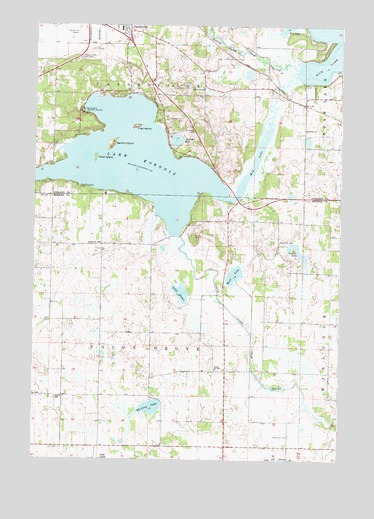
Lake Koronis, MN USGS Topographic Map
Click on map above to begin viewing in our Map Viewer.

This topographic map contains these locations and features:
Feature Name Type Latitude Longitude GNIS ID View Map
Assembly of God ChurchChurchN45.3611°W94.7050°2067998View Map
Centra Care Paynesville HospitalHospitalN45.3744°W94.7156°2067999View Map
Ebenezer ChurchChurchN45.3450°W94.6397°643142View Map
Ebenezer Church CemeteryCemeteryN45.3450°W94.6397°2068104View Map
Empire Valley Airport (historical)AirportN45.2834°W94.6764°660345View Map
First IslandIslandN45.3458°W94.7086°643648View Map
Integrated Health CenterHospitalN45.3747°W94.7111°2068001View Map
Koronis Hills Golf ClubLocaleN45.3655°W94.7311°659868View Map
Krueger LakeLakeN45.3418°W94.6923°646265View Map
Lake EmmaLakeN45.2980°W94.6892°643349View Map
Lake KoronisReservoirN45.3356°W94.7091°646237View Map
Lake Koronis Assembly GroundLocaleN45.3511°W94.7314°646368View Map
Lake Koronis Regional Park CampgroundLocaleN45.3258°W94.7278°2066686View Map
Lake Koronis Regional Park CampgroundLocaleN45.3258°W94.7278°2066049View Map
Lake Koronis Rest AreaLocaleN45.3447°W94.6856°2068382View Map
Manannah CemeteryCemeteryN45.2569°W94.6450°647431View Map
Mud LakeLakeN45.3364°W94.6600°648240View Map
Paynesville High SchoolSchoolN45.3744°W94.7278°2068003View Map
Paynesville Medical ClinicHospitalN45.3747°W94.7153°2068000View Map
Paynesville Middle SchoolSchoolN45.3742°W94.7278°2068004View Map
Paynesville Municipal AirportAirportN45.3720°W94.7377°660344View Map
Pigeon LakeLakeN45.3097°W94.6419°649401View Map
Sandy Point ParkParkN45.3292°W94.7361°2067995View Map
School Number 1088SchoolN45.3127°W94.6497°651340View Map
School Number 1089SchoolN45.3119°W94.7228°651341View Map
School Number 1090SchoolN45.2677°W94.7381°651344View Map
School Number 1096SchoolN45.2761°W94.6756°651345View Map
School Number 2044SchoolN45.3569°W94.6814°651485View Map
Second IslandIslandN45.3408°W94.7183°651818View Map
South Koronis ParkParkN45.3275°W94.7319°652322View Map
Third IslandIslandN45.3369°W94.7250°653132View Map
Township of PaynesvilleCivilN45.3686°W94.7003°665266View Map
Township of Union GroveCivilN45.2826°W94.7019°665840View Map
West LakeLakeN45.3032°W94.6681°653974View Map
Whitney LakeLakeN45.2650°W94.7017°654116View Map

Note: Coordinates in the location and feature list above are referenced to NAD83 datum.


Copyright (C) 2008-2024 Ryan Niemi / Sunset Dynamics ... All Rights Reserved