TopoQuest Logo
Do you find TopoQuest useful?
Help keep TopoQuest running and adding new maps/features by donating!
Bitcoin:  19c7KJd3qBynnjoSw5npx9KScwjBe4ifkT
Litecoin:  LXs6TkuXGGXo1vDsWCkWVdjQX94eUKd6ui
Home View Maps Find Maps Find Places Resources & Links


Barge Lake, Mississippi Topographic Map

USGS Map Title: Barge Lake, MS
USGS Map MRC: 33088B7
DRG (GeoTIFF) Download: o33088b7.tif


Neighboring USGS Topographic Map Quads:


  Bradley, MS  
33088C8
 

  Bluff Lake, MS  
33088C7
 

  Crawford West, MS  
33088C6
 

  Betheden, MS  
33088B8
 

  Barge Lake, MS  
33088B7
 

  Lynn Creek, MS  
33088B6
 

  Boon, MS  
33088A8
 

  Fearns Springs, MS  
33088A7
 

  Mashulaville, MS  
33088A6


Map MRC Location:

N34°
W89°
N34°
W88°
H8 H7 H6 H5 H4 H3 H2 H1
G8 G7 G6 G5 G4 G3 G2 G1
F8 F7 F6 F5 F4 F3 F2 F1
E8 E7 E6 E5 E4 E3 E2 E1
D8 D7 D6 D5 D4 D3 D2 D1
C8 C7 C6 C5 C4 C3 C2 C1
B8 B7 B6 B5 B4 B3 B2 B1
A8 A7 A6 A5 A4 A3 A2 A1
N33°
W89°
N33°
W88°

Barge Lake, MS USGS 1:24K Topographic Map Preview:
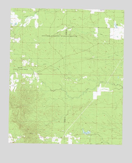
Barge Lake, MS USGS Topographic Map
Click on map above to begin viewing in our Map Viewer.

This topographic map contains these locations and features:
Feature Name Type Latitude Longitude GNIS ID View Map
Antioch CemeteryCemeteryN33.1968°W88.8456°666290View Map
Antioch ChurchChurchN33.2015°W88.8612°666318View Map
Ball Ground CreekStreamN33.1662°W88.8064°689567View Map
Barge LakeReservoirN33.1362°W88.7894°666518View Map
Barge Lookout TowerTowerN33.1343°W88.8523°711197View Map
Cades LakeReservoirN33.2357°W88.7595°667901View Map
Farewells (historical)Populated PlaceN33.1626°W88.7778°689606View Map
Flatwoods School (historical)SchoolN33.2493°W88.7931°689609View Map
Harrington CemeteryCemeteryN33.1935°W88.8270°670966View Map
Lake Forest Ranch CampLocaleN33.1343°W88.7864°672260View Map
Lake Forrest DamDamN33.1335°W88.7851°681867View Map
Little Yellow CreekStreamN33.1815°W88.7762°693793View Map
Lonely Valley ChurchChurchN33.1893°W88.8439°672790View Map
Mitchells Church (historical)ChurchN33.2182°W88.7759°689658View Map
Sam D Hamilton Noxubee National Wildlife RefugeParkN33.2194°W88.8285°2765488View Map
Singleton (historical)Populated PlaceN33.1890°W88.8570°687705View Map
Sixteen CemeteryCemeteryN33.1579°W88.8681°677859View Map
Triplett Lake DamDamN33.2385°W88.8684°681947View Map
Yellow Creek CemeteryCemeteryN33.1373°W88.8153°710082View Map
Yellow Creek ChurchChurchN33.1368°W88.8142°679942View Map

Note: Coordinates in the location and feature list above are referenced to NAD83 datum.


Copyright (C) 2008-2024 Ryan Niemi / Sunset Dynamics ... All Rights Reserved