TopoQuest Logo
Do you find TopoQuest useful?
Help keep TopoQuest running and adding new maps/features by donating!
Bitcoin:  19c7KJd3qBynnjoSw5npx9KScwjBe4ifkT
Litecoin:  LXs6TkuXGGXo1vDsWCkWVdjQX94eUKd6ui
Home View Maps Find Maps Find Places Resources & Links


Knoxville, Missouri Topographic Map

USGS Map Title: Knoxville, MO
USGS Map MRC: 39094D1
DRG (GeoTIFF) Download: o39094d1.tif


Neighboring USGS Topographic Map Quads:


  Elmira, MO  
39094E2
 

  Polo, MO  
39094E1
 

  Cowgill, MO  
39093E8
 

  Lawson, MO  
39094D2
 

  Knoxville, MO  
39094D1
 

  Millville, MO  
39093D8
 

  Excelsior Springs, MO  
39094C2
 

  Rayville, MO  
39094C1
 

  Richmond, MO  
39093C8


Map MRC Location:

N40°
W95°
N40°
W94°
H8 H7 H6 H5 H4 H3 H2 H1
G8 G7 G6 G5 G4 G3 G2 G1
F8 F7 F6 F5 F4 F3 F2 F1
E8 E7 E6 E5 E4 E3 E2 E1
D8 D7 D6 D5 D4 D3 D2 D1
C8 C7 C6 C5 C4 C3 C2 C1
B8 B7 B6 B5 B4 B3 B2 B1
A8 A7 A6 A5 A4 A3 A2 A1
N39°
W95°
N39°
W94°

Knoxville, MO USGS 1:24K Topographic Map Preview:
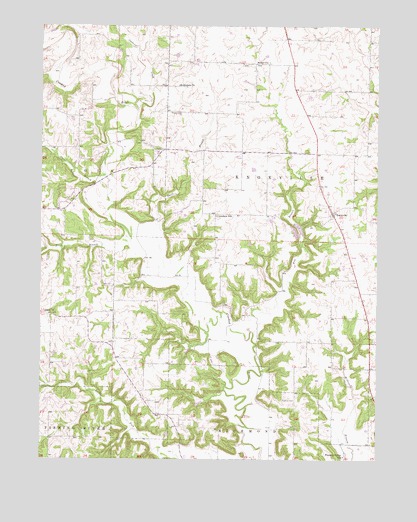
Knoxville, MO USGS Topographic Map
Click on map above to begin viewing in our Map Viewer.

This topographic map contains these locations and features:
Feature Name Type Latitude Longitude GNIS ID View Map
Bethel ChurchChurchN39.4897°W94.0411°714069View Map
Bethlehem ChurchChurchN39.4831°W94.0744°714104View Map
Bisbee Lake DamDamN39.3750°W94.1169°761897View Map
Cockerel CreekStreamN39.4758°W94.0894°716059View Map
Coon BranchStreamN39.4567°W94.1011°716235View Map
Crenshaw SchoolSchoolN39.4453°W94.0602°716485View Map
Davis BranchStreamN39.4328°W94.0794°716698View Map
Fairplay School (historical)SchoolN39.4842°W94.0780°747092View Map
Fire BranchStreamN39.4120°W94.0469°717929View Map
Hidden Valley Subdivision Lake DamDamN39.3933°W94.1236°761898View Map
Kings BranchStreamN39.4375°W94.0924°720621View Map
KnoxvillePopulated PlaceN39.4461°W94.0169°730130View Map
Koetting Lake DamDamN39.3817°W94.0786°761717View Map
Loyd School (historical)SchoolN39.4095°W94.0630°747096View Map
Maddux CemeteryCemeteryN39.3922°W94.0308°721744View Map
Marion School (historical)SchoolN39.4164°W94.0099°747095View Map
Mayes CemeteryCemeteryN39.4753°W94.0774°722008View Map
Murray School (historical)SchoolN39.4172°W94.1027°747093View Map
Pleasant Valley SchoolSchoolN39.3761°W94.0122°724630View Map
Rocky Fork School (historical)SchoolN39.3861°W94.0666°747097View Map
SandalsPopulated PlaceN39.4606°W94.0838°739633View Map
Sandals CemeteryCemeteryN39.4639°W94.0830°726023View Map
Taylor School (historical)SchoolN39.4781°W94.0166°747094View Map
Township of KnoxvilleCivilN39.4620°W94.0194°767272View Map
Union ChurchChurchN39.4167°W94.1222°728000View Map

Note: Coordinates in the location and feature list above are referenced to NAD83 datum.


Copyright (C) 2008-2024 Ryan Niemi / Sunset Dynamics ... All Rights Reserved