TopoQuest Logo
Do you find TopoQuest useful?
Help keep TopoQuest running and adding new maps/features by donating!
Bitcoin:  19c7KJd3qBynnjoSw5npx9KScwjBe4ifkT
Litecoin:  LXs6TkuXGGXo1vDsWCkWVdjQX94eUKd6ui
Home View Maps Find Maps Find Places Resources & Links


Excelsior Springs, Missouri Topographic Map

USGS Map Title: Excelsior Springs, MO
USGS Map MRC: 39094C2
DRG (GeoTIFF) Download: o39094c2.tif


Neighboring USGS Topographic Map Quads:


  Holt, MO  
39094D3
 

  Lawson, MO  
39094D2
 

  Knoxville, MO  
39094D1
 

  Kearney, MO  
39094C3
 

  Excelsior Springs, MO  
39094C2
 

  Rayville, MO  
39094C1
 

  Missouri City, MO  
39094B3
 

  Buckner, MO  
39094B2
 

  Camden, MO  
39094B1


Map MRC Location:

N40°
W95°
N40°
W94°
H8 H7 H6 H5 H4 H3 H2 H1
G8 G7 G6 G5 G4 G3 G2 G1
F8 F7 F6 F5 F4 F3 F2 F1
E8 E7 E6 E5 E4 E3 E2 E1
D8 D7 D6 D5 D4 D3 D2 D1
C8 C7 C6 C5 C4 C3 C2 C1
B8 B7 B6 B5 B4 B3 B2 B1
A8 A7 A6 A5 A4 A3 A2 A1
N39°
W95°
N39°
W94°

Excelsior Springs, MO USGS 1:24K Topographic Map Preview:
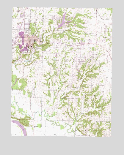
Excelsior Springs, MO USGS Topographic Map
Click on map above to begin viewing in our Map Viewer.

This topographic map contains these locations and features:
Feature Name Type Latitude Longitude GNIS ID View Map
Bogart CreekStreamN39.2600°W94.1761°714480View Map
Chick (historical)Populated PlaceN39.3156°W94.2352°740181View Map
City of Crystal LakesCivilN39.3606°W94.1874°2393688View Map
City of Excelsior SpringsCivilN39.3395°W94.2377°2394718View Map
City of Wood HeightsCivilN39.3414°W94.1635°2397361View Map
Clevenger CemeteryCemeteryN39.3600°W94.1563°715970View Map
Clevenger SchoolSchoolN39.3500°W94.1541°715972View Map
CoopersPopulated PlaceN39.3006°W94.2305°740182View Map
Cox CemeteryCemeteryN39.3369°W94.1822°716427View Map
Crescent LakePopulated PlaceN39.3256°W94.2405°730079View Map
Crescent Lake Christian AcademySchoolN39.3229°W94.2448°2545158View Map
Crown Hill CemeteryCemeteryN39.3447°W94.2477°716558View Map
Crystal LakesPopulated PlaceN39.3594°W94.1899°1669598View Map
Crystal Lakes Section 31 DamDamN39.3600°W94.1936°762760View Map
Dry ForkStreamN39.3394°W94.2244°717110View Map
Dry Fork LakeReservoirN39.3490°W94.2156°735965View Map
East Fork Fishing RiverStreamN39.2831°W94.2452°717284View Map
Elmwood CemeteryCemeteryN39.3354°W94.2488°717554View Map
Enon CemeteryCemeteryN39.2960°W94.2219°2702720View Map
Excelsior InstituteSchoolN39.3411°W94.2227°717704View Map
Excelsior SpringsPopulated PlaceN39.3392°W94.2261°730098View Map
Excelsior Springs Career CenterSchoolN39.3317°W94.2232°2545290View Map
Excelsior Springs Fire DepartmentBuildingN39.3535°W94.2385°2620364View Map
Excelsior Springs High SchoolSchoolN39.3485°W94.2455°2545333View Map
Excelsior Springs HospitalHospitalN39.3628°W94.2380°2655079View Map
Excelsior Springs Memorial AirportAirportN39.3365°W94.1986°758671View Map
Excelsior Springs Police DepartmentBuildingN39.3412°W94.2229°2752196View Map
Excelsior Springs Post OfficePost OfficeN39.3389°W94.2280°2477761View Map
Excelsior Springs Technology High SchoolSchoolN39.3363°W94.2300°2545355View Map
Excelsior Springs WaterworksLocaleN39.2725°W94.2236°755175View Map
Gold Mine CreekStreamN39.3497°W94.2002°718542View Map
Golf HillPopulated PlaceN39.3344°W94.2094°739636View Map
Greenwood SchoolSchoolN39.2872°W94.2266°730111View Map
Hall School (historical)SchoolN39.2506°W94.1558°747103View Map
HarrisLocaleN39.2878°W94.2263°759724View Map
Hedges Lake DamDamN39.3133°W94.1669°762256View Map
HomesteadPopulated PlaceN39.3628°W94.2008°1681814View Map
Isley SchoolSchoolN39.3417°W94.2147°720183View Map
Keeney CreekStreamN39.2833°W94.1255°730124View Map
KEXS-AM (Excelsior Springs)TowerN39.3403°W94.2408°759199View Map
KLTY-FM (Liberty)TowerN39.3056°W94.1486°759160View Map
Lake Arrowhead DamDamN39.3617°W94.1819°761136View Map
Lake DoniphanReservoirN39.3251°W94.1962°758274View Map
Lake Doniphan Dam-Lower DamDamN39.3233°W94.1969°761151View Map
Lake MaurerLakeN39.3229°W94.2311°721989View Map
Lewis Elementary SchoolSchoolN39.3375°W94.2285°720948View Map
Lick CreekStreamN39.2750°W94.2091°721022View Map
Maurer Lake DamDamN39.3233°W94.2302°760379View Map
Miles CreekStreamN39.2811°W94.2052°722315View Map
MiltondalePopulated PlaceN39.2583°W94.2222°722414View Map
Moore SchoolSchoolN39.3228°W94.2441°722586View Map
New GardenPopulated PlaceN39.3231°W94.1661°739635View Map
New Garden ChurchChurchN39.3272°W94.1647°723204View Map
New Garden SchoolSchoolN39.3236°W94.1827°723206View Map
Number 165 DamDamN39.3567°W94.1936°761134View Map
Number 165 ReservoirReservoirN39.3594°W94.1811°761135View Map
Number 166 ReservoirReservoirN39.3616°W94.1793°761137View Map
Number 172 ReservoirReservoirN39.3616°W94.1872°761153View Map
Odell ChurchChurchN39.2995°W94.1352°723696View Map
Old New Garden ChurchChurchN39.3231°W94.1669°723770View Map
Pisgah ChurchChurchN39.3375°W94.1772°724439View Map
Red Brush SchoolSchoolN39.2861°W94.1263°725153View Map
Riffe CemeteryCemeteryN39.2514°W94.1494°725301View Map
Rowland CemeteryCemeteryN39.2694°W94.1391°725639View Map
Saint Stephens Lake DamDamN39.3583°W94.1736°762621View Map
Shackelford BranchStreamN39.2661°W94.2044°726224View Map
Siloam ParkParkN39.3397°W94.2194°726441View Map
Sunnyside ParkParkN39.3450°W94.2294°727309View Map
Sunnyside School (historical)SchoolN39.3260°W94.1257°727312View Map
Three Springs Farm Lake DamDamN39.3650°W94.1786°762620View Map
Timber Lake DamDamN39.3600°W94.1836°761152View Map
Township of Fishing RiverCivilN39.3305°W94.1553°767270View Map
Turner CemeteryCemeteryN39.2944°W94.1980°727898View Map
Union School (historical)SchoolN39.2514°W94.1974°747102View Map
Upper Doniphan DamDamN39.3267°W94.1952°762749View Map
Village of HomesteadCivilN39.3632°W94.2005°2398536View Map
Wallace SchoolSchoolN39.2872°W94.1836°728283View Map
Westview Elementary SchoolSchoolN39.3468°W94.2414°2545106View Map
Wood HeightsPopulated PlaceN39.3395°W94.1627°729086View Map
Wood Heights Fire Protection DistrictBuildingN39.3398°W94.1458°2620370View Map
Wood Heights Police DepartmentBuildingN39.3383°W94.1718°2752105View Map
Woods LakeReservoirN39.3432°W94.1611°729126View Map
Wyman SchoolSchoolN39.3431°W94.2283°729177View Map

Note: Coordinates in the location and feature list above are referenced to NAD83 datum.


Copyright (C) 2008-2024 Ryan Niemi / Sunset Dynamics ... All Rights Reserved