TopoQuest Logo
Do you find TopoQuest useful?
Help keep TopoQuest running and adding new maps/features by donating!
Bitcoin:  19c7KJd3qBynnjoSw5npx9KScwjBe4ifkT
Litecoin:  LXs6TkuXGGXo1vDsWCkWVdjQX94eUKd6ui
Home View Maps Find Maps Find Places Resources & Links


Knowles Peak, Montana Topographic Map

USGS Map Title: Knowles Peak, MT
USGS Map MRC: 45110C5
DRG (GeoTIFF) Download: o45110c5.tif


Neighboring USGS Topographic Map Quads:


  Pray, MT  
45110D6
 

  Dexter Point, MT  
45110D5
 

  Mount Cowen, MT  
45110D4
 

  Emigrant, MT  
45110C6
 

  Knowles Peak, MT  
45110C5
 

  The Pyramid, MT  
45110C4
 

  Monitor Peak, MT  
45110B6
 

  Mineral Mountain, MT  
45110B5
 

  Mount Wallace, MT  
45110B4


Map MRC Location:

N46°
W111°
N46°
W110°
H8 H7 H6 H5 H4 H3 H2 H1
G8 G7 G6 G5 G4 G3 G2 G1
F8 F7 F6 F5 F4 F3 F2 F1
E8 E7 E6 E5 E4 E3 E2 E1
D8 D7 D6 D5 D4 D3 D2 D1
C8 C7 C6 C5 C4 C3 C2 C1
B8 B7 B6 B5 B4 B3 B2 B1
A8 A7 A6 A5 A4 A3 A2 A1
N45°
W111°
N45°
W110°

Knowles Peak, MT USGS 1:24K Topographic Map Preview:
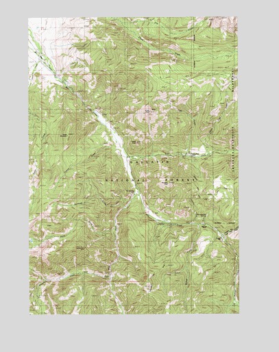
Knowles Peak, MT USGS Topographic Map
Click on map above to begin viewing in our Map Viewer.

This topographic map contains these locations and features:
Feature Name Type Latitude Longitude GNIS ID View Map
Alice C MineMineN45.2969°W110.5780°804881View Map
Arrastra CreekStreamN45.2655°W110.5772°779142View Map
Arrow PeakSummitN45.3355°W110.5533°779148View Map
Barbara Ann MineMineN45.2777°W110.5935°804865View Map
Barbara Ann MineMineN45.2777°W110.5930°768499View Map
Bow and Arrow RanchLocaleN45.3016°W110.5621°780296View Map
Bulldozer CreekStreamN45.2952°W110.5674°780585View Map
Burnt CreekStreamN45.2880°W110.5744°780630View Map
Castle RockPillarN45.3222°W110.5619°781031View Map
Counts CreekStreamN45.3227°W110.5735°781760View Map
Davis CreekStreamN45.3569°W110.6188°782106View Map
East Dam CreekStreamN45.2827°W110.5105°782793View Map
East Fork Mill CreekStreamN45.3160°W110.5674°782876View Map
Fire CreekStreamN45.3727°W110.5699°793674View Map
Green MountainSummitN45.3252°W110.6027°784289View Map
Highland TrailTrailN45.3030°W110.5252°784871View Map
Jomaha CreekStreamN45.2883°W110.5271°785555View Map
Knowles PeakSummitN45.3047°W110.5435°785812View Map
Merlyn MineMineN45.2558°W110.6230°804880View Map
Mill Creek Camp and Picnic GroundsLocaleN45.2847°W110.5152°787370View Map
Mill Creek Guard StationLocaleN45.2885°W110.5444°787375View Map
Mill Creek RanchLocaleN45.2869°W110.5213°787377View Map
Montanapolis School (historical)SchoolN45.3122°W110.5666°787577View Map
Montanapolis SpringsSpringN45.2910°W110.5201°787578View Map
Montanapolis Springs (historical)Populated PlaceN45.3122°W110.5666°1743370View Map
NE Section 4 - FS MineMineN45.2541°W110.6202°804882View Map
Passage CreekStreamN45.2735°W110.5021°788676View Map
Queen Esther MineMineN45.2552°W110.6216°804878View Map
Sage CreekStreamN45.3169°W110.5333°789902View Map
SE Section 23 MineMineN45.2999°W110.5827°804883View Map
Snowbank CampgroundLocaleN45.2880°W110.5446°801841View Map
Snowy Range RanchLocaleN45.3166°W110.5308°790813View Map
Templed HillsLocaleN45.2794°W110.5116°806813View Map
Upper Sage CreekStreamN45.3169°W110.5183°792651View Map
West Fork Mill CreekStreamN45.3005°W110.5602°793048View Map
Wicked CreekStreamN45.2872°W110.5244°793262View Map
Yellowstone Bible EncampmentLocaleN45.3013°W110.5605°1743173View Map

Note: Coordinates in the location and feature list above are referenced to NAD83 datum.


Copyright (C) 2008-2024 Ryan Niemi / Sunset Dynamics ... All Rights Reserved