TopoQuest Logo
Do you find TopoQuest useful?
Help keep TopoQuest running and adding new maps/features by donating!
Bitcoin:  19c7KJd3qBynnjoSw5npx9KScwjBe4ifkT
Litecoin:  LXs6TkuXGGXo1vDsWCkWVdjQX94eUKd6ui
Home View Maps Find Maps Find Places Resources & Links


Dexter Point, Montana Topographic Map

USGS Map Title: Dexter Point, MT
USGS Map MRC: 45110D5
DRG (GeoTIFF) Download: o45110d5.tif


Neighboring USGS Topographic Map Quads:


  Chimney Rock, MT  
45110E6
 

  Brisbin, MT  
45110E5
 

  Livingston Peak, MT  
45110E4
 

  Pray, MT  
45110D6
 

  Dexter Point, MT  
45110D5
 

  Mount Cowen, MT  
45110D4
 

  Emigrant, MT  
45110C6
 

  Knowles Peak, MT  
45110C5
 

  The Pyramid, MT  
45110C4


Map MRC Location:

N46°
W111°
N46°
W110°
H8 H7 H6 H5 H4 H3 H2 H1
G8 G7 G6 G5 G4 G3 G2 G1
F8 F7 F6 F5 F4 F3 F2 F1
E8 E7 E6 E5 E4 E3 E2 E1
D8 D7 D6 D5 D4 D3 D2 D1
C8 C7 C6 C5 C4 C3 C2 C1
B8 B7 B6 B5 B4 B3 B2 B1
A8 A7 A6 A5 A4 A3 A2 A1
N45°
W111°
N45°
W110°

Dexter Point, MT USGS 1:24K Topographic Map Preview:
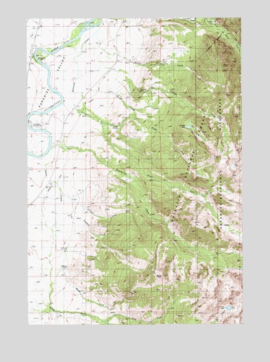
Dexter Point, MT USGS Topographic Map
Click on map above to begin viewing in our Map Viewer.

This topographic map contains these locations and features:
Feature Name Type Latitude Longitude GNIS ID View Map
Barney CreekStreamN45.4947°W110.5855°779375View Map
Cascade CreekStreamN45.4880°W110.5844°780990View Map
Cascade FallsFallsN45.4697°W110.5602°781000View Map
Dexter PointSummitN45.3960°W110.5483°782348View Map
Elbow CreekStreamN45.4369°W110.6160°783022View Map
Fire LakeLakeN45.3816°W110.5090°783407View Map
George CreekStreamN45.4680°W110.5719°783892View Map
George LakeLakeN45.4555°W110.5320°783895View Map
Johnson CreekStreamN45.4283°W110.6063°793677View Map
Kauffman CreekStreamN45.4188°W110.5980°793678View Map
Lillie Dutton Memorial ChapelChurchN45.4997°W110.5308°1743175View Map
Livingston DivisionCivilN45.4547°W110.5502°1940733View Map
Loch Leven CampgroundLocaleN45.4560°W110.6233°1743075View Map
Loch Leven Fishing Access SiteLocaleN45.4599°W110.6160°1744525View Map
Loch Leven Recreational AreaLocaleN45.4560°W110.6233°806832View Map
Luccock Park Assembly GroundsParkN45.4991°W110.5288°806784View Map
Magee CemeteryCemeteryN45.3988°W110.6069°793679View Map
Magee CreekStreamN45.3974°W110.6058°793680View Map
Mallards Rest CampgroundLocaleN45.4830°W110.6205°1743076View Map
Mallards Rest Fishing Access SiteLocaleN45.4816°W110.6205°1744521View Map
Mallards Rest Recreational AreaLocaleN45.4830°W110.6205°801835View Map
McDonald CreekStreamN45.4972°W110.5847°787027View Map
North Fork Elbow CreekStreamN45.3763°W110.5819°793681View Map
North Fork McDonald CreekStreamN45.4580°W110.5802°788208View Map
Paradise CanalCanalN45.4272°W110.6188°793682View Map
Paradise Valley Community ChurchChurchN45.4485°W110.6063°1743161View Map
Park CountyCivilN45.4884°W110.5267°1720027View Map
Pine Creek CampgroundLocaleN45.4977°W110.5216°1743077View Map
Pine Creek Recreation AreaParkN45.4958°W110.5177°788890View Map
Rosedale School (historical)SchoolN45.4674°W110.5944°789778View Map
Shorthill CemeteryCemeteryN45.4558°W110.5771°793685View Map
South Fork McDonald CreekStreamN45.4535°W110.5783°791012View Map
South Fork Pine CreekStreamN45.4877°W110.5019°791027View Map
Strawberry CreekStreamN45.4480°W110.6124°791591View Map
Trail Creek (historical)LocaleN45.4819°W110.6244°1743383View Map

Note: Coordinates in the location and feature list above are referenced to NAD83 datum.


Copyright (C) 2008-2024 Ryan Niemi / Sunset Dynamics ... All Rights Reserved