TopoQuest Logo
Do you find TopoQuest useful?
Help keep TopoQuest running and adding new maps/features by donating!
Bitcoin:  19c7KJd3qBynnjoSw5npx9KScwjBe4ifkT
Litecoin:  LXs6TkuXGGXo1vDsWCkWVdjQX94eUKd6ui
Home View Maps Find Maps Find Places Resources & Links


Kent, Connecticut Topographic Map

USGS Map Title: Kent, CT
USGS Map MRC: 41073F4
DRG (GeoTIFF) Download: o41073f4.tif


Neighboring USGS Topographic Map Quads:


  Amenia, NY  
41073G5
 

  Ellsworth, CT  
41073G4
 

  Cornwall, CT  
41073G3
 

  Dover Plains, NY  
41073F5
 

  Kent, CT  
41073F4
 

  New Preston, CT  
41073F3
 

  Pawling, NY  
41073E5
 

  New Milford, CT  
41073E4
 

  Roxbury, CT  
41073E3


Map MRC Location:

N42°
W74°
N42°
W73°
H8 H7 H6 H5 H4 H3 H2 H1
G8 G7 G6 G5 G4 G3 G2 G1
F8 F7 F6 F5 F4 F3 F2 F1
E8 E7 E6 E5 E4 E3 E2 E1
D8 D7 D6 D5 D4 D3 D2 D1
C8 C7 C6 C5 C4 C3 C2 C1
B8 B7 B6 B5 B4 B3 B2 B1
A8 A7 A6 A5 A4 A3 A2 A1
N41°
W74°
N41°
W73°

Kent, CT USGS 1:24K Topographic Map Preview:
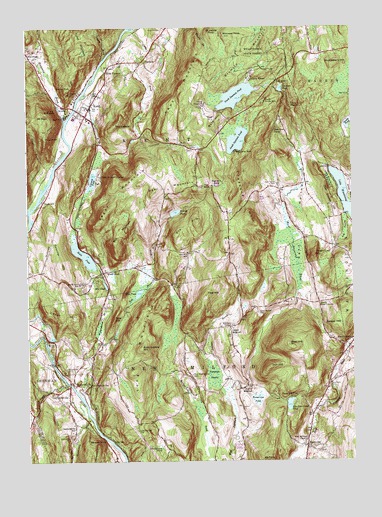
Kent, CT USGS Topographic Map
Click on map above to begin viewing in our Map Viewer.

This topographic map contains these locations and features:
Feature Name Type Latitude Longitude GNIS ID View Map
Ash SwampSwampN41.6915°W73.3779°205131View Map
Bald HillSummitN41.7234°W73.4260°205214View Map
Beaman PondLakeN41.7323°W73.4020°205337View Map
Bear HillSummitN41.6582°W73.3998°205342View Map
Birch HillSummitN41.6990°W73.4915°205515View Map
Bog Hollow BrookStreamN41.7415°W73.4960°205609View Map
Bromica MountainSummitN41.7448°W73.4112°205745View Map
Bull MountainSummitN41.6909°W73.4635°205821View Map
Bull Mountain BrookStreamN41.6451°W73.4804°205822View Map
Camp Ella FohsLocaleN41.6437°W73.4001°205947View Map
Camp FrancisLocaleN41.7268°W73.3979°205948View Map
Camp KenicoLocaleN41.7357°W73.4135°205958View Map
Camp KenmontLocaleN41.7273°W73.4318°205959View Map
Camp KentLocaleN41.7145°W73.4185°205960View Map
Camp Leonard LeonoreLocaleN41.7073°W73.4715°205962View Map
Camp Po-Ne-MahLocaleN41.7293°W73.4085°205974View Map
Carlsons GroveLocaleN41.6482°W73.3812°1931863View Map
Cedar HillSummitN41.6668°W73.4854°206077View Map
Cedar Hill PondReservoirN41.6606°W73.4906°1770634View Map
Cedar Hill Pond DamDamN41.6601°W73.4906°1770633View Map
Choggam BrookStreamN41.7423°W73.4682°206268View Map
Cobble BrookStreamN41.7493°W73.4587°206339View Map
Congregational CemeteryCemeteryN41.7312°W73.4743°1931900View Map
Denman BrookStreamN41.6445°W73.4246°206665View Map
East KentPopulated PlaceN41.7345°W73.4037°212446View Map
Ella Fohs Camp PondReservoirN41.6414°W73.3996°206927View Map
Ella Fohs Camp Pond DamDamN41.6420°W73.4007°1770631View Map
Emery ParkParkN41.7134°W73.4640°1931948View Map
Emmanuel Williamson ParkParkN41.6279°W73.4685°1931949View Map
Erickson CornerPopulated PlaceN41.6637°W73.4221°212455View Map
FlandersPopulated PlaceN41.7407°W73.4551°212459View Map
Flanders Historic DistrictParkN41.7401°W73.4546°1931968View Map
Flat RockSummitN41.7045°W73.4307°207112View Map
Fuller BridgeBridgeN41.7265°W73.4810°1931986View Map
Fuller MountainSummitN41.7468°W73.4787°207223View Map
Gaylord BridgeBridgeN41.6473°W73.4837°1931991View Map
GaylordsvillePopulated PlaceN41.6465°W73.4843°207270View Map
Gaylordsville CemeteryCemeteryN41.6318°W73.4834°207271View Map
Gaylordsville Post OfficePost OfficeN41.6394°W73.4821°1931992View Map
Gaylordsville SchoolSchoolN41.6345°W73.4823°207272View Map
Gaylordsville StationLocaleN41.6470°W73.4760°207273View Map
Gaylordsville United Methodist ChurchChurchN41.6448°W73.4843°1931993View Map
Gaylordsville Volunteer Fire DepartmentBuildingN41.6486°W73.4837°2420368View Map
Geer MountainSummitN41.7068°W73.4462°207275View Map
Geer Mountain CampLocaleN41.7048°W73.4285°207276View Map
Glacier RockSummitN41.7323°W73.4840°207315View Map
Golf Course HillSummitN41.7018°W73.3835°207346View Map
Good Hill CemeteryCemeteryN41.7495°W73.4471°207350View Map
Grand StaircaseCliffN41.7265°W73.4885°207395View Map
Hatch Four CornersLocaleN41.6707°W73.3876°207710View Map
Hatch PondLakeN41.6844°W73.4783°207711View Map
Henderson PondLakeN41.6295°W73.4490°207785View Map
Hickory HavenPopulated PlaceN41.6251°W73.3943°212478View Map
Huckleberry HillSummitN41.7390°W73.3812°208008View Map
Iron HillSummitN41.6518°W73.4071°208101View Map
Iron Mountain ReservationParkN41.7007°W73.4318°1932083View Map
Irvings PondReservoirN41.6966°W73.4431°1771367View Map
Irvings Pond DamDamN41.6956°W73.4443°1771366View Map
KentPopulated PlaceN41.7248°W73.4771°208267View Map
Kent Art AssociationBuildingN41.7218°W73.4785°1932097View Map
Kent Building Fire Marshal's OfficeBuildingN41.7265°W73.4721°2420328View Map
Kent Center SchoolSchoolN41.7240°W73.4815°1932098View Map
Kent Community HouseBuildingN41.7262°W73.4737°1932099View Map
Kent FurnacePopulated PlaceN41.7376°W73.4693°212489View Map
Kent GreenParkN41.7287°W73.4729°1932102View Map
Kent Green Shopping CenterLocaleN41.7287°W73.4726°1932103View Map
Kent HollowValleyN41.6757°W73.3954°208270View Map
Kent Hollow CemeteryCemeteryN41.7046°W73.4037°208271View Map
Kent Memorial LibraryBuildingN41.7262°W73.4754°1932105View Map
Kent MountainSummitN41.7337°W73.4396°208273View Map
Kent Post OfficePost OfficeN41.7272°W73.4719°1932106View Map
Kent Town HallBuildingN41.7295°W73.4721°1932107View Map
Kent Volunteer Fire DepartmentBuildingN41.7229°W73.4755°1932100View Map
Lake Wanamaug Country ClubLocaleN41.6926°W73.3815°1932115View Map
Lake Waramaug State ParkParkN41.7065°W73.3826°208359View Map
Leonard MountainSummitN41.7065°W73.4657°1932128View Map
Leonard PondLakeN41.7058°W73.4746°208444View Map
Long MountainSummitN41.6515°W73.4587°208571View Map
Long Mountain CemeteryCemeteryN41.6340°W73.4582°208572View Map
Lower MerryallPopulated PlaceN41.6468°W73.4157°208624View Map
Lower Segar MountainSummitN41.7065°W73.4823°1932165View Map
MacedoniaPopulated PlaceN41.7429°W73.4990°212497View Map
Macedonia BrookStreamN41.7234°W73.4851°208658View Map
Mauwee PeakSummitN41.7473°W73.4235°208776View Map
MerwinsvillePopulated PlaceN41.6476°W73.4829°208848View Map
Mill PondReservoirN41.6758°W73.4699°208916View Map
Morningside CemeteryCemeteryN41.6512°W73.4832°209050View Map
Morrissey BrookStreamN41.6384°W73.4773°209059View Map
Mount AlgoSummitN41.7240°W73.4937°205060View Map
Mud PondLakeN41.6735°W73.4571°209118View Map
Near East CampLocaleN41.7201°W73.4048°209197View Map
New Milford ChurchChurchN41.6312°W73.3929°209244View Map
North Spectacle PondLakeN41.7303°W73.4189°209376View Map
NorthvillePopulated PlaceN41.6293°W73.3932°212532View Map
Northville CemeteryCemeteryN41.6465°W73.3843°209396View Map
Northville Volunteer Fire DepartmentBuildingN41.6382°W73.3914°2420261View Map
Numeral RockSummitN41.7312°W73.4843°209428View Map
Ore HillSummitN41.6929°W73.4385°209527View Map
Ore Hill SchoolSchoolN41.6854°W73.4385°209530View Map
Peet CemeteryCemeteryN41.6754°W73.4435°209691View Map
Peet HillSummitN41.6734°W73.4315°209692View Map
Pine HillSummitN41.6662°W73.4668°209780View Map
Pine LedgeCliffN41.7179°W73.4901°209788View Map
Rock Cobble HillSummitN41.6579°W73.4565°210245View Map
Saint Johns PeakSummitN41.7479°W73.4285°210460View Map
Sawyer HillSummitN41.6640°W73.3804°210675View Map
Segar MountainSummitN41.6993°W73.4648°210749View Map
South KentPopulated PlaceN41.6795°W73.4707°212570View Map
South Kent SchoolSchoolN41.6762°W73.4798°210991View Map
South Spectacle PondLakeN41.7174°W73.4188°211010View Map
Spooner HillSummitN41.6815°W73.4871°211067View Map
Squash Hollow BrookStreamN41.6254°W73.4635°211115View Map
Straits PondLakeN41.7223°W73.3763°211239View Map
Straits Pond DamDamN41.7212°W73.3760°1771418View Map
Straits RockSummitN41.6309°W73.4732°211240View Map
Strastrom PondLakeN41.6429°W73.4121°211243View Map
Sugar Loaf HillSummitN41.6843°W73.3893°211284View Map
Tamarack SwampSwampN41.6496°W73.4287°211350View Map
Thayer BrookStreamN41.7095°W73.4901°211400View Map
The CobbleSummitN41.7234°W73.4643°211410View Map
Town of KentCivilN41.7299°W73.4540°213446View Map
Treasure HillSummitN41.7009°W73.4137°211557View Map
Upper MerryallPopulated PlaceN41.6623°W73.4221°211694View Map
Upper Merryall CemeteryCemeteryN41.6679°W73.4115°211695View Map
West Meetinghouse CemeteryCemeteryN41.6498°W73.4371°211962View Map
West Meetinghouse HillSummitN41.6520°W73.4390°1943297View Map
WGSK-FM (South Kent)TowerN41.6762°W73.4796°213372View Map
Wimisink BrookStreamN41.6473°W73.4846°212178View Map
Womenshenuk BrookStreamN41.6587°W73.4746°212224View Map

Note: Coordinates in the location and feature list above are referenced to NAD83 datum.


Copyright (C) 2008-2024 Ryan Niemi / Sunset Dynamics ... All Rights Reserved