TopoQuest Logo
Do you find TopoQuest useful?
Help keep TopoQuest running and adding new maps/features by donating!
Bitcoin:  19c7KJd3qBynnjoSw5npx9KScwjBe4ifkT
Litecoin:  LXs6TkuXGGXo1vDsWCkWVdjQX94eUKd6ui
Home View Maps Find Maps Find Places Resources & Links


Ellsworth, Connecticut Topographic Map

USGS Map Title: Ellsworth, CT
USGS Map MRC: 41073G4
DRG (GeoTIFF) Download: o41073g4.tif


Neighboring USGS Topographic Map Quads:


  Millerton, NY  
41073H5
 

  Sharon, CT  
41073H4
 

  South Canaan, CT  
41073H3
 

  Amenia, NY  
41073G5
 

  Ellsworth, CT  
41073G4
 

  Cornwall, CT  
41073G3
 

  Dover Plains, NY  
41073F5
 

  Kent, CT  
41073F4
 

  New Preston, CT  
41073F3


Map MRC Location:

N42°
W74°
N42°
W73°
H8 H7 H6 H5 H4 H3 H2 H1
G8 G7 G6 G5 G4 G3 G2 G1
F8 F7 F6 F5 F4 F3 F2 F1
E8 E7 E6 E5 E4 E3 E2 E1
D8 D7 D6 D5 D4 D3 D2 D1
C8 C7 C6 C5 C4 C3 C2 C1
B8 B7 B6 B5 B4 B3 B2 B1
A8 A7 A6 A5 A4 A3 A2 A1
N41°
W74°
N41°
W73°

Ellsworth, CT USGS 1:24K Topographic Map Preview:
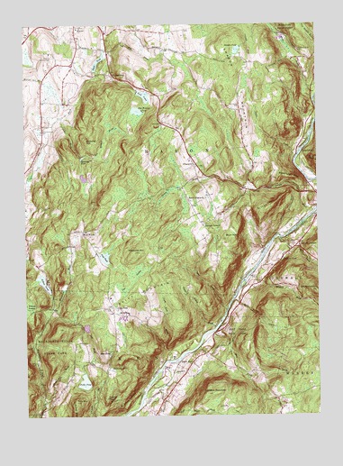
Ellsworth, CT USGS Topographic Map
Click on map above to begin viewing in our Map Viewer.

This topographic map contains these locations and features:
Feature Name Type Latitude Longitude GNIS ID View Map
Beebe BrookStreamN41.8448°W73.4857°205404View Map
Blatz PondReservoirN41.7697°W73.4639°205581View Map
Bog Meadow BrookStreamN41.8329°W73.4690°205610View Map
Bog Meadow PondReservoirN41.8476°W73.4513°205611View Map
Bolland District CemeteryCemeteryN41.8412°W73.4921°205623View Map
Bonney BrookStreamN41.8151°W73.3754°205638View Map
Bread Loaf MountainSummitN41.8259°W73.3848°205703View Map
Buck HillSummitN41.8070°W73.4140°205792View Map
Calebs PeakSummitN41.7559°W73.4648°205915View Map
Calhoun CornersPopulated PlaceN41.8037°W73.3818°205923View Map
Case PondReservoirN41.7843°W73.4608°206055View Map
Choggam Corner (historical)LocaleN41.7615°W73.4671°1931875View Map
Deep BrookStreamN41.7873°W73.4104°206642View Map
Deming HillSummitN41.8379°W73.4732°206662View Map
East Street CemeteryCemeteryN41.8492°W73.4076°206857View Map
Eastman PondReservoirN41.8326°W73.4749°206879View Map
EllsworthPopulated PlaceN41.8301°W73.4271°212454View Map
Ellsworth CemeteryCemeteryN41.8290°W73.4285°1931947View Map
Ellsworth HillSummitN41.8023°W73.4526°206935View Map
Flanders MountainSummitN41.7570°W73.4221°207102View Map
Ford PondReservoirN41.8522°W73.4481°207133View Map
Ford Pond DamDamN41.8535°W73.4512°1771360View Map
Fuller PondLakeN41.7609°W73.4749°207224View Map
Guinea BrookStreamN41.8143°W73.3768°207562View Map
Gunn BrookStreamN41.8070°W73.3907°207573View Map
Hamlin PondReservoirN41.8671°W73.4078°207636View Map
Hatch BrookStreamN41.8332°W73.3829°207708View Map
Hatch PondReservoirN41.8632°W73.4679°207712View Map
Hatch Pond DamDamN41.8602°W73.4694°1771354View Map
Hilltop PondReservoirN41.7929°W73.4921°207851View Map
Hilltop Pond DamDamN41.7894°W73.4889°1771364View Map
Housatonic Meadows State ParkParkN41.8451°W73.3785°207978View Map
Jack BrookStreamN41.7679°W73.4715°208122View Map
Jordan PondReservoirN41.7784°W73.4738°1771564View Map
Jordan Pond DamDamN41.7773°W73.4732°1771563View Map
Kent Falls BrookStreamN41.7770°W73.4193°208268View Map
Kent Falls State ParkParkN41.7759°W73.4093°208269View Map
Macedonia Brook State ParkParkN41.7729°W73.4843°208659View Map
Mauwee BrookStreamN41.7557°W73.4498°208775View Map
Millard BrookStreamN41.7945°W73.4040°208925View Map
MitcheltownPopulated PlaceN41.8584°W73.4604°212511View Map
North Flanders BrookStreamN41.7651°W73.4418°209354View Map
North KentPopulated PlaceN41.7670°W73.4285°212529View Map
North Kent BrookStreamN41.7679°W73.4385°209360View Map
Oak Ledge PondReservoirN41.8246°W73.4744°212386View Map
Pearson CornersLocaleN41.8109°W73.4235°209667View Map
Peck PondReservoirN41.8009°W73.4658°209680View Map
Peck Pond DamDamN41.8020°W73.4689°1771362View Map
Pine SwampSwampN41.7899°W73.4571°209804View Map
Pond MountainSummitN41.7548°W73.4787°209910View Map
Pond Mountain BrookStreamN41.7543°W73.4921°209911View Map
Pond Mountain Natural AreaParkN41.7548°W73.4785°1932305View Map
Richards PondReservoirN41.7650°W73.4630°210178View Map
Roger Lewis PondReservoirN41.8284°W73.4762°1771357View Map
Roger Lewis Pond DamDamN41.8284°W73.4762°1771356View Map
Saint Johns LedgesBenchN41.7554°W73.4562°210459View Map
Sharon Country ClubLocaleN41.8648°W73.4879°212983View Map
Sharon Eastside CemeteryCemeteryN41.8667°W73.3823°210779View Map
Sharon Fire Department Station 2BuildingN41.8306°W73.4276°2656265View Map
Sharon MountainSummitN41.8543°W73.4115°210780View Map
Silver HillSummitN41.8159°W73.3965°210860View Map
Skiff MountainLocaleN41.7823°W73.4568°210886View Map
Skiff MountainSummitN41.7909°W73.4529°210887View Map
Skiff Mountain CemeteryCemeteryN41.7847°W73.4627°210888View Map
South EllsworthPopulated PlaceN41.8190°W73.4293°212569View Map
Stewart Hollow BrookStreamN41.7782°W73.4187°211177View Map
Stony BrookStreamN41.7837°W73.4137°211215View Map
Town of SharonCivilN41.8575°W73.4375°213503View Map
West WoodsPopulated PlaceN41.8093°W73.4748°212594View Map
Whitcomb HillSummitN41.7901°W73.3751°212070View Map
Whitten SwampSwampN41.7845°W73.4991°212102View Map
Wilford PondLakeN41.7999°W73.3896°212134View Map
Wyantenock State ForestForestN41.7684°W73.3910°212294View Map
Yuza Mini BrookStreamN41.7545°W73.4410°212315View Map

Note: Coordinates in the location and feature list above are referenced to NAD83 datum.


Copyright (C) 2008-2024 Ryan Niemi / Sunset Dynamics ... All Rights Reserved