TopoQuest Logo
Do you find TopoQuest useful?
Help keep TopoQuest running and adding new maps/features by donating!
Bitcoin:  19c7KJd3qBynnjoSw5npx9KScwjBe4ifkT
Litecoin:  LXs6TkuXGGXo1vDsWCkWVdjQX94eUKd6ui
Home View Maps Find Maps Find Places Resources & Links


Kansas, Illinois Topographic Map

USGS Map Title: Kansas, IL
USGS Map MRC: 39087E8
DRG (GeoTIFF) Download: o39087e8.tif


Neighboring USGS Topographic Map Quads:


  Oakland, IL  
39088F1
 

  Brocton, IL  
39087F8
 

  Redmon, IL  
39087F7
 

  Ashmore, IL  
39088E1
 

  Kansas, IL  
39087E8
 

  Grandview, IL  
39087E7
 

  Westfield West, IL  
39088D1
 

  Westfield East, IL  
39087D8
 

  Clarksville, IL  
39087D7


Map MRC Location:

N40°
W88°
N40°
W87°
H8 H7 H6 H5 H4 H3 H2 H1
G8 G7 G6 G5 G4 G3 G2 G1
F8 F7 F6 F5 F4 F3 F2 F1
E8 E7 E6 E5 E4 E3 E2 E1
D8 D7 D6 D5 D4 D3 D2 D1
C8 C7 C6 C5 C4 C3 C2 C1
B8 B7 B6 B5 B4 B3 B2 B1
A8 A7 A6 A5 A4 A3 A2 A1
N39°
W88°
N39°
W87°

Kansas, IL USGS 1:24K Topographic Map Preview:
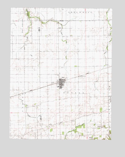
Kansas, IL USGS Topographic Map
Click on map above to begin viewing in our Map Viewer.

This topographic map contains these locations and features:
Feature Name Type Latitude Longitude GNIS ID View Map
Bell School (historical)SchoolN39.5986°W87.9975°404129View Map
Boyer CemeteryCemeteryN39.5017°W87.9017°1736478View Map
College School (historical)SchoolN39.5395°W87.9806°406371View Map
Cornwell CemeteryCemeteryN39.5159°W87.9384°406602View Map
East Donica CreekStreamN39.6167°W87.9778°407629View Map
Elm Grove (historical)WoodsN39.5836°W87.8786°1808098View Map
Fairview CemeteryCemeteryN39.5603°W87.9131°408188View Map
Gough Airport (historical)AirportN39.5383°W87.8768°427416View Map
Greenwood School (historical)SchoolN39.5031°W87.9867°409468View Map
Harmony CemeteryCemeteryN39.6056°W87.9420°1808107View Map
Harmony ChurchChurchN39.6056°W87.9417°409805View Map
Harmony School (historical)SchoolN39.5989°W87.9273°409813View Map
Hickory Grove School (historical)SchoolN39.5998°W87.8856°410157View Map
Inclose School (historical)SchoolN39.5045°W87.9331°410808View Map
KansasPopulated PlaceN39.5528°W87.9395°411307View Map
Kansas Ambulance CompanyBuildingN39.5528°W87.9398°2673950View Map
Kansas Christian ChurchChurchN39.5536°W87.9364°2043565View Map
Kansas Elementary SchoolSchoolN39.5528°W87.9342°1808111View Map
Kansas Fire Protection DistrictBuildingN39.5534°W87.9424°2682502View Map
Kansas High SchoolSchoolN39.5503°W87.9403°1736503View Map
Kansas Post OfficePost OfficeN39.5532°W87.9384°2788545View Map
Liberty School (historical)SchoolN39.5695°W87.9642°412022View Map
Pleasant Hill CemeteryCemeteryN39.5122°W87.8861°1808122View Map
Pleasant Hill ChurchChurchN39.5120°W87.8870°415836View Map
Pleasant Hill School (historical)SchoolN39.5039°W87.8781°415843View Map
Poulter CemeteryCemeteryN39.5034°W87.9448°1934490View Map
Prairie Union Church (historical)ChurchN39.5914°W87.9909°416167View Map
Providence Church (historical)ChurchN39.6192°W87.9642°416256View Map
Shields CemeteryCemeteryN39.6139°W87.9650°418390View Map
Shively School (historical)SchoolN39.5978°W87.9650°418440View Map
Simpson School (historical)SchoolN39.5692°W87.8898°418536View Map
Township of KansasCivilN39.5477°W87.9209°429195View Map
Village of KansasCivilN39.5544°W87.9394°2398327View Map
Waite CemeteryCemeteryN39.5139°W87.9511°421024View Map
Walnut Grove School (historical)SchoolN39.5406°W87.8886°420465View Map
WarringtonPopulated PlaceN39.6128°W87.9375°1736562View Map
West Donica CreekStreamN39.6164°W87.9778°420815View Map
Wilhoit CemeteryCemeteryN39.5178°W87.9239°421175View Map

Note: Coordinates in the location and feature list above are referenced to NAD83 datum.


Copyright (C) 2008-2024 Ryan Niemi / Sunset Dynamics ... All Rights Reserved