TopoQuest Logo
Do you find TopoQuest useful?
Help keep TopoQuest running and adding new maps/features by donating!
Bitcoin:  19c7KJd3qBynnjoSw5npx9KScwjBe4ifkT
Litecoin:  LXs6TkuXGGXo1vDsWCkWVdjQX94eUKd6ui
Home View Maps Find Maps Find Places Resources & Links


Kaibab, Arizona Topographic Map

USGS Map Title: Kaibab, AZ
USGS Map MRC: 36112H6
DRG (GeoTIFF) Download: o36112h6.tif


Neighboring USGS Topographic Map Quads:


  Elephant Butte, UT  
37112A7
 

  Yellowjacket Canyon, UT  
37112A6
 

  Kanab, UT  
37112A5
 

  Moccasin, AZ  
36112H7
 

  Kaibab, AZ  
36112H6
 

  Fredonia, AZ  
36112H5
 

  Pipe Valley, AZ  
36112G7
 

  Pipe Spring, AZ  
36112G6
 

  Clear Water Spring, AZ  
36112G5


Map MRC Location:

N37°
W113°
N37°
W112°
H8 H7 H6 H5 H4 H3 H2 H1
G8 G7 G6 G5 G4 G3 G2 G1
F8 F7 F6 F5 F4 F3 F2 F1
E8 E7 E6 E5 E4 E3 E2 E1
D8 D7 D6 D5 D4 D3 D2 D1
C8 C7 C6 C5 C4 C3 C2 C1
B8 B7 B6 B5 B4 B3 B2 B1
A8 A7 A6 A5 A4 A3 A2 A1
N36°
W113°
N36°
W112°

Kaibab, AZ USGS 1:24K Topographic Map Preview:
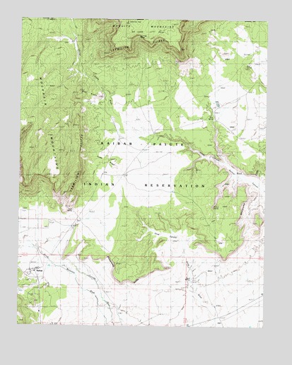
Kaibab, AZ USGS Topographic Map
Click on map above to begin viewing in our Map Viewer.

This topographic map contains these locations and features:
Feature Name Type Latitude Longitude GNIS ID View Map
Aulson SpringSpringN36.9236°W112.6521°889View Map
Blue KnollsSummitN36.9658°W112.7105°1708View Map
Cedar RidgeRidgeN36.9425°W112.7060°2641View Map
Cove CanyonValleyN36.9119°W112.6741°24245View Map
Ed Lamb PointCliffN36.9917°W112.6855°4348View Map
Indian MoccasinPopulated PlaceN36.8972°W112.7424°6219View Map
KaibabPopulated PlaceN36.8967°W112.7408°42814View Map
Kaibab Census Designated PlaceCensusN36.8815°W112.7236°2408459View Map
Kaibab Indian ReservationCivilN36.9128°W112.6797°23994View Map
Pine SpringSpringN36.9604°W112.6528°9477View Map
Point SpringSpringN36.9217°W112.7235°9606View Map
Red Cliff SpringSpringN36.9850°W112.6891°10035View Map
Riggs SpringSpringN36.9485°W112.6253°23164View Map
Sand SpringSpringN36.8938°W112.6632°10888View Map
Shinarump CliffsCliffN36.9082°W112.6570°11216View Map
Stock PondLakeN36.8947°W112.7210°11851View Map
Twomile CorralsLocaleN36.8828°W112.7016°13013View Map
Wolf SpringSpringN36.9817°W112.6360°13966View Map

Note: Coordinates in the location and feature list above are referenced to NAD83 datum.


Copyright (C) 2008-2024 Ryan Niemi / Sunset Dynamics ... All Rights Reserved