TopoQuest Logo
Do you find TopoQuest useful?
Help keep TopoQuest running and adding new maps/features by donating!
Bitcoin:  19c7KJd3qBynnjoSw5npx9KScwjBe4ifkT
Litecoin:  LXs6TkuXGGXo1vDsWCkWVdjQX94eUKd6ui
Home View Maps Find Maps Find Places Resources & Links


Joiner, Arkansas Topographic Map

USGS Map Title: Joiner, AR
USGS Map MRC: 35090E2
DRG (GeoTIFF) Download: o35090e2.tif


Neighboring USGS Topographic Map Quads:


  Rivervale, AR  
35090F3
 

  Etowah, AR  
35090F2
 

  Keiser, AR  
35090F1
 

  Lepanto, AR  
35090E3
 

  Joiner, AR  
35090E2
 

  Wilson, AR  
35090E1
 

  Tyronza, AR  
35090D3
 

  Frenchmans Bayou, AR  
35090D2
 

  Pecan Point, AR  
35090D1


Map MRC Location:

N36°
W91°
N36°
W90°
H8 H7 H6 H5 H4 H3 H2 H1
G8 G7 G6 G5 G4 G3 G2 G1
F8 F7 F6 F5 F4 F3 F2 F1
E8 E7 E6 E5 E4 E3 E2 E1
D8 D7 D6 D5 D4 D3 D2 D1
C8 C7 C6 C5 C4 C3 C2 C1
B8 B7 B6 B5 B4 B3 B2 B1
A8 A7 A6 A5 A4 A3 A2 A1
N35°
W91°
N35°
W90°

Joiner, AR USGS 1:24K Topographic Map Preview:
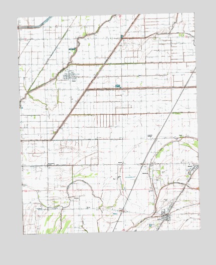
Joiner, AR USGS Topographic Map
Click on map above to begin viewing in our Map Viewer.

This topographic map contains these locations and features:
Feature Name Type Latitude Longitude GNIS ID View Map
Ashburn CemeteryCemeteryN35.5380°W90.1600°45952View Map
BardstownPopulated PlaceN35.5356°W90.1601°57328View Map
BassettPopulated PlaceN35.5365°W90.1268°57337View Map
Bassett CemeteryCemeteryN35.5313°W90.1329°46140View Map
Bassett Post OfficePost OfficeN35.5324°W90.1301°2773507View Map
Bowden CemeteryCemeteryN35.5169°W90.1488°61964View Map
Butler Lake DitchCanalN35.5520°W90.1262°47238View Map
ChelfordPopulated PlaceN35.5167°W90.2368°57541View Map
Chelford SchoolSchoolN35.5145°W90.2282°47719View Map
City of JoinerCivilN35.5059°W90.1501°2404810View Map
Creamery PackageLocaleN35.5534°W90.1648°76703View Map
Ditch Number 13CanalN35.5476°W90.1301°82070View Map
Ditch Number 31CanalN35.5956°W90.2154°82213View Map
Ditch Number 38CanalN35.6076°W90.2223°82238View Map
Ditch Number 40-BCanalN35.5967°W90.2029°82255View Map
Ditch Number 40-CCanalN35.5812°W90.2037°82256View Map
Ditch Number 49CanalN35.5970°W90.1504°82289View Map
Ditch Number 5CanalN35.5251°W90.1312°82299View Map
Ditch Number 50CanalN35.5823°W90.1684°82306View Map
Ditch Number 51CanalN35.5676°W90.1826°82308View Map
Ditch Number 52CanalN35.5537°W90.2029°82313View Map
Ditch Number 53CanalN35.5398°W90.2282°82317View Map
Ditch Number 6CanalN35.5473°W90.1493°82337View Map
Ditch Number 6CanalN35.5059°W90.2493°82343View Map
Ditch Number 6ACanalN35.5048°W90.1665°82348View Map
Ditch Number 7CanalN35.5123°W90.1384°82374View Map
Ditch Number 8CanalN35.5065°W90.1309°81956View Map
DyessPopulated PlaceN35.5898°W90.2134°82838View Map
Dyess Elementary School (historical)SchoolN35.5927°W90.2124°61962View Map
Dyess Post OfficePost OfficeN35.5896°W90.2141°2773510View Map
Dyess Volunteer Fire DepartmentBuildingN35.5972°W90.2145°2116376View Map
Harston CemeteryCemeteryN35.5337°W90.1513°61965View Map
Hill CemeteryCemeteryN35.5400°W90.1352°61966View Map
Interchange 34CrossingN35.5120°W90.1801°59042View Map
Interchange 36CrossingN35.5384°W90.1643°59043View Map
JoinerPopulated PlaceN35.5079°W90.1470°57996View Map
Joiner Police DepartmentBuildingN35.5072°W90.1504°2118571View Map
Joiner Post OfficePost OfficeN35.5090°W90.1526°2773508View Map
Joiner Volunteer Fire DepartmentBuildingN35.5082°W90.1482°2116653View Map
Louise CemeteryCemeteryN35.5239°W90.1589°51480View Map
McClendons CornerPopulated PlaceN35.5401°W90.2315°58139View Map
Mount Asby ChurchChurchN35.5142°W90.2037°52259View Map
Mount Pisby CemeteryCemeteryN35.5142°W90.2049°52372View Map
MuirPopulated PlaceN35.5315°W90.1829°58231View Map
New Bethel ChurchChurchN35.5251°W90.1512°77805View Map
New Bethel ChurchChurchN35.5237°W90.1581°77559View Map
NordenPopulated PlaceN35.5542°W90.1343°58271View Map
Saint Marys CemeteryCemeteryN35.5143°W90.2282°54411View Map
Saint Marys ChurchChurchN35.5142°W90.2273°78255View Map
Shawnee SchoolSchoolN35.5101°W90.1251°54751View Map
Town of BassettCivilN35.5358°W90.1293°2405212View Map
Town of DyessCivilN35.5894°W90.2133°2406409View Map
Township of DyessCivilN35.5922°W90.2260°69657View Map
Township of ScottCivilN35.5322°W90.1575°69668View Map
Tyronza BayouStreamN35.6112°W90.1754°55774View Map
Upper Sandy BayouStreamN35.6134°W90.1423°55855View Map
Uzzell CemeteryCemeteryN35.5530°W90.1409°55866View Map
WardellPopulated PlaceN35.5390°W90.1784°58829View Map
Wardell Baptist ChurchChurchN35.5317°W90.1815°78694View Map
Wells Mill (historical)LocaleN35.5484°W90.2340°61963View Map
WestoverPopulated PlaceN35.5212°W90.2134°58859View Map

Note: Coordinates in the location and feature list above are referenced to NAD83 datum.


Copyright (C) 2008-2024 Ryan Niemi / Sunset Dynamics ... All Rights Reserved