TopoQuest Logo
Do you find TopoQuest useful?
Help keep TopoQuest running and adding new maps/features by donating!
Bitcoin:  19c7KJd3qBynnjoSw5npx9KScwjBe4ifkT
Litecoin:  LXs6TkuXGGXo1vDsWCkWVdjQX94eUKd6ui
Home View Maps Find Maps Find Places Resources & Links


Baldy Mountain, Oregon Topographic Map

USGS Map Title: Baldy Mountain, OR
USGS Map MRC: 43123H7
DRG (GeoTIFF) Download: o43123h7.tif


Neighboring USGS Topographic Map Quads:


  Tiernan, OR  
44123A8
 

  Mapleton, OR  
44123A7
 

  Greenleaf, OR  
44123A6
 

  Goodwin Peak, OR  
43123H8
 

  Baldy Mountain, OR  
43123H7
 

  Roman Nose Mountain, OR  
43123H6
 

  North Fork, OR  
43123G8
 

  Smith River Falls, OR  
43123G7
 

  Twin Sisters, OR  
43123G6


Map MRC Location:

N44°
W124°
N44°
W123°
H8 H7 H6 H5 H4 H3 H2 H1
G8 G7 G6 G5 G4 G3 G2 G1
F8 F7 F6 F5 F4 F3 F2 F1
E8 E7 E6 E5 E4 E3 E2 E1
D8 D7 D6 D5 D4 D3 D2 D1
C8 C7 C6 C5 C4 C3 C2 C1
B8 B7 B6 B5 B4 B3 B2 B1
A8 A7 A6 A5 A4 A3 A2 A1
N43°
W124°
N43°
W123°

Baldy Mountain, OR USGS 1:24K Topographic Map Preview:
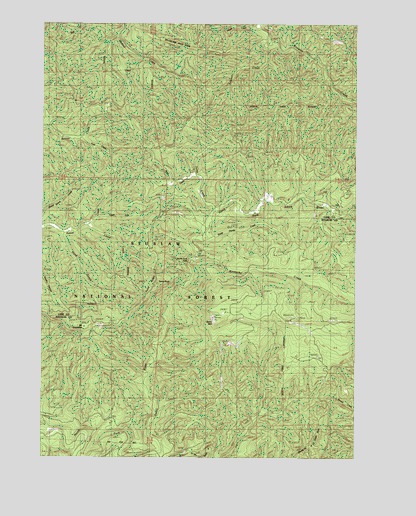
Baldy Mountain, OR USGS Topographic Map
Click on map above to begin viewing in our Map Viewer.

This topographic map contains these locations and features:
Feature Name Type Latitude Longitude GNIS ID View Map
Baldy MountainSummitN43.9136°W123.8066°1137475View Map
Deer CreekStreamN43.9668°W123.8596°1140825View Map
Hand CreekStreamN43.9390°W123.8654°1143260View Map
Hand RidgeRidgeN43.9254°W123.8326°1134689View Map
Hood CreekStreamN43.9998°W123.7907°1143703View Map
Jump CreekStreamN43.9462°W123.8068°1144423View Map
Kentucky CreekStreamN43.9312°W123.8168°1144561View Map
Lloyd CreekStreamN43.9421°W123.8584°1134688View Map
Lower Kentucky FallsFallsN43.9313°W123.8157°2435990View Map
Middle Fork North Fork Smith RiverStreamN43.8760°W123.8290°1146154View Map
Mount GraybackSummitN43.9125°W123.8592°1637909View Map
North Fork FallsFallsN43.9323°W123.8177°1146953View Map
Ord Post Office (historical)Post OfficeN43.9482°W123.7984°1164566View Map
Ryan CreekStreamN43.9565°W123.8143°1148871View Map
Sheep Herder CreekStreamN43.9312°W123.8168°1149339View Map
Smith River Recreation Site (historical)LocaleN43.8773°W123.8646°1153676View Map
Smittie RidgeRidgeN43.8946°W123.8457°1153668View Map
South Fork Sweet CreekStreamN43.9437°W123.8534°1639328View Map
Sulphur CreekStreamN43.9932°W123.7857°1150577View Map
Table RockPillarN43.9257°W123.8290°1150823View Map
Upper Kentucky FallsFallsN43.9282°W123.8025°2435969View Map

Note: Coordinates in the location and feature list above are referenced to NAD83 datum.


Copyright (C) 2008-2024 Ryan Niemi / Sunset Dynamics ... All Rights Reserved