TopoQuest Logo
Do you find TopoQuest useful?
Help keep TopoQuest running and adding new maps/features by donating!
Bitcoin:  19c7KJd3qBynnjoSw5npx9KScwjBe4ifkT
Litecoin:  LXs6TkuXGGXo1vDsWCkWVdjQX94eUKd6ui
Home View Maps Find Maps Find Places Resources & Links


Hookstown, Pennsylvania Topographic Map

USGS Map Title: Hookstown, PA
USGS Map MRC: 40080E4
DRG (GeoTIFF) Download: o40080e4.tif


Neighboring USGS Topographic Map Quads:


  East Liverpool North, OH  
40080F5
 

  Midland, PA  
40080F4
 

  Beaver, PA  
40080F3
 

  East Liverpool South, OH  
40080E5
 

  Hookstown, PA  
40080E4
 

  Aliquippa, PA  
40080E3
 

  Weirton, WV  
40080D5
 

  Burgettstown, PA  
40080D4
 

  Clinton, PA  
40080D3


Map MRC Location:

N41°
W81°
N41°
W80°
H8 H7 H6 H5 H4 H3 H2 H1
G8 G7 G6 G5 G4 G3 G2 G1
F8 F7 F6 F5 F4 F3 F2 F1
E8 E7 E6 E5 E4 E3 E2 E1
D8 D7 D6 D5 D4 D3 D2 D1
C8 C7 C6 C5 C4 C3 C2 C1
B8 B7 B6 B5 B4 B3 B2 B1
A8 A7 A6 A5 A4 A3 A2 A1
N40°
W81°
N40°
W80°

Hookstown, PA USGS 1:24K Topographic Map Preview:
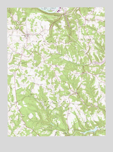
Hookstown, PA USGS Topographic Map
Click on map above to begin viewing in our Map Viewer.

This topographic map contains these locations and features:
Feature Name Type Latitude Longitude GNIS ID View Map
Bethel / Bethel Methodist Church CemeteryCemeteryN40.5162°W80.4815°1169363View Map
Bethel ChurchChurchN40.5195°W80.4809°1169389View Map
Borough of HookstownCivilN40.5989°W80.4737°1214880View Map
Buchanan SchoolSchoolN40.5409°W80.4703°1170502View Map
Christler Family CemeteryCemeteryN40.6248°W80.4274°2776000View Map
Findlay Township HallBuildingN40.5421°W80.4132°2429991View Map
Fino AirportAirportN40.6048°W80.4574°1194039View Map
Free Methodist ChurchChurchN40.6140°W80.4753°1175205View Map
Group Camping Area LakeReservoirN40.5119°W80.4430°1194881View Map
Hanny Beaver Airpark IncAirportN40.5362°W80.4462°2443644View Map
Hanover CemeteryCemeteryN40.5353°W80.4234°1176474View Map
Hanover ChurchChurchN40.5406°W80.4192°1176476View Map
Hanover Township Volunteer Fire Department Station 68 - 1BuildingN40.5244°W80.4217°2644727View Map
Hanover Township Volunteer Fire Department Station 68 - 2BuildingN40.5222°W80.4837°2645782View Map
HarshavillePopulated PlaceN40.5417°W80.4106°1176598View Map
HookstownPopulated PlaceN40.5992°W80.4728°1177356View Map
Hookstown CemeteryCemeteryN40.5995°W80.4640°1177357View Map
Hookstown GrangeLocaleN40.5870°W80.4762°1177358View Map
Hookstown Post OfficePost OfficeN40.5987°W80.4719°2777400View Map
Hookstown Volunteer Fire Department Station 60BuildingN40.5858°W80.4758°2645339View Map
KendallPopulated PlaceN40.5342°W80.4878°1203926View Map
Little Service RunStreamN40.5040°W80.4242°1179674View Map
Main LakeReservoirN40.5053°W80.3936°1194880View Map
Mc Coy AirportAirportN40.5392°W80.4130°1194016View Map
McClearyPopulated PlaceN40.6090°W80.4003°1204127View Map
MechanicsburgPopulated PlaceN40.5617°W80.4028°1180843View Map
Mill Creek CemeteryCemeteryN40.5720°W80.4787°1181155View Map
Mill Creek ChurchChurchN40.5712°W80.4815°1181156View Map
Mill Creek Hill CemeteryCemeteryN40.5617°W80.4915°1181158View Map
Miller SchoolSchoolN40.5223°W80.4220°1181237View Map
Mount Pleasant ChurchChurchN40.6212°W80.3909°1181817View Map
Phillis IslandIslandN40.6220°W80.4426°1183682View Map
Pleasant Hill Wesleyan AcademySchoolN40.5497°W80.4435°2431512View Map
Raccoon Creek State ParkParkN40.5078°W80.4362°1184577View Map
Raccoon Creek State Park DamDamN40.5084°W80.3865°1194879View Map
Raccoon Township Independent Volunteer Fire Department Station 35 SubstationBuildingN40.5957°W80.3949°2645871View Map
Raccoon Township Police DepartmentBuildingN40.5952°W80.3950°2780480View Map
Reed SchoolSchoolN40.5684°W80.4615°1184824View Map
South Side Elementary SchoolSchoolN40.5684°W80.4381°1207365View Map
Southside Middle School and High SchoolSchoolN40.5684°W80.4365°1207364View Map
State Park HeadquartersLocaleN40.5031°W80.4242°1188555View Map
Township of GreeneCivilN40.5951°W80.4720°1215873View Map
Township of HanoverCivilN40.5181°W80.4429°1215874View Map
Township of RaccoonCivilN40.6008°W80.3753°1215884View Map
Traverse Creek DamDamN40.5112°W80.4406°1212690View Map
Wallory BarBarN40.6167°W80.4498°1214137View Map
Wesleyan ChurchChurchN40.5495°W80.4570°1190869View Map

Note: Coordinates in the location and feature list above are referenced to NAD83 datum.


Copyright (C) 2008-2024 Ryan Niemi / Sunset Dynamics ... All Rights Reserved