TopoQuest Logo
Do you find TopoQuest useful?
Help keep TopoQuest running and adding new maps/features by donating!
Bitcoin:  19c7KJd3qBynnjoSw5npx9KScwjBe4ifkT
Litecoin:  LXs6TkuXGGXo1vDsWCkWVdjQX94eUKd6ui
Home View Maps Find Maps Find Places Resources & Links


Hollywood, Mississippi Topographic Map

USGS Map Title: Hollywood, MS
USGS Map MRC: 34090F3
DRG (GeoTIFF) Download: o34090f3.tif


Neighboring USGS Topographic Map Quads:


  Council, AR  
34090G4
 

  Robinsonville, MS  
34090G3
 

  Banks, MS  
34090G2
 

  Tunica, MS  
34090F4
 

  Hollywood, MS  
34090F3
 

  Arkabutla West, MS  
34090F2
 

  Dundee, MS  
34090E4
 

  Walnut Lake, MS  
34090E3
 

  Crenshaw North, MS  
34090E2


Map MRC Location:

N35°
W91°
N35°
W90°
H8 H7 H6 H5 H4 H3 H2 H1
G8 G7 G6 G5 G4 G3 G2 G1
F8 F7 F6 F5 F4 F3 F2 F1
E8 E7 E6 E5 E4 E3 E2 E1
D8 D7 D6 D5 D4 D3 D2 D1
C8 C7 C6 C5 C4 C3 C2 C1
B8 B7 B6 B5 B4 B3 B2 B1
A8 A7 A6 A5 A4 A3 A2 A1
N34°
W91°
N34°
W90°

Hollywood, MS USGS 1:24K Topographic Map Preview:
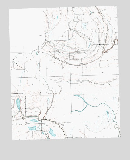
Hollywood, MS USGS Topographic Map
Click on map above to begin viewing in our Map Viewer.

This topographic map contains these locations and features:
Feature Name Type Latitude Longitude GNIS ID View Map
Arnold Field Airport (historical)AirportN34.7494°W90.2823°2676385View Map
Belmont CemeteryCemeteryN34.7145°W90.2648°666803View Map
Belmont ChurchChurchN34.7143°W90.2634°666809View Map
Bill SchoolSchoolN34.6851°W90.3359°667165View Map
Buck Island BayouGutN34.7354°W90.2665°667735View Map
Christian Grove ChurchChurchN34.6407°W90.3229°668424View Map
Clear LakeLakeN34.7446°W90.2801°684834View Map
Clear Lake CemeteryCemeteryN34.7431°W90.2901°668584View Map
Clear Lake ChurchChurchN34.7432°W90.2901°668585View Map
Corinth CemeteryCemeteryN34.7293°W90.2959°668826View Map
Corinth ChurchChurchN34.7215°W90.2998°668839View Map
Corinth SchoolSchoolN34.7215°W90.2998°668840View Map
Cypress Grove ChurchChurchN34.6704°W90.2526°669058View Map
Delta Hills of Pritchard SchoolSchoolN34.7173°W90.2798°676564View Map
Fish LakeLakeN34.6505°W90.2640°669983View Map
Fredonia CemeteryCemeteryN34.7079°W90.3740°670175View Map
Fredonia SchoolSchoolN34.7068°W90.3740°670181View Map
Free Grace ChurchChurchN34.6851°W90.3570°670184View Map
HollywoodPopulated PlaceN34.7454°W90.3582°671340View Map
Houston SchoolSchoolN34.6454°W90.3354°671523View Map
Isles SchoolSchoolN34.7134°W90.2640°671740View Map
Jack Lake BayouGutN34.6959°W90.2962°671761View Map
Jasper LakeSwampN34.7429°W90.3187°671812View Map
Jenkins ChapelChurchN34.6745°W90.3048°671836View Map
Little TexasPopulated PlaceN34.6273°W90.2820°672698View Map
Little Texas ChurchChurchN34.6265°W90.2970°672699View Map
Little Texas SchoolSchoolN34.6265°W90.2970°672700View Map
Little White Oak BayouStreamN34.6445°W90.3365°672708View Map
Macedonia CemeteryCemeteryN34.7431°W90.3626°684856View Map
Mathis BayouLakeN34.6791°W90.2817°673237View Map
Millers Union ChurchChurchN34.7451°W90.2984°673647View Map
Millers Union SchoolSchoolN34.7443°W90.2987°673648View Map
Minton BayouGutN34.7357°W90.3051°673685View Map
Moon ChapelChurchN34.6407°W90.3690°673758View Map
Mud LakeLakeN34.7048°W90.3426°674444View Map
New Hope CemeteryCemeteryN34.6407°W90.3576°674673View Map
New Hope ChurchChurchN34.6415°W90.3582°674743View Map
New Hope SchoolSchoolN34.6415°W90.3582°674755View Map
Oak Grove CemeteryCemeteryN34.6957°W90.3054°675017View Map
Oak Grove ChurchChurchN34.6957°W90.3054°675065View Map
Pleasant Ridge CemeteryCemeteryN34.6698°W90.3293°676099View Map
Pleasant Ridge ChurchChurchN34.6698°W90.3293°676125View Map
Saint Mathews ChurchChurchN34.6993°W90.2709°677161View Map
Saint Pauls ChurchChurchN34.7073°W90.3584°677223View Map
Shiloh CemeteryCemeteryN34.7426°W90.2676°677675View Map
Shiloh ChurchChurchN34.7426°W90.2676°677705View Map
Supervisor District 2CivilN34.7252°W90.2842°712106View Map
Supervisor District 3CivilN34.6392°W90.3210°712107View Map
Tunica Municipal AirportAirportN34.6847°W90.3498°2676386View Map
Tunica-Rosa Fort High SchoolSchoolN34.7034°W90.3737°706982View Map
White OakPopulated PlaceN34.6459°W90.3543°684877View Map
White Oak Census Designated PlaceCensusN34.6439°W90.3494°2586614View Map

Note: Coordinates in the location and feature list above are referenced to NAD83 datum.


Copyright (C) 2008-2024 Ryan Niemi / Sunset Dynamics ... All Rights Reserved