TopoQuest Logo
Do you find TopoQuest useful?
Help keep TopoQuest running and adding new maps/features by donating!
Bitcoin:  19c7KJd3qBynnjoSw5npx9KScwjBe4ifkT
Litecoin:  LXs6TkuXGGXo1vDsWCkWVdjQX94eUKd6ui
Home View Maps Find Maps Find Places Resources & Links


Baden, Georgia Topographic Map

USGS Map Title: Baden, GA
USGS Map MRC: 30083F5
DRG (GeoTIFF) Download: o30083f5.tif


Neighboring USGS Topographic Map Quads:


  Dixie, GA  
30083G6
 

  Quitman, GA  
30083G5
 

  Ousley, GA  
30083G4
 

  Grooverville, GA  
30083F6
 

  Baden, GA  
30083F5
 

  Nankin, GA  
30083F4
 

  Ashville, FL  
30083E6
 

  Hamburg, FL  
30083E5
 

  Cherry Lake, FL  
30083E4


Map MRC Location:

N31°
W84°
N31°
W83°
H8 H7 H6 H5 H4 H3 H2 H1
G8 G7 G6 G5 G4 G3 G2 G1
F8 F7 F6 F5 F4 F3 F2 F1
E8 E7 E6 E5 E4 E3 E2 E1
D8 D7 D6 D5 D4 D3 D2 D1
C8 C7 C6 C5 C4 C3 C2 C1
B8 B7 B6 B5 B4 B3 B2 B1
A8 A7 A6 A5 A4 A3 A2 A1
N30°
W84°
N30°
W83°

Baden, GA USGS 1:24K Topographic Map Preview:
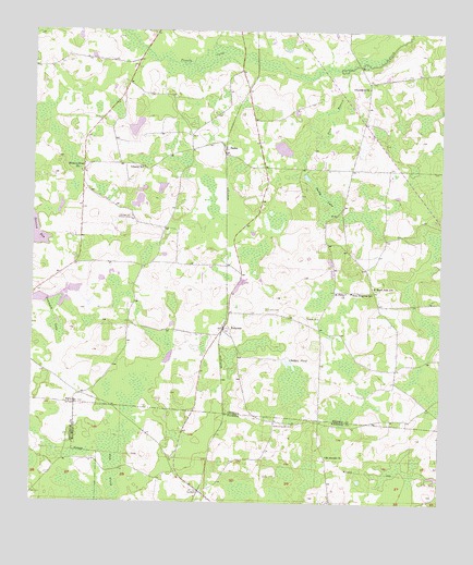
Baden, GA USGS Topographic Map
Click on map above to begin viewing in our Map Viewer.

This topographic map contains these locations and features:
Feature Name Type Latitude Longitude GNIS ID View Map
BadenPopulated PlaceN30.7174°W83.5652°310709View Map
Catledge Hill Lookout TowerTowerN30.7005°W83.5946°344202View Map
Childers PondReservoirN30.6631°W83.5464°312639View Map
Church of the LordChurchN30.6538°W83.5738°345530View Map
Denmark LakeSwampN30.6738°W83.6185°313441View Map
EmpressPopulated PlaceN30.6716°W83.5657°326266View Map
Empress DivisionCivilN30.6868°W83.5126°1936251View Map
Hickory Head ChurchChurchN30.7127°W83.6102°356274View Map
Johson CemeteryCemeteryN30.6496°W83.5754°345557View Map
Liberty ChurchChurchN30.7141°W83.5915°345564View Map
Liberty SchoolSchoolN30.7141°W83.5907°316843View Map
LovettPopulated PlaceN30.6283°W83.5732°294842View Map
Mount Moriah ChurchChurchN30.6377°W83.5343°287238View Map
New Empress SchoolSchoolN30.6810°W83.5271°319308View Map
Pine BranchStreamN30.7399°W83.5288°320540View Map
Pineview ChurchChurchN30.6624°W83.5724°345588View Map
Pride BranchStreamN30.7474°W83.5935°319238View Map
Purdy LakeSwampN30.7046°W83.5346°321233View Map
Redford Denson CemeteryCemeteryN30.6466°W83.5502°289579View Map
Saint Philip ChurchChurchN30.6808°W83.5288°322304View Map
South Brooks Division (historical)CensusN30.6996°W83.6143°1936547View Map
South Brooks Volunteer Fire DepartmentBuildingN30.7258°W83.5241°2604990View Map
South Side SchoolSchoolN30.6821°W83.5199°323286View Map
Sweetfield ChurchChurchN30.7352°W83.5221°323816View Map
Union CemeteryCemeteryN30.6763°W83.5524°324489View Map
Union ChurchChurchN30.6741°W83.5371°324501View Map
Union School (historical)SchoolN30.6738°W83.5374°345621View Map
Worn CemeteryCemeteryN30.7330°W83.5354°345623View Map

Note: Coordinates in the location and feature list above are referenced to NAD83 datum.


Copyright (C) 2008-2024 Ryan Niemi / Sunset Dynamics ... All Rights Reserved