TopoQuest Logo
Do you find TopoQuest useful?
Help keep TopoQuest running and adding new maps/features by donating!
Bitcoin:  19c7KJd3qBynnjoSw5npx9KScwjBe4ifkT
Litecoin:  LXs6TkuXGGXo1vDsWCkWVdjQX94eUKd6ui
Home View Maps Find Maps Find Places Resources & Links


Harrisville, Michigan Topographic Map

USGS Map Title: Harrisville, MI
USGS Map MRC: 44083F3
DRG (GeoTIFF) Download: o44083f3.tif


Neighboring USGS Topographic Map Quads:


  Spruce, MI  
44083G4
 

  Black River, MI  
44083G3


  Lincoln, MI  
44083F4
 

  Harrisville, MI  
44083F3


  Mikado, MI  
44083E4
 

  Greenbush, MI  
44083E3


Map MRC Location:

N45°
W84°
N45°
W83°
H8 H7 H6 H5 H4 H3 H2 H1
G8 G7 G6 G5 G4 G3 G2 G1
F8 F7 F6 F5 F4 F3 F2 F1
E8 E7 E6 E5 E4 E3 E2 E1
D8 D7 D6 D5 D4 D3 D2 D1
C8 C7 C6 C5 C4 C3 C2 C1
B8 B7 B6 B5 B4 B3 B2 B1
A8 A7 A6 A5 A4 A3 A2 A1
N44°
W84°
N44°
W83°

Harrisville, MI USGS 1:24K Topographic Map Preview:
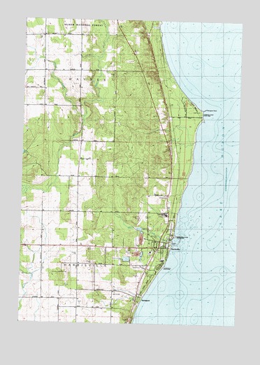
Harrisville, MI USGS Topographic Map
Click on map above to begin viewing in our Map Viewer.

This topographic map contains these locations and features:
Feature Name Type Latitude Longitude GNIS ID View Map
Alcona County Court HouseBuildingN44.6567°W83.2972°2498735View Map
Alcona County LibraryBuildingN44.6561°W83.2986°2498734View Map
Alcona County Sheriff's OfficeBuildingN44.6567°W83.2971°2498739View Map
Alcona Health CenterHospitalN44.6564°W83.2919°2498736View Map
City of HarrisvilleCivilN44.6572°W83.2947°1626440View Map
Family Heritage Baptist ChurchChurchN44.6569°W83.3494°2498726View Map
Harbor ParkParkN44.6586°W83.2881°2104311View Map
HarrisvillePopulated PlaceN44.6564°W83.2947°627866View Map
Harrisville AirportAirportN44.6697°W83.3035°1623950View Map
Harrisville Fire DepartmentBuildingN44.6576°W83.2960°2498733View Map
Harrisville Post OfficePost OfficeN44.6569°W83.2906°2498732View Map
Harrisville State Access SiteLocaleN44.6617°W83.2856°2104310View Map
Harrisville State ParkParkN44.6495°W83.2930°627867View Map
Harrisville State Park Modern CampgroundLocaleN44.6494°W83.2931°2498677View Map
Harrisville StationLocaleN44.6667°W83.2889°2498731View Map
Harrisville Township HallBuildingN44.6311°W83.3414°2498740View Map
Harrisville United Methodist ChurchChurchN44.6586°W83.2950°2498729View Map
Haynes CreekStreamN44.7106°W83.3402°628001View Map
J and J Harrisville CampgroundLocaleN44.6478°W83.3017°2498737View Map
Jamieson Nursing HomeHospitalN44.6344°W83.3106°2498738View Map
Lakeshore Terminal and Pipeline CompanyLocaleN44.6700°W83.2925°1618605View Map
Mill CreekStreamN44.6597°W83.2869°632315View Map
Mill Pond ParkParkN44.6608°W83.2950°2104312View Map
Mission Lutheran ChurchChurchN44.6553°W83.2975°2498727View Map
Saint Andrews ChurchChurchN44.6778°W83.2908°1617099View Map
Saint Anne's ChurchChurchN44.6558°W83.2958°2498728View Map
Saint Annes CemeteryCemeteryN44.6450°W83.3027°636538View Map
SpringportPopulated PlaceN44.6353°W83.3055°1617124View Map
Springport CemeteryCemeteryN44.6256°W83.3119°638631View Map
Springport Hills Golf CourseLocaleN44.6375°W83.3189°2498741View Map
Springport StationLocaleN44.6353°W83.3056°2498679View Map
Sturgeon PointCapeN44.7136°W83.2700°638988View Map
Sturgeon Point LightLocaleN44.7122°W83.2727°1622884View Map
Sturgeon Point State ParkParkN44.7117°W83.2722°1617100View Map
Township of HarrisvilleCivilN44.6445°W83.3509°1626441View Map
Township of HaynesCivilN44.7273°W83.3448°1626456View Map
Westlawn CemeteryCemeteryN44.6556°W83.3122°1616216View Map
Westminster Presbyterian ChurchChurchN44.6575°W83.2931°2498725View Map

Note: Coordinates in the location and feature list above are referenced to NAD83 datum.


Copyright (C) 2008-2024 Ryan Niemi / Sunset Dynamics ... All Rights Reserved