TopoQuest Logo
Do you find TopoQuest useful?
Help keep TopoQuest running and adding new maps/features by donating!
Bitcoin:  19c7KJd3qBynnjoSw5npx9KScwjBe4ifkT
Litecoin:  LXs6TkuXGGXo1vDsWCkWVdjQX94eUKd6ui
Home View Maps Find Maps Find Places Resources & Links


Lincoln, Michigan Topographic Map

USGS Map Title: Lincoln, MI
USGS Map MRC: 44083F4
DRG (GeoTIFF) Download: o44083f4.tif


Neighboring USGS Topographic Map Quads:


  Hubbard Lake, MI  
44083G5
 

  Spruce, MI  
44083G4
 

  Black River, MI  
44083G3
 

  Barton City, MI  
44083F5
 

  Lincoln, MI  
44083F4
 

  Harrisville, MI  
44083F3
 

  Sprinkler Lake, MI  
44083E5
 

  Mikado, MI  
44083E4
 

  Greenbush, MI  
44083E3


Map MRC Location:

N45°
W84°
N45°
W83°
H8 H7 H6 H5 H4 H3 H2 H1
G8 G7 G6 G5 G4 G3 G2 G1
F8 F7 F6 F5 F4 F3 F2 F1
E8 E7 E6 E5 E4 E3 E2 E1
D8 D7 D6 D5 D4 D3 D2 D1
C8 C7 C6 C5 C4 C3 C2 C1
B8 B7 B6 B5 B4 B3 B2 B1
A8 A7 A6 A5 A4 A3 A2 A1
N44°
W84°
N44°
W83°

Lincoln, MI USGS 1:24K Topographic Map Preview:
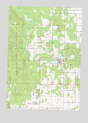
Lincoln, MI USGS Topographic Map
Click on map above to begin viewing in our Map Viewer.

This topographic map contains these locations and features:
Feature Name Type Latitude Longitude GNIS ID View Map
Alcona County Emergency Medical Services Station 1BuildingN44.6554°W83.4191°2662004View Map
Alcona County FairgroundsLocaleN44.6806°W83.3931°2498724View Map
Alcona County Recreation AreaParkN44.6803°W83.3911°1617116View Map
Alcona Elementary SchoolSchoolN44.6628°W83.4056°2498723View Map
Alcona Health CenterHospitalN44.6611°W83.4022°2498722View Map
Alcona High SchoolSchoolN44.6572°W83.4055°619914View Map
Brownlee LakeLakeN44.6895°W83.4091°622105View Map
Church of GodChurchN44.6603°W83.4022°1617098View Map
Crystal LakeLakeN44.6899°W83.3897°624176View Map
Faith Lutheran ChurchChurchN44.6564°W83.3875°2498730View Map
First Baptist ChurchChurchN44.6844°W83.4097°2498713View Map
Fish CreekStreamN44.7231°W83.4447°1619915View Map
GustinPopulated PlaceN44.6272°W83.4144°1617600View Map
Gustin Post Office (historical)Post OfficeN44.6272°W83.4144°2498696View Map
Gustin Station (historical)LocaleN44.6269°W83.4144°2498681View Map
Gustin Township HallBuildingN44.6856°W83.4114°2498721View Map
Hawes Post Office (historical)Post OfficeN44.7058°W83.4336°2498694View Map
KillmasterPopulated PlaceN44.6317°W83.4514°629664View Map
Killmaster Post Office (historical)Post OfficeN44.6317°W83.4514°2498693View Map
LincolnPopulated PlaceN44.6847°W83.4122°630440View Map
Lincoln Branch LibraryBuildingN44.6817°W83.4167°2498720View Map
Lincoln Haven Health Care CenterHospitalN44.6839°W83.4025°2498719View Map
Lincoln LakeLakeN44.6834°W83.4195°630455View Map
Lincoln Lookout Tower (historical)TowerN44.7286°W83.4158°1623488View Map
Lincoln Post OfficePost OfficeN44.6825°W83.4117°2498718View Map
Lincoln Station (historical)LocaleN44.6833°W83.4119°2498717View Map
Lincoln Volunteer Fire DepartmentBuildingN44.6836°W83.4130°2626975View Map
Millikin LakeLakeN44.7360°W83.3976°632412View Map
Milwrick Flying M AirportAirportN44.7376°W83.3825°1624009View Map
Mud PondLakeN44.6946°W83.3758°633086View Map
Pettis CreekStreamN44.7233°W83.4447°1621222View Map
Township of GustinCivilN44.6412°W83.4636°1626416View Map
Trask LakeLakeN44.6835°W83.4360°1615041View Map
Trinity Evangelical Lutheran ChurchChurchN44.6819°W83.4083°2498714View Map
Twin Lake CemeteryCemeteryN44.6814°W83.4250°2498769View Map
United Methodist ChurchChurchN44.6850°W83.4114°2498715View Map
Village of LincolnCivilN44.6841°W83.4133°2398441View Map
Vincent CreekStreamN44.7467°W83.4850°1615592View Map
West Harrisville Depot Historical MarkerParkN44.6839°W83.4114°2498765View Map

Note: Coordinates in the location and feature list above are referenced to NAD83 datum.


Copyright (C) 2008-2024 Ryan Niemi / Sunset Dynamics ... All Rights Reserved