TopoQuest Logo
Do you find TopoQuest useful?
Help keep TopoQuest running and adding new maps/features by donating!
Bitcoin:  19c7KJd3qBynnjoSw5npx9KScwjBe4ifkT
Litecoin:  LXs6TkuXGGXo1vDsWCkWVdjQX94eUKd6ui
Home View Maps Find Maps Find Places Resources & Links


Guthrie, Texas Topographic Map

USGS Map Title: Guthrie, TX
USGS Map MRC: 33100E3
DRG (GeoTIFF) Download: o33100e3.tif


Neighboring USGS Topographic Map Quads:


  Guthrie NW, TX  
33100F4
 

  Fourmile Hill, TX  
33100F3
 

  J Y Ranch, TX  
33100F2
 

  Pitchfork Flats, TX  
33100E4
 

  Guthrie, TX  
33100E3
 

  Dark Canyon, TX  
33100E2
 

  Southerland Canyon, TX  
33100D4
 

  Bob Creek, TX  
33100D3
 

  Kiowa Peak NW, TX  
33100D2


Map MRC Location:

N34°
W101°
N34°
W100°
H8 H7 H6 H5 H4 H3 H2 H1
G8 G7 G6 G5 G4 G3 G2 G1
F8 F7 F6 F5 F4 F3 F2 F1
E8 E7 E6 E5 E4 E3 E2 E1
D8 D7 D6 D5 D4 D3 D2 D1
C8 C7 C6 C5 C4 C3 C2 C1
B8 B7 B6 B5 B4 B3 B2 B1
A8 A7 A6 A5 A4 A3 A2 A1
N33°
W101°
N33°
W100°

Guthrie, TX USGS 1:24K Topographic Map Preview:
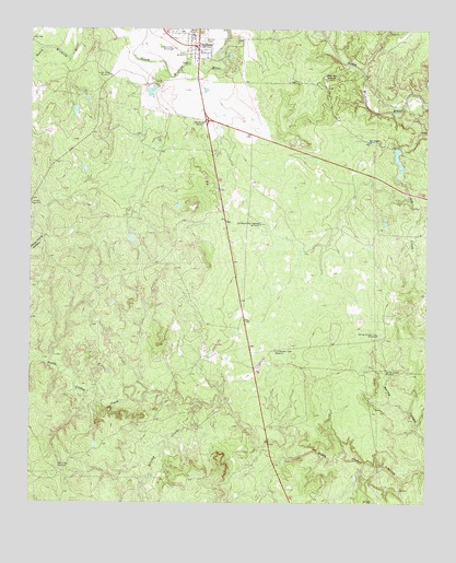
Guthrie, TX USGS Topographic Map
Click on map above to begin viewing in our Map Viewer.

This topographic map contains these locations and features:
Feature Name Type Latitude Longitude GNIS ID View Map
Ash CreekStreamN33.5781°W100.2523°1385449View Map
Ash CreekStreamN33.6031°W100.2621°1351300View Map
Ash Creek TankReservoirN33.5937°W100.2605°1858911View Map
Ash Creek Tank DamDamN33.5934°W100.2604°1858910View Map
Ash Creek WindmillLocaleN33.5954°W100.2693°1351301View Map
Brushy CreekStreamN33.5265°W100.3209°1353057View Map
Field WindmillLocaleN33.6181°W100.3271°1357309View Map
GuthriePopulated PlaceN33.6206°W100.3229°1358533View Map
Guthrie CemeteryCemeteryN33.6230°W100.3093°2773410View Map
Guthrie Census Designated PlaceCensusN33.6216°W100.3290°2584647View Map
Guthrie DivisionCivilN33.6165°W100.2559°1938815View Map
Guthrie LakeReservoirN33.6085°W100.3376°1858913View Map
Guthrie Lake DamDamN33.6101°W100.3354°1858912View Map
Guthrie Post OfficePost OfficeN33.6204°W100.3224°2731202View Map
King CountyCivilN33.6165°W100.2559°1383920View Map
King County Emergency Medical ServicesBuildingN33.6249°W100.3223°2655991View Map
King County JailBuildingN33.6186°W100.3222°2738822View Map
King County Sheriff's OfficeBuildingN33.6186°W100.3222°2750340View Map
Little River WindmillLocaleN33.6126°W100.3504°1361447View Map
Middle Field WindmillLocaleN33.6198°W100.3312°1362719View Map
Old Aspermont Highway WindmillLocaleN33.5734°W100.3026°1364385View Map
Old Wooden Town WindmillLocaleN33.5401°W100.2982°1364506View Map
Ralive Pen WindmillLocaleN33.5098°W100.3662°1365974View Map
Rock Pen WindmillLocaleN33.6126°W100.2826°1366687View Map
Salt Knobs WindmillLocaleN33.6004°W100.3204°1367437View Map
Spring Canyon Trap WindmillLocaleN33.5445°W100.2657°1368960View Map
Spring Canyon WindmillLocaleN33.5354°W100.2632°1368961View Map

Note: Coordinates in the location and feature list above are referenced to NAD83 datum.


Copyright (C) 2008-2024 Ryan Niemi / Sunset Dynamics ... All Rights Reserved