TopoQuest Logo
Do you find TopoQuest useful?
Help keep TopoQuest running and adding new maps/features by donating!
Bitcoin:  19c7KJd3qBynnjoSw5npx9KScwjBe4ifkT
Litecoin:  LXs6TkuXGGXo1vDsWCkWVdjQX94eUKd6ui
Home View Maps Find Maps Find Places Resources & Links


Grubbs, Arkansas Topographic Map

USGS Map Title: Grubbs, AR
USGS Map MRC: 35091F1
DRG (GeoTIFF) Download: o35091f1.tif


Neighboring USGS Topographic Map Quads:


  Swifton West, AR  
35091G2
 

  Swifton East, AR  
35091G1
 

  Cash, AR  
35090G8
 

  Tuckerman, AR  
35091F2
 

  Grubbs, AR  
35091F1
 

  Risher, AR  
35090F8
 

  Auvergne, AR  
35091E2
 

  Amagon, AR  
35091E1
 

  Weiner, AR  
35090E8


Map MRC Location:

N36°
W92°
N36°
W91°
H8 H7 H6 H5 H4 H3 H2 H1
G8 G7 G6 G5 G4 G3 G2 G1
F8 F7 F6 F5 F4 F3 F2 F1
E8 E7 E6 E5 E4 E3 E2 E1
D8 D7 D6 D5 D4 D3 D2 D1
C8 C7 C6 C5 C4 C3 C2 C1
B8 B7 B6 B5 B4 B3 B2 B1
A8 A7 A6 A5 A4 A3 A2 A1
N35°
W92°
N35°
W91°

Grubbs, AR USGS 1:24K Topographic Map Preview:
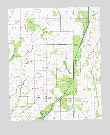
Grubbs, AR USGS Topographic Map
Click on map above to begin viewing in our Map Viewer.

This topographic map contains these locations and features:
Feature Name Type Latitude Longitude GNIS ID View Map
Adams School (historical)SchoolN35.7276°W91.0015°64547View Map
Ash Spread DitchCanalN35.6451°W91.0193°45950View Map
Ballews ChapelChurchN35.6840°W91.0737°46065View Map
Blanchard LakeLakeN35.6362°W91.0698°74677View Map
ChilsonPopulated PlaceN35.7126°W91.0015°64552View Map
Chilson ChapelChurchN35.7104°W91.0012°47742View Map
Chilson ChurchChurchN35.7109°W91.0001°47743View Map
City of GrubbsCivilN35.6541°W91.0752°2403766View Map
Clark CemeteryCemeteryN35.6454°W91.0218°47799View Map
Credit (historical)Populated PlaceN35.7217°W91.0057°64556View Map
Deep SloughStreamN35.6667°W91.0393°48448View Map
Denton CemeteryCemeteryN35.6740°W91.0765°48476View Map
Denton Island CemeteryCemeteryN35.7409°W91.0437°48478View Map
GrubbsPopulated PlaceN35.6498°W91.0740°49697View Map
Grubbs Elementary SchoolSchoolN35.6501°W91.0715°61815View Map
Grubbs High SchoolSchoolN35.6506°W91.0718°61816View Map
Grubbs Post OfficePost OfficeN35.6524°W91.0743°2781852View Map
Grubbs Volunteer Fire DepartmentBuildingN35.6514°W91.0748°2116514View Map
Gum Pond DitchCanalN35.7209°W91.0768°49719View Map
Hale (historical)Populated PlaceN35.6367°W91.0912°61817View Map
Hale LakeLakeN35.6296°W91.0791°74873View Map
Hankins-Sullins CemeteryCemeteryN35.6340°W91.1093°49822View Map
Harley Anderson DitchCanalN35.6954°W91.0460°49859View Map
Holloway CemeteryCemeteryN35.7078°W91.0139°50206View Map
Johnson LakeLakeN35.6851°W91.0480°74932View Map
Long Creek ChurchChurchN35.6498°W91.0096°51424View Map
Milltown Auxiliary Army Airfield (historical)MilitaryN35.7300°W91.1172°1988507View Map
North PittsPopulated PlaceN35.6781°W91.0276°52834View Map
Oil Trough Landing Strip (historical)AirportN35.7292°W91.1182°64903View Map
Old Channel Cache RiverStreamN35.6817°W91.0368°52991View Map
Parsley ReservoirReservoirN35.7349°W91.1123°75069View Map
PittsPopulated PlaceN35.6745°W91.0315°58396View Map
Skillet DitchCanalN35.6784°W91.1026°54890View Map
Tiger DitchCanalN35.7262°W91.0990°55570View Map
Township of GrubbsCivilN35.6571°W91.0923°66726View Map
Tupelo SloughGutN35.7417°W91.0065°55707View Map
Tuscany (historical)Populated PlaceN35.6965°W91.1085°61839View Map
UnoPopulated PlaceN35.6487°W91.0276°78638View Map

Note: Coordinates in the location and feature list above are referenced to NAD83 datum.


Copyright (C) 2008-2024 Ryan Niemi / Sunset Dynamics ... All Rights Reserved