TopoQuest Logo
Do you find TopoQuest useful?
Help keep TopoQuest running and adding new maps/features by donating!
Bitcoin:  19c7KJd3qBynnjoSw5npx9KScwjBe4ifkT
Litecoin:  LXs6TkuXGGXo1vDsWCkWVdjQX94eUKd6ui
Home View Maps Find Maps Find Places Resources & Links


Gooseneck Lake, Michigan Topographic Map

USGS Map Title: Gooseneck Lake, MI
USGS Map MRC: 46086A5
DRG (GeoTIFF) Download: o46086a5.tif


Neighboring USGS Topographic Map Quads:


  Tie Lake, MI  
46086B6
 

  Corner Lake, MI  
46086B5


  Waco Lake, MI  
46086A6
 

  Gooseneck Lake, MI  
46086A5


  Saint Jacques, MI  
45086H6
 

  Garden Corners, MI  
45086H5


Map MRC Location:

N47°
W87°
N47°
W86°
H8 H7 H6 H5 H4 H3 H2 H1
G8 G7 G6 G5 G4 G3 G2 G1
F8 F7 F6 F5 F4 F3 F2 F1
E8 E7 E6 E5 E4 E3 E2 E1
D8 D7 D6 D5 D4 D3 D2 D1
C8 C7 C6 C5 C4 C3 C2 C1
B8 B7 B6 B5 B4 B3 B2 B1
A8 A7 A6 A5 A4 A3 A2 A1
N46°
W87°
N46°
W86°

Gooseneck Lake, MI USGS 1:24K Topographic Map Preview:
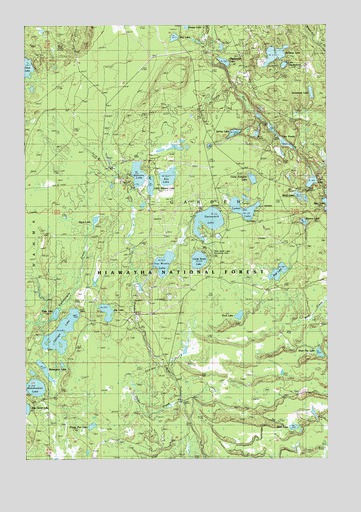
Gooseneck Lake, MI USGS Topographic Map
Click on map above to begin viewing in our Map Viewer.

This topographic map contains these locations and features:
Feature Name Type Latitude Longitude GNIS ID View Map
Back LakeLakeN46.0688°W86.5961°1619068View Map
Bog LakeLakeN46.1214°W86.5631°1619272View Map
Camp Fortyone LakeLakeN46.0802°W86.5307°622577View Map
Camp Seven LakeLakeN46.0572°W86.5533°1619412View Map
Camp Seven Lake CampgroundLocaleN46.0583°W86.5490°1622255View Map
Camp Seven Lake Recreation AreaParkN46.0577°W86.5499°1622254View Map
Carr LakeLakeN46.0797°W86.5065°1619442View Map
Carr PondsLakeN46.0937°W86.5211°1622253View Map
Chicago LakeLakeN46.0364°W86.6102°623179View Map
Eva LakeLakeN46.0811°W86.5660°1619870View Map
Fern LakeLakeN46.0413°W86.5367°625910View Map
Frying Pan LakeLakeN46.0094°W86.5977°626545View Map
Ganamush LakeLakeN46.1057°W86.5064°1619994View Map
Gooseneck LakeLakeN46.0686°W86.5492°626985View Map
Highbridge LakeLakeN46.1144°W86.5424°1620202View Map
Jackpine LakeLakeN46.1164°W86.5214°629163View Map
Jug LakeLakeN46.0424°W86.5914°1622698View Map
Lake TwentythreeLakeN46.1134°W86.5176°1615228View Map
Little Stevens LakeLakeN46.0787°W86.5730°630774View Map
Lyman LakeLakeN46.0714°W86.5352°1620653View Map
Mahskeekee LakeLakeN46.0206°W86.6209°631336View Map
Molly LakeLakeN46.0757°W86.5118°1620876View Map
Onion CreekStreamN46.0166°W86.5610°634068View Map
Remington LakeLakeN46.0256°W86.6171°1621371View Map
Shoe Pac LakeLakeN46.0305°W86.5035°637827View Map
Spring LakeLakeN46.0940°W86.5382°1621738View Map
Square LakeLakeN46.0683°W86.5097°638658View Map
Stevens LakeLakeN46.0821°W86.5783°1621773View Map
Van Winkle LakeLakeN46.0563°W86.5677°1622016View Map
Vista LakeLakeN46.0418°W86.6127°1615608View Map
West LakeLakeN46.0091°W86.5144°1622114View Map
Wolf LakeLakeN46.0538°W86.5200°1616699View Map

Note: Coordinates in the location and feature list above are referenced to NAD83 datum.


Copyright (C) 2008-2024 Ryan Niemi / Sunset Dynamics ... All Rights Reserved