TopoQuest Logo
Do you find TopoQuest useful?
Help keep TopoQuest running and adding new maps/features by donating!
Bitcoin:  19c7KJd3qBynnjoSw5npx9KScwjBe4ifkT
Litecoin:  LXs6TkuXGGXo1vDsWCkWVdjQX94eUKd6ui
Home View Maps Find Maps Find Places Resources & Links


Corner Lake, Michigan Topographic Map

USGS Map Title: Corner Lake, MI
USGS Map MRC: 46086B5
DRG (GeoTIFF) Download: o46086b5.tif


Neighboring USGS Topographic Map Quads:


  Powell Lake, MI  
46086C6
 

  Juniper, MI  
46086C5


  Tie Lake, MI  
46086B6
 

  Corner Lake, MI  
46086B5


  Waco Lake, MI  
46086A6
 

  Gooseneck Lake, MI  
46086A5


Map MRC Location:

N47°
W87°
N47°
W86°
H8 H7 H6 H5 H4 H3 H2 H1
G8 G7 G6 G5 G4 G3 G2 G1
F8 F7 F6 F5 F4 F3 F2 F1
E8 E7 E6 E5 E4 E3 E2 E1
D8 D7 D6 D5 D4 D3 D2 D1
C8 C7 C6 C5 C4 C3 C2 C1
B8 B7 B6 B5 B4 B3 B2 B1
A8 A7 A6 A5 A4 A3 A2 A1
N46°
W87°
N46°
W86°

Corner Lake, MI USGS 1:24K Topographic Map Preview:
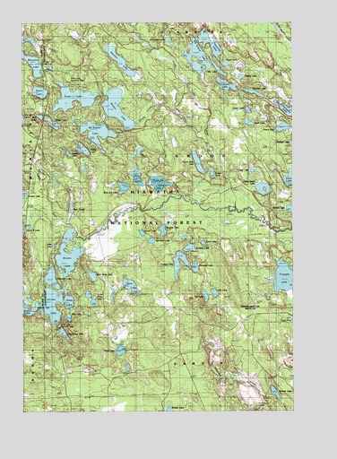
Corner Lake, MI USGS Topographic Map
Click on map above to begin viewing in our Map Viewer.

This topographic map contains these locations and features:
Feature Name Type Latitude Longitude GNIS ID View Map
Big Island LakeLakeN46.2358°W86.5443°1619191View Map
Big Island Lake Portage Canoe TrailTrailN46.2255°W86.5121°1622364View Map
Big Island Lake WildernessReserveN46.2186°W86.5082°2035049View Map
Blue Joe LakeLakeN46.1969°W86.5784°621629View Map
Brevick LakeLakeN46.1900°W86.5015°1619316View Map
Camp K LakeLakeN46.1831°W86.6246°1619403View Map
Center LakeLakeN46.2217°W86.5205°1622365View Map
Coattail LakeLakeN46.2299°W86.5306°1619542View Map
Cookson LakeLakeN46.1983°W86.5618°623762View Map
Corner LakeLakeN46.1588°W86.6115°1619588View Map
Corner Lake Recreation AreaLocaleN46.1533°W86.6079°1622369View Map
Corner Lake Recreation ParkParkN46.1528°W86.6089°2336377View Map
Cucumber LakeLakeN46.2438°W86.5569°624192View Map
Deep LakeLakeN46.1611°W86.6042°1619687View Map
Deer CreekStreamN46.1930°W86.5479°624455View Map
Dinner LakeLakeN46.1823°W86.5699°624689View Map
Dipper LakeLakeN46.2080°W86.6040°1619721View Map
Grants LakeLakeN46.1949°W86.6246°1620060View Map
Grassy CreekStreamN46.2111°W86.5390°1620066View Map
Grassy LakeLakeN46.2225°W86.5813°627229View Map
Green Bass LakeLakeN46.2049°W86.5439°1620073View Map
Herman LakeLakeN46.2378°W86.5799°628135View Map
Hub LakeLakeN46.1630°W86.5365°1620266View Map
Hugoboom LakeLakeN46.1500°W86.6064°628790View Map
Ironjaw LakeLakeN46.1715°W86.5518°629083View Map
Kimble LakeLakeN46.2176°W86.6107°1620430View Map
Klondike LakeLakeN46.2218°W86.5027°1620448View Map
Little Indian RiverStreamN46.1905°W86.5202°1620555View Map
Little Island LakeLakeN46.1965°W86.5138°630648View Map
Little LakeLakeN46.1781°W86.6109°1620559View Map
McInnes LakeLakeN46.2273°W86.5178°631914View Map
McKeever LakeLakeN46.2148°W86.5909°1620771View Map
Mid LakeLakeN46.2353°W86.5344°632222View Map
Mike White LakeLakeN46.1686°W86.5929°1620820View Map
Moccasin LakeLakeN46.2370°W86.6203°1620872View Map
Moccasin Lake Picnic AreaLocaleN46.2375°W86.6165°1622367View Map
Mowe LakeLakeN46.1448°W86.5800°1620922View Map
Neds LakeLakeN46.2178°W86.5203°633254View Map
Nineteen LakeLakeN46.1714°W86.5456°1621013View Map
Norway LakeLakeN46.1310°W86.5088°633758View Map
Onega LakeLakeN46.2323°W86.5238°1621107View Map
Ostrander LakeLakeN46.1679°W86.6116°634148View Map
Peanut LakeLakeN46.2017°W86.5375°1621175View Map
Petes LakeLakeN46.2257°W86.6011°634729View Map
Petes Lake Recreation AreaLocaleN46.2291°W86.5993°1622368View Map
Pewee LakeLakeN46.2023°W86.5190°1621224View Map
Pike LakeLakeN46.1552°W86.6039°634869View Map
Red LakeLakeN46.2005°W86.5722°1621357View Map
Rim LakeLakeN46.1621°W86.5407°635943View Map
River SloughLakeN46.1899°W86.6027°1621397View Map
Rumble LakeLakeN46.1832°W86.5602°636371View Map
Spot LakeLakeN46.2198°W86.6169°1621728View Map
Sprinkler LakeLakeN46.1799°W86.5654°638637View Map
Spud LakeLakeN46.1790°W86.5414°1621745View Map
Straits LakeLakeN46.1755°W86.6042°638936View Map
Stueben Landing Field (historical)AirportN46.1252°W86.5804°1622270View Map
Swamp LakeLakeN46.1254°W86.5581°1621838View Map
Swan LakeLakeN46.1654°W86.5753°1614468View Map
Thornton LakeLakeN46.2447°W86.6226°1621902View Map
Toms LakeLakeN46.1612°W86.5932°1614949View Map
Town LakeLakeN46.2277°W86.6169°1621929View Map
Townline LakeLakeN46.2430°W86.5377°1615014View Map
Tri - County Volunteer Fire DepartmentBuildingN46.1676°W86.6229°2626757View Map
Triangle LakeLakeN46.1678°W86.5042°1621943View Map
Uno Post Office (historical)Post OfficeN46.1556°W86.6139°2351121View Map
Upper LakeLakeN46.2358°W86.5216°1622002View Map
Vance LakeLakeN46.2162°W86.5046°1615494View Map
Verdant LakeLakeN46.1775°W86.5478°1622020View Map
Wedge LakeLakeN46.2092°W86.5970°1615963View Map

Note: Coordinates in the location and feature list above are referenced to NAD83 datum.


Copyright (C) 2008-2024 Ryan Niemi / Sunset Dynamics ... All Rights Reserved