TopoQuest Logo
Do you find TopoQuest useful?
Help keep TopoQuest running and adding new maps/features by donating!
Bitcoin:  19c7KJd3qBynnjoSw5npx9KScwjBe4ifkT
Litecoin:  LXs6TkuXGGXo1vDsWCkWVdjQX94eUKd6ui
Home View Maps Find Maps Find Places Resources & Links


Glover, Missouri Topographic Map

USGS Map Title: Glover, MO
USGS Map MRC: 37090D6
DRG (GeoTIFF) Download: o37090d6.tif


Neighboring USGS Topographic Map Quads:


  Johnson Shut-ins, MO  
37090E7
 

  Ironton, MO  
37090E6
 

  Lake Killarney, MO  
37090E5
 

  Lesterville, MO  
37090D7
 

  Glover, MO  
37090D6
 

  Des Arc NE, MO  
37090D5
 

  Lesterville SE, MO  
37090C7
 

  Des Arc, MO  
37090C6
 

  Brunot, MO  
37090C5


Map MRC Location:

N38°
W91°
N38°
W90°
H8 H7 H6 H5 H4 H3 H2 H1
G8 G7 G6 G5 G4 G3 G2 G1
F8 F7 F6 F5 F4 F3 F2 F1
E8 E7 E6 E5 E4 E3 E2 E1
D8 D7 D6 D5 D4 D3 D2 D1
C8 C7 C6 C5 C4 C3 C2 C1
B8 B7 B6 B5 B4 B3 B2 B1
A8 A7 A6 A5 A4 A3 A2 A1
N37°
W91°
N37°
W90°

Glover, MO USGS 1:24K Topographic Map Preview:
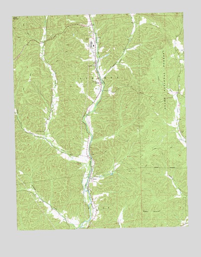
Glover, MO USGS Topographic Map
Click on map above to begin viewing in our Map Viewer.

This topographic map contains these locations and features:
Feature Name Type Latitude Longitude GNIS ID View Map
Asarco LakeReservoirN37.4931°W90.6842°763896View Map
Asarco Lake DamDamN37.4917°W90.6868°763895View Map
Asarco Section 11 Lower DamDamN37.4767°W90.6851°765210View Map
Asarco Section 11 Upper DamDamN37.4750°W90.6818°765209View Map
BerrymanPopulated PlaceN37.4762°W90.6879°736657View Map
Big Creek ChurchChurchN37.4703°W90.6915°748832View Map
Blue HoleLakeN37.4066°W90.6807°736656View Map
Bollinger SchoolSchoolN37.4392°W90.7260°748098View Map
Carver CreekStreamN37.4078°W90.6965°749238View Map
Carver Creek School (historical)SchoolN37.4853°W90.7265°736659View Map
ChloridePopulated PlaceN37.4606°W90.6871°749349View Map
Crane Lake Picnic AreaLocaleN37.4256°W90.6257°754057View Map
Crane Pond School (historical)SchoolN37.4534°W90.6298°748100View Map
Emilys Chapel (historical)ChurchN37.4325°W90.7273°748099View Map
Emilys Chapel CemeteryCemeteryN37.4325°W90.7287°749837View Map
GloverPopulated PlaceN37.4864°W90.6912°750053View Map
Glover Baptist ChurchChurchN37.4899°W90.6924°2702338View Map
Glover Baptist Church CemeteryCemeteryN37.4900°W90.6918°2702337View Map
Glover SchoolSchoolN37.4703°W90.6907°748097View Map
Goff BranchStreamN37.4887°W90.6893°736658View Map
Grassy MountainSummitN37.3859°W90.6610°750110View Map
Huff CemeteryCemeteryN37.4609°W90.6898°750414View Map
Hurst CemeteryCemeteryN37.4303°W90.6290°750433View Map
Lawless Lake DamDamN37.4017°W90.6835°765470View Map
Little Carver CreekStreamN37.4287°W90.7279°750745View Map
Little CreekStreamN37.4617°W90.6860°750760View Map
Number 466 DamDamN37.4000°W90.6685°764459View Map
Number 809 DamDamN37.4700°W90.6868°763894View Map
Richland CreekStreamN37.3753°W90.7082°751868View Map
Russell Number Two Iron BankMineN37.4539°W90.6348°736654View Map
SabulaPopulated PlaceN37.4048°W90.6962°751995View Map
Section House HoleLakeN37.4153°W90.6951°736653View Map
Township of LibertyCivilN37.4589°W90.6592°766797View Map
Walnut Hollow LakeReservoirN37.3854°W90.6754°764457View Map
Walnut Hollow Lake DamDamN37.3850°W90.6751°764456View Map
Walnut Hollow Lake Section 2 DamDamN37.3967°W90.6818°764458View Map

Note: Coordinates in the location and feature list above are referenced to NAD83 datum.


Copyright (C) 2008-2024 Ryan Niemi / Sunset Dynamics ... All Rights Reserved