TopoQuest Logo
Do you find TopoQuest useful?
Help keep TopoQuest running and adding new maps/features by donating!
Bitcoin:  19c7KJd3qBynnjoSw5npx9KScwjBe4ifkT
Litecoin:  LXs6TkuXGGXo1vDsWCkWVdjQX94eUKd6ui
Home View Maps Find Maps Find Places Resources & Links


Ironton, Missouri Topographic Map

USGS Map Title: Ironton, MO
USGS Map MRC: 37090E6
DRG (GeoTIFF) Download: o37090e6.tif


Neighboring USGS Topographic Map Quads:


  Banner, MO  
37090F7
 

  Graniteville, MO  
37090F6
 

  Iron Mountain Lake, MO  
37090F5
 

  Johnson Shut-ins, MO  
37090E7
 

  Ironton, MO  
37090E6
 

  Lake Killarney, MO  
37090E5
 

  Lesterville, MO  
37090D7
 

  Glover, MO  
37090D6
 

  Des Arc NE, MO  
37090D5


Map MRC Location:

N38°
W91°
N38°
W90°
H8 H7 H6 H5 H4 H3 H2 H1
G8 G7 G6 G5 G4 G3 G2 G1
F8 F7 F6 F5 F4 F3 F2 F1
E8 E7 E6 E5 E4 E3 E2 E1
D8 D7 D6 D5 D4 D3 D2 D1
C8 C7 C6 C5 C4 C3 C2 C1
B8 B7 B6 B5 B4 B3 B2 B1
A8 A7 A6 A5 A4 A3 A2 A1
N37°
W91°
N37°
W90°

Ironton, MO USGS 1:24K Topographic Map Preview:
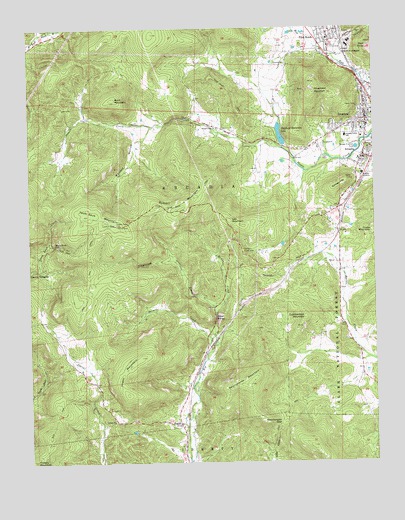
Ironton, MO USGS Topographic Map
Click on map above to begin viewing in our Map Viewer.

This topographic map contains these locations and features:
Feature Name Type Latitude Longitude GNIS ID View Map
Ackhurst Iron BankMineN37.5442°W90.6376°736645View Map
Allen MillsPopulated PlaceN37.5045°W90.6948°736644View Map
ArcadiaPopulated PlaceN37.5881°W90.6290°748606View Map
Arcadia Fire DepartmentBuildingN37.5872°W90.6302°2620859View Map
Arcadia Valley SchoolSchoolN37.5937°W90.6351°748608View Map
Big Bogy Mountain Iron BankMineN37.5484°W90.6621°736643View Map
Bogy Ore BendMineN37.5417°W90.6601°736642View Map
Brown RowLocaleN37.6142°W90.6318°736641View Map
Buck MountainSummitN37.6048°W90.7190°749086View Map
Buckner BranchStreamN37.5837°W90.6501°736640View Map
Cartey and Mann Limestone QuarriesMineN37.5845°W90.6662°736639View Map
Carver Creek School (historical)SchoolN37.5112°W90.7240°765821View Map
Cedar Bluff SchoolSchoolN37.5959°W90.6790°753430View Map
City of ArcadiaCivilN37.5864°W90.6292°2393973View Map
City of IrontonCivilN37.6010°W90.6282°2395440View Map
City of Pilot KnobCivilN37.6237°W90.6454°2396205View Map
Claybaugh CreekStreamN37.5431°W90.6823°749374View Map
College HillSummitN37.5803°W90.6360°749421View Map
Cuthbertson MountainSummitN37.5417°W90.6501°749557View Map
Cuthbertsons Iron BankMineN37.5395°W90.6510°736638View Map
Devils TollgateLocaleN37.5548°W90.7498°749648View Map
East Branch Knob CreekStreamN37.6201°W90.6360°756010View Map
English TownPopulated PlaceN37.6225°W90.6404°736637View Map
HoganPopulated PlaceN37.5112°W90.6960°750360View Map
Hogan MountainSummitN37.5198°W90.7148°750363View Map
Hogan Mountain Iron MinesMineN37.5442°W90.6765°736636View Map
Hogan SchoolSchoolN37.5225°W90.6935°753433View Map
Hollman Brothers Limestone QuarryMineN37.5164°W90.6968°736635View Map
Iron CountyCivilN37.5043°W90.6900°758501View Map
Iron County Medical CenterHospitalN37.6231°W90.6447°2655121View Map
Iron County Sheriff's OfficeBuildingN37.5975°W90.6291°2752587View Map
IrontonPopulated PlaceN37.5973°W90.6273°750466View Map
Ironton Fire DepartmentBuildingN37.6002°W90.6275°2620959View Map
Ironton Police DepartmentBuildingN37.6003°W90.6275°2752346View Map
Ironton Post OfficePost OfficeN37.5972°W90.6282°2783121View Map
Ketcherside GapGapN37.5114°W90.6593°750595View Map
Ketcherside MountainSummitN37.5237°W90.6690°750596View Map
KYLS-FM (Ironton)TowerN37.5731°W90.6932°759051View Map
Leeds Hill Iron BankMineN37.5564°W90.6301°736634View Map
Mina Sauk FallsFallsN37.5625°W90.7412°751106View Map
Minor CreekStreamN37.5342°W90.6821°751124View Map
Missouri Department of Conservation Forestry Southeast Regional Field Fire Office IrontonBuildingN37.5972°W90.6273°2620860View Map
Palmer CreekStreamN37.5292°W90.6871°751478View Map
Pilot KnobPopulated PlaceN37.6212°W90.6404°751590View Map
Pilot Knob Fire Protection District Station 1BuildingN37.6224°W90.6412°2620863View Map
Pilot Knob National Wildlife RefugeParkN37.6175°W90.6250°2765450View Map
Pilot Knob Police DepartmentBuildingN37.6225°W90.6413°2752301View Map
Pilot Knob Post OfficePost OfficeN37.6205°W90.6418°2782876View Map
Reagan School (historical)SchoolN37.5981°W90.7065°736646View Map
Royal GorgeGapN37.5417°W90.6826°751976View Map
Russell MountainSummitN37.5730°W90.6952°751989View Map
Sarah P Childers Marble QuarryMineN37.6031°W90.6873°736633View Map
Schwab CemeteryCemeteryN37.6145°W90.6604°752059View Map
Scott Lake DamDamN37.5334°W90.6251°764881View Map
Shepard Mountain DamDamN37.5917°W90.6585°764053View Map
Shepherd MountainSummitN37.6070°W90.6457°752109View Map
Shepherd Mountain LakeReservoirN37.5943°W90.6588°758340View Map
Site of Fort DavidsonLocaleN37.6198°W90.6398°755405View Map
Stouts Creek ChurchChurchN37.5962°W90.6810°752388View Map
Taum Sauk MountainSummitN37.5713°W90.7292°752501View Map
Taum Sauk TrailTrailN37.6034°W90.6737°752502View Map
Tip TopLocaleN37.5512°W90.6648°753431View Map
Tip Top Picnic AreaLocaleN37.5614°W90.6723°752549View Map
Township of ArcadiaCivilN37.5777°W90.6569°766793View Map
Ursuline AcademySchoolN37.5828°W90.6290°752682View Map
Vail MountainSummitN37.5681°W90.6726°752685View Map
Victory ChurchChurchN37.5123°W90.7198°752709View Map
Victory MountainSummitN37.5534°W90.7179°736632View Map
Wallace HollowValleyN37.5945°W90.7094°752737View Map
West Branch Knob CreekStreamN37.6159°W90.6385°752807View Map
White SchoolSchoolN37.5398°W90.6371°753432View Map

Note: Coordinates in the location and feature list above are referenced to NAD83 datum.


Copyright (C) 2008-2024 Ryan Niemi / Sunset Dynamics ... All Rights Reserved