TopoQuest Logo
Do you find TopoQuest useful?
Help keep TopoQuest running and adding new maps/features by donating!
Bitcoin:  19c7KJd3qBynnjoSw5npx9KScwjBe4ifkT
Litecoin:  LXs6TkuXGGXo1vDsWCkWVdjQX94eUKd6ui
Home View Maps Find Maps Find Places Resources & Links


Glenwood, Georgia Topographic Map

USGS Map Title: Glenwood, GA
USGS Map MRC: 32082B6
DRG (GeoTIFF) Download: o32082b6.tif


Neighboring USGS Topographic Map Quads:


  Lowery, GA  
32082C7
 

  Lothair, GA  
32082C6
 

  Soperton South, GA  
32082C5
 

  Alamo, GA  
32082B7
 

  Glenwood, GA  
32082B6
 

  Mount Vernon, GA  
32082B5
 

  Scotland, GA  
32082A7
 

  Jordan, GA  
32082A6
 

  Uvalda, GA  
32082A5


Map MRC Location:

N33°
W83°
N33°
W82°
H8 H7 H6 H5 H4 H3 H2 H1
G8 G7 G6 G5 G4 G3 G2 G1
F8 F7 F6 F5 F4 F3 F2 F1
E8 E7 E6 E5 E4 E3 E2 E1
D8 D7 D6 D5 D4 D3 D2 D1
C8 C7 C6 C5 C4 C3 C2 C1
B8 B7 B6 B5 B4 B3 B2 B1
A8 A7 A6 A5 A4 A3 A2 A1
N32°
W83°
N32°
W82°

Glenwood, GA USGS 1:24K Topographic Map Preview:
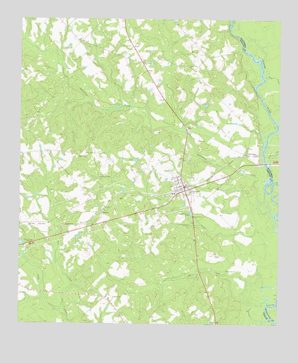
Glenwood, GA USGS Topographic Map
Click on map above to begin viewing in our Map Viewer.

This topographic map contains these locations and features:
Feature Name Type Latitude Longitude GNIS ID View Map
Adams CemeteryCemeteryN32.1360°W82.7040°310393View Map
Baker CemeteryCemeteryN32.1996°W82.6635°310738View Map
Baker CemeteryCemeteryN32.2368°W82.6671°310739View Map
Bear CreekStreamN32.1307°W82.7282°310926View Map
Bear CreekStreamN32.2268°W82.6315°310937View Map
Big BranchStreamN32.2135°W82.6951°311338View Map
Boatwright CemeteryCemeteryN32.1788°W82.6949°351271View Map
Boatwright CemeteryCemeteryN32.1468°W82.6501°311592View Map
City of GlenwoodCivilN32.1805°W82.6712°2403708View Map
Flat CreekStreamN32.1880°W82.6287°314177View Map
GlenwoodPopulated PlaceN32.1799°W82.6696°314643View Map
Glenwood City Volunteer Fire DepartmentBuildingN32.1806°W82.6754°2604760View Map
Glenwood Police DepartmentBuildingN32.1813°W82.6713°2733926View Map
Jones CemeteryCemeteryN32.1952°W82.7146°316209View Map
Landsburg ChurchChurchN32.2318°W82.6890°316612View Map
Larry CreekStreamN32.1266°W82.6271°316653View Map
Lower Oconee Community HospitalHospitalN32.1800°W82.6720°2611000View Map
Mason CemeteryCemeteryN32.1941°W82.7215°317773View Map
New Stuckey CemeteryCemeteryN32.1849°W82.7051°319548View Map
OchwalkeePopulated PlaceN32.1938°W82.6399°326435View Map
Ochwalkee CreekStreamN32.1713°W82.6299°356442View Map
Pearson Grove ChurchChurchN32.2307°W82.6679°320327View Map
Peterson CreekStreamN32.1607°W82.6296°320416View Map
Starlight ChurchChurchN32.1255°W82.6551°323528View Map
StuckeyPopulated PlaceN32.1710°W82.7101°333147View Map
Stuckey ChurchChurchN32.1716°W82.7096°351277View Map
Stuckey Volunteer Fire DepartmentBuildingN32.1685°W82.7110°2604773View Map
Troop GraveCemeteryN32.1530°W82.6551°324326View Map
Wheeler County Elementary SchoolSchoolN32.1785°W82.6762°351280View Map
Wheeler County Emergency Medical ServicesBuildingN32.1805°W82.6757°2625450View Map

Note: Coordinates in the location and feature list above are referenced to NAD83 datum.


Copyright (C) 2008-2024 Ryan Niemi / Sunset Dynamics ... All Rights Reserved