TopoQuest Logo
Do you find TopoQuest useful?
Help keep TopoQuest running and adding new maps/features by donating!
Bitcoin:  19c7KJd3qBynnjoSw5npx9KScwjBe4ifkT
Litecoin:  LXs6TkuXGGXo1vDsWCkWVdjQX94eUKd6ui
Home View Maps Find Maps Find Places Resources & Links


Gannett Peak, Wyoming Topographic Map

USGS Map Title: Gannett Peak, WY
USGS Map MRC: 43109B6
DRG (GeoTIFF) Download: o43109b6.tif


Neighboring USGS Topographic Map Quads:


  Green River Lakes, WY  
43109C7
 

  Downs Mountain, WY  
43109C6
 

  Ink Wells, WY  
43109C5
 

  Squaretop Mountain, WY  
43109B7
 

  Gannett Peak, WY  
43109B6
 

  Fremont Peak North, WY  
43109B5
 

  Fremont Lake North, WY  
43109A7
 

  Bridger Lakes, WY  
43109A6
 

  Fremont Peak South, WY  
43109A5


Map MRC Location:

N44°
W110°
N44°
W109°
H8 H7 H6 H5 H4 H3 H2 H1
G8 G7 G6 G5 G4 G3 G2 G1
F8 F7 F6 F5 F4 F3 F2 F1
E8 E7 E6 E5 E4 E3 E2 E1
D8 D7 D6 D5 D4 D3 D2 D1
C8 C7 C6 C5 C4 C3 C2 C1
B8 B7 B6 B5 B4 B3 B2 B1
A8 A7 A6 A5 A4 A3 A2 A1
N43°
W110°
N43°
W109°

Gannett Peak, WY USGS 1:24K Topographic Map Preview:
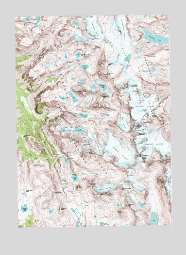
Gannett Peak, WY USGS Topographic Map
Click on map above to begin viewing in our Map Viewer.

This topographic map contains these locations and features:
Feature Name Type Latitude Longitude GNIS ID View Map
American Legion PeakSummitN43.1472°W109.6657°1597737View Map
Baby GlacierGlacierN43.1711°W109.6835°1597853View Map
Bastion PeakSummitN43.2061°W109.6649°1597957View Map
Big Tourist LakeLakeN43.2268°W109.6992°2785672View Map
Bobs TowersSummitN43.1619°W109.6435°1598282View Map
Bonney PassGapN43.1647°W109.6382°1609359View Map
Bow MountainSummitN43.1441°W109.6838°1598333View Map
Brimstone MountainSummitN43.1480°W109.6899°1598375View Map
Clark CreekStreamN43.1802°W109.7463°1598768View Map
Cube Rock PassGapN43.1516°W109.7129°1599071View Map
Dale LakeLakeN43.1507°W109.7124°1599109View Map
Desolation LakeLakeN43.2081°W109.6795°2785674View Map
Desolation PeakSummitN43.2016°W109.6793°1599227View Map
Dinwoody GlacierGlacierN43.1733°W109.6385°1599256View Map
Dinwoody GlaciersGlacierN43.2127°W109.6549°1599257View Map
Dinwoody PeakSummitN43.1636°W109.6318°1608702View Map
Doublet PeakSummitN43.1633°W109.6296°1599299View Map
Flagstone LakeLakeN43.2194°W109.6941°2785673View Map
Flagstone PeakSummitN43.2152°W109.6757°1609090View Map
Gannett GlacierGlacierN43.1958°W109.6454°1599901View Map
Gannett PeakSummitN43.1845°W109.6541°1599903View Map
Glacier PassGapN43.1769°W109.6554°1599949View Map
Glacier TrailTrailN43.1852°W109.6260°1608703View Map
Golden LakesLakeN43.2480°W109.7310°1599970View Map
Gooseneck GlacierGlacierN43.1819°W109.6482°1599985View Map
Gooseneck PinnaclePillarN43.1797°W109.6513°1599986View Map
Grasshopper GlacierGlacierN43.2366°W109.6653°1600044View Map
Green River PassGapN43.1461°W109.7435°1600088View Map
Henderson PeakSummitN43.1375°W109.6610°1600294View Map
J GlacierGlacierN43.2380°W109.6988°1600553View Map
Klondike LakeLakeN43.2357°W109.6353°1600744View Map
Klondike PeakSummitN43.2363°W109.6879°1600745View Map
Knapsack ColGapN43.1544°W109.6615°1600748View Map
Ladd PeakSummitN43.1752°W109.7021°1600770View Map
Lost Pipe LakesLakeN43.1821°W109.7052°2785675View Map
Mammoth GlacierGlacierN43.1680°W109.6663°1601237View Map
Minor GlacierGlacierN43.1866°W109.6624°1604809View Map
Miriam PeakSummitN43.1630°W109.6410°1601488View Map
Mount ArrowheadSummitN43.1444°W109.6771°1597813View Map
Mount HelenSummitN43.1511°W109.6310°1600287View Map
Mount KovenSummitN43.1950°W109.6574°1600754View Map
Mount OeneisSummitN43.1452°W109.7196°1601895View Map
Mount SolitudeSummitN43.2049°W109.6954°1603078View Map
Mount WarrenSummitN43.1636°W109.6279°1603993View Map
Mount WhitecapSummitN43.1686°W109.6921°1604150View Map
Mount Woodrow WilsonSummitN43.1669°W109.6515°1604286View Map
Peak LakeReservoirN43.1539°W109.7034°1602064View Map
Pedestal PeakSummitN43.2213°W109.6746°1602074View Map
Philsmith PeakSummitN43.2261°W109.6393°1602128View Map
Pinnacle RidgeRidgeN43.2030°W109.6879°1608768View Map
Rampart PeakSummitN43.2025°W109.6663°1602376View Map
Scott LakeReservoirN43.1908°W109.6956°1602782View Map
Shannon PassGapN43.1452°W109.7038°1602817View Map
Shannon Pass TrailTrailN43.1408°W109.7007°1602818View Map
Sky Pilot PeakSummitN43.1355°W109.7154°1602956View Map
Skyline PeakSummitN43.1630°W109.6463°1602957View Map
Sourdough GlacierGlacierN43.2466°W109.6874°1603086View Map
Split MountainSummitN43.1641°W109.6724°1603224View Map
Stone Pillar PassGapN43.1727°W109.6963°1603379View Map
Stonehammer LakeReservoirN43.1646°W109.7109°1603382View Map
Stroud GlacierGlacierN43.1472°W109.6793°1603411View Map
Stroud PeakSummitN43.1483°W109.7007°1603412View Map
Sulphur PeakSummitN43.1499°W109.6890°1603430View Map
Summer Ice LakeLakeN43.1372°W109.6500°1603431View Map
Summit LakeReservoirN43.1363°W109.7443°1603434View Map
The SphinxSummitN43.1655°W109.6479°1603621View Map
Three Forks ParkFlatN43.1977°W109.7424°1603656View Map
Tourist CreekStreamN43.2033°W109.7438°1603716View Map
Trail CreekStreamN43.1886°W109.7390°1603727View Map
Trail Creek ParkFlatN43.1788°W109.7457°1603737View Map
Twin PeaksSummitN43.1600°W109.6585°1603834View Map
Twins GlacierGlacierN43.1497°W109.6540°1603836View Map
Upper Jean LakeLakeN43.1260°W109.6819°1603879View Map
Vista PassGapN43.1649°W109.7324°1603934View Map
Wells CreekStreamN43.1949°W109.7388°1604028View Map
West SentinelSummitN43.1897°W109.6357°1604098View Map
Winifred PeakSummitN43.1511°W109.6618°1604250View Map

Note: Coordinates in the location and feature list above are referenced to NAD83 datum.


Copyright (C) 2008-2024 Ryan Niemi / Sunset Dynamics ... All Rights Reserved