TopoQuest Logo
Do you find TopoQuest useful?
Help keep TopoQuest running and adding new maps/features by donating!
Bitcoin:  19c7KJd3qBynnjoSw5npx9KScwjBe4ifkT
Litecoin:  LXs6TkuXGGXo1vDsWCkWVdjQX94eUKd6ui
Home View Maps Find Maps Find Places Resources & Links


Squaretop Mountain, Wyoming Topographic Map

USGS Map Title: Squaretop Mountain, WY
USGS Map MRC: 43109B7
DRG (GeoTIFF) Download: o43109b7.tif


Neighboring USGS Topographic Map Quads:


  Big Sheep Mountain, WY  
43109C8
 

  Green River Lakes, WY  
43109C7
 

  Downs Mountain, WY  
43109C6
 

  Kendall Mountain, WY  
43109B8
 

  Squaretop Mountain, WY  
43109B7
 

  Gannett Peak, WY  
43109B6
 

  New Fork Lakes, WY  
43109A8
 

  Fremont Lake North, WY  
43109A7
 

  Bridger Lakes, WY  
43109A6


Map MRC Location:

N44°
W110°
N44°
W109°
H8 H7 H6 H5 H4 H3 H2 H1
G8 G7 G6 G5 G4 G3 G2 G1
F8 F7 F6 F5 F4 F3 F2 F1
E8 E7 E6 E5 E4 E3 E2 E1
D8 D7 D6 D5 D4 D3 D2 D1
C8 C7 C6 C5 C4 C3 C2 C1
B8 B7 B6 B5 B4 B3 B2 B1
A8 A7 A6 A5 A4 A3 A2 A1
N43°
W110°
N43°
W109°

Squaretop Mountain, WY USGS 1:24K Topographic Map Preview:
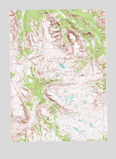
Squaretop Mountain, WY USGS Topographic Map
Click on map above to begin viewing in our Map Viewer.

This topographic map contains these locations and features:
Feature Name Type Latitude Longitude GNIS ID View Map
Beaver ParkFlatN43.2202°W109.7599°1598080View Map
Bench LakeLakeN43.2487°W109.7947°1598107View Map
Clark LakeLakeN43.1790°W109.7663°1598772View Map
Cutthroat LakesLakeN43.1331°W109.7831°1599096View Map
Dean LakeLakeN43.1280°W109.8003°1599166View Map
Dodge CreekStreamN43.1674°W109.8393°1599281View Map
Dome PeakSummitN43.1602°W109.8618°1599288View Map
Doubletop MountainSummitN43.1308°W109.8304°1599300View Map
Doubletop Mountain TrailTrailN43.1319°W109.8077°1599301View Map
Elbow CreekStreamN43.2258°W109.7646°1599558View Map
Glover PeakSummitN43.1588°W109.7646°1599957View Map
Granite LakeLakeN43.2198°W109.7749°1600029View Map
Granite PeakCliffN43.2238°W109.7718°1600035View Map
Greeley PointCliffN43.1869°W109.7829°1600065View Map
Hidden LakesLakeN43.1674°W109.8065°1600319View Map
Jim Creek TrailTrailN43.2036°W109.8671°1600618View Map
Kenny LakeLakeN43.1872°W109.8148°1600697View Map
Lozier LakesLakeN43.1872°W109.8148°1601188View Map
Marten CreekStreamN43.2108°W109.7552°1601266View Map
Marten LakeLakeN43.1965°W109.8075°1601268View Map
New Fork ParkFlatN43.1605°W109.8443°1601684View Map
New Fork TrailTrailN43.1813°W109.7849°1601687View Map
No Name LakesLakeN43.1399°W109.7714°1601704View Map
Palmer CanyonValleyN43.1608°W109.8204°1602000View Map
Palmer LakeLakeN43.1373°W109.8183°1602003View Map
Palmer Lake TrailTrailN43.1322°W109.8190°1602004View Map
Penny LakeLakeN43.1453°W109.8243°1602092View Map
Pixley CreekStreamN43.2249°W109.7638°1602201View Map
Porcupine PassGapN43.2027°W109.8518°1602270View Map
Porcupine TrailTrailN43.2413°W109.8563°1602273View Map
Reynolds CreekStreamN43.1680°W109.8365°1602512View Map
Rim LakeLakeN43.1460°W109.8294°1602529View Map
Squaretop MountainSummitN43.2241°W109.7902°1609160View Map
Thomson LakesLakeN43.1660°W109.7957°1603637View Map

Note: Coordinates in the location and feature list above are referenced to NAD83 datum.


Copyright (C) 2008-2024 Ryan Niemi / Sunset Dynamics ... All Rights Reserved