TopoQuest Logo
Do you find TopoQuest useful?
Help keep TopoQuest running and adding new maps/features by donating!
Bitcoin:  19c7KJd3qBynnjoSw5npx9KScwjBe4ifkT
Litecoin:  LXs6TkuXGGXo1vDsWCkWVdjQX94eUKd6ui
Home View Maps Find Maps Find Places Resources & Links


Fritchton, Indiana Topographic Map

USGS Map Title: Fritchton, IN
USGS Map MRC: 38087F4
DRG (GeoTIFF) Download: o38087f4.tif


Neighboring USGS Topographic Map Quads:


  Russellville, IL  
38087G5
 

  Oaktown, IN  
38087G4
 

  Bicknell, IN  
38087G3
 

  Vincennes, IN  
38087F5
 

  Fritchton, IN  
38087F4
 

  Wheatland, IN  
38087F3
 

  Decker, IN  
38087E5
 

  Iona, IN  
38087E4
 

  Monroe City, IN  
38087E3


Map MRC Location:

N39°
W88°
N39°
W87°
H8 H7 H6 H5 H4 H3 H2 H1
G8 G7 G6 G5 G4 G3 G2 G1
F8 F7 F6 F5 F4 F3 F2 F1
E8 E7 E6 E5 E4 E3 E2 E1
D8 D7 D6 D5 D4 D3 D2 D1
C8 C7 C6 C5 C4 C3 C2 C1
B8 B7 B6 B5 B4 B3 B2 B1
A8 A7 A6 A5 A4 A3 A2 A1
N38°
W88°
N38°
W87°

Fritchton, IN USGS 1:24K Topographic Map Preview:
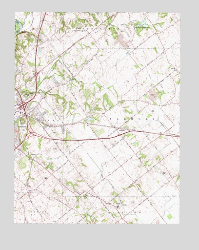
Fritchton, IN USGS Topographic Map
Click on map above to begin viewing in our Map Viewer.

This topographic map contains these locations and features:
Feature Name Type Latitude Longitude GNIS ID View Map
FritchtonPopulated PlaceN38.6803°W87.4231°434873View Map
Fritchton CemeteryCemeteryN38.6717°W87.4245°434874View Map
Highland CemeteryCemeteryN38.6434°W87.4881°436152View Map
Hillcrest Special Education SchoolSchoolN38.7012°W87.4895°436207View Map
Indiana ChurchChurchN38.6420°W87.4459°436790View Map
Jordanville Post Office (historical)Post OfficeN38.6281°W87.4170°453031View Map
Knox CountyCivilN38.6891°W87.4180°450366View Map
Langton - Root CemeteryCemeteryN38.6916°W87.3967°442284View Map
Marchino FieldAirportN38.6388°W87.4356°2676898View Map
Palmyra Township Fire DepartmentBuildingN38.6797°W87.4220°2626575View Map
Royal Oak ChurchChurchN38.7164°W87.3772°442372View Map
Saint Vincents OrphanageSchoolN38.6456°W87.4934°442861View Map
Scott CreekStreamN38.7217°W87.4672°443146View Map
Smalls CreekStreamN38.7414°W87.4950°443649View Map
South Knox Junior and Senior High SchoolSchoolN38.6359°W87.4214°443824View Map
Township of PalmyraCivilN38.6838°W87.4055°453704View Map
Upper Indiana ChurchChurchN38.7100°W87.4592°445167View Map
VernePopulated PlaceN38.6367°W87.4295°445253View Map
Vincennes Fire Department Station 4BuildingN38.6882°W87.4846°2625788View Map
Vincennes Township Fire Department Station 5BuildingN38.7154°W87.4955°2626471View Map
WADV-AM (Vincennes)TowerN38.7073°W87.4950°448467View Map
Welton ChapelChurchN38.6548°W87.3884°445673View Map
White Oak State Fishing AreaParkN38.7423°W87.4042°452502View Map
WRTB-FM (Vincennes)TowerN38.7073°W87.4950°448918View Map
WVUB-FM (Vincennes)TowerN38.6517°W87.4770°448917View Map
WVUT-TV (Vincennes)TowerN38.6517°W87.4770°447003View Map

Note: Coordinates in the location and feature list above are referenced to NAD83 datum.


Copyright (C) 2008-2024 Ryan Niemi / Sunset Dynamics ... All Rights Reserved