TopoQuest Logo
Do you find TopoQuest useful?
Help keep TopoQuest running and adding new maps/features by donating!
Bitcoin:  19c7KJd3qBynnjoSw5npx9KScwjBe4ifkT
Litecoin:  LXs6TkuXGGXo1vDsWCkWVdjQX94eUKd6ui
Home View Maps Find Maps Find Places Resources & Links


Fraser, Colorado Topographic Map

USGS Map Title: Fraser, CO
USGS Map MRC: 39105H7
DRG (GeoTIFF) Download: o39105h7.tif


Neighboring USGS Topographic Map Quads:


  Granby, CO  
40105A8
 

  Strawberry Lake, CO  
40105A7
 

  Monarch Lake, CO  
40105A6
 

  Bottle Pass, CO  
39105H8
 

  Fraser, CO  
39105H7
 

  East Portal, CO  
39105H6
 

  Byers Peak, CO  
39105G8
 

  Berthoud Pass, CO  
39105G7
 

  Empire, CO  
39105G6


Map MRC Location:

N40°
W106°
N40°
W105°
H8 H7 H6 H5 H4 H3 H2 H1
G8 G7 G6 G5 G4 G3 G2 G1
F8 F7 F6 F5 F4 F3 F2 F1
E8 E7 E6 E5 E4 E3 E2 E1
D8 D7 D6 D5 D4 D3 D2 D1
C8 C7 C6 C5 C4 C3 C2 C1
B8 B7 B6 B5 B4 B3 B2 B1
A8 A7 A6 A5 A4 A3 A2 A1
N39°
W106°
N39°
W105°

Fraser, CO USGS 1:24K Topographic Map Preview:
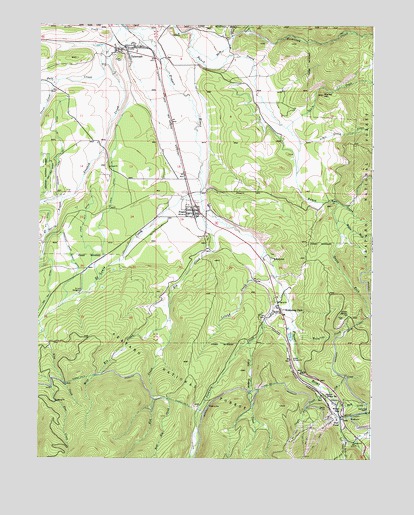
Fraser, CO USGS Topographic Map
Click on map above to begin viewing in our Map Viewer.

This topographic map contains these locations and features:
Feature Name Type Latitude Longitude GNIS ID View Map
Arrow SpringSpringN39.9172°W105.7617°180962View Map
Arrow Spring CemeteryCemeteryN39.9169°W105.7606°2734540View Map
Arrow TunnelTunnelN39.9136°W105.7564°180953View Map
Arrow WellWellN39.9155°W105.7620°180952View Map
Blue Star Picnic GroundLocaleN39.9003°W105.7786°197791View Map
Buck CreekStreamN39.8914°W105.7639°180944View Map
Cabin CreekStreamN39.9714°W105.7839°178424View Map
Church of the Eternal HillsChurchN39.9936°W105.8731°2041851View Map
Cooper CreekStreamN39.8961°W105.7689°180958View Map
Cozens Ranch CemeteryCemeteryN39.9345°W105.7886°2087610View Map
Cozens Ranch MuseumBuildingN39.9325°W105.7911°2036523View Map
Crooked Creek Number 1 DitchCanalN39.9686°W105.8686°180968View Map
Crooked Creek Supply DitchCanalN39.9400°W105.8670°180965View Map
Cub CreekStreamN39.8944°W105.7661°180956View Map
East Elk CreekStreamN39.8936°W105.8317°180947View Map
East Grand County Fire District 4 Main StationBuildingN39.9348°W105.7931°2036520View Map
East Grand County Fire District 4 Tabernash StationBuildingN39.9917°W105.8416°2667309View Map
Elk CreekStreamN39.9505°W105.8147°180948View Map
FraserPopulated PlaceN39.9450°W105.8172°204701View Map
Fraser CemeteryCemeteryN39.9383°W105.8114°2087607View Map
Fraser Historic Church Community CenterChurchN39.9469°W105.8200°2037194View Map
Fraser Post OfficePost OfficeN39.9494°W105.8167°2037190View Map
Fraser Town HallBuildingN39.9478°W105.8195°2037192View Map
Fraser Valley Baptist ChurchChurchN39.9442°W105.8150°2037195View Map
Fraser Valley Elementary SchoolSchoolN39.9494°W105.8196°2037189View Map
Fraser Valley LibraryBuildingN39.9492°W105.8222°2037188View Map
Fraser Winter Park Police DepartmentBuildingN39.9167°W105.7842°2757333View Map
Grand County Emergency Medical Services Station 2BuildingN39.9465°W105.8165°2735529View Map
Hamilton CreekStreamN39.9983°W105.7992°178423View Map
Hideaway ParkPopulated PlaceN39.9180°W105.7856°204700View Map
Hurd CreekStreamN39.9892°W105.8133°178410View Map
Idlewild CampgroundLocaleN39.9042°W105.7786°180955View Map
Idlewild Ranger StationLocaleN39.8933°W105.7672°180957View Map
Idlewild Ski AreaLocaleN39.9247°W105.7783°197793View Map
Jim CreekStreamN39.8797°W105.7564°180945View Map
KGRJ-AM (Fraser)TowerN39.9836°W105.8503°204014View Map
King CreekStreamN39.9139°W105.8747°180951View Map
Little Cabin CreekStreamN39.9664°W105.7789°180940View Map
Little Vasquez CreekStreamN39.9086°W105.7959°180949View Map
Lutz ReservoirReservoirN39.9480°W105.7970°184613View Map
Marker HillSummitN39.9803°W105.7692°180970View Map
Mary Jane CreekStreamN39.8811°W105.7595°180950View Map
MaryvalePopulated PlaceN39.9330°W105.7872°180963View Map
Meadow CreekStreamN39.9994°W105.8253°178412View Map
Middle Fork Ranch CreekStreamN39.9442°W105.7636°180942View Map
Moffat OverlookLocaleN39.8872°W105.7611°197792View Map
Pole CreekStreamN39.9892°W105.8508°180917View Map
Ranch CreekStreamN39.9947°W105.8408°180941View Map
Saint Louis CampgroundLocaleN39.9236°W105.8606°180966View Map
Saint Louis CreekStreamN39.9514°W105.8147°181304View Map
Saint Louis DitchCanalN39.9605°W105.8481°180969View Map
Saint Louis Number 2 DitchCanalN39.9503°W105.8558°180964View Map
Silver CreekStreamN39.9992°W105.8464°178389View Map
Skunk CreekStreamN39.9839°W105.8678°180916View Map
South Fork Ranch CreekStreamN39.9492°W105.7636°180943View Map
Spring BranchStreamN39.9497°W105.8667°180915View Map
TabernashPopulated PlaceN39.9936°W105.8431°180967View Map
Tabernash Census Designated PlaceCensusN39.9788°W105.8444°2410044View Map
Tabernash Post OfficePost OfficeN39.9934°W105.8467°2734582View Map
Town of FraserCivilN39.9304°W105.8030°2412655View Map
Town of Winter ParkCivilN39.8778°W105.7828°2413502View Map
Trail CreekStreamN39.9953°W105.8042°178411View Map
Vasquez CreekStreamN39.9247°W105.7836°180939View Map
West Elk CreekStreamN39.9169°W105.8261°180946View Map
West PortalLocaleN39.8867°W105.7631°180959View Map
Winter ParkPopulated PlaceN39.8917°W105.7631°180960View Map
Winter Park - Fraser Amtrak StationBuildingN39.9472°W105.8178°2037193View Map
Winter Park Highlands Airport (historical)AirportN39.9969°W105.8650°204596View Map
Winter Park Picnic GroundLocaleN39.8922°W105.7636°197789View Map
Winter Park Post OfficePost OfficeN39.9238°W105.7876°2041852View Map
Winter Park Ski AreaLocaleN39.8833°W105.7739°197790View Map
Wolverine CreekStreamN39.9133°W105.7797°180954View Map

Note: Coordinates in the location and feature list above are referenced to NAD83 datum.


Copyright (C) 2008-2024 Ryan Niemi / Sunset Dynamics ... All Rights Reserved