TopoQuest Logo
Do you find TopoQuest useful?
Help keep TopoQuest running and adding new maps/features by donating!
Bitcoin:  19c7KJd3qBynnjoSw5npx9KScwjBe4ifkT
Litecoin:  LXs6TkuXGGXo1vDsWCkWVdjQX94eUKd6ui
Home View Maps Find Maps Find Places Resources & Links


Florence, Ohio Topographic Map

USGS Map Title: Florence, OH
USGS Map MRC: 39083G5
DRG (GeoTIFF) Download: o39083g5.tif


Neighboring USGS Topographic Map Quads:


  New Moorefield, OH  
39083H6
 

  South Vienna, OH  
39083H5
 

  London, OH  
39083H4
 

  South Charleston, OH  
39083G6
 

  Florence, OH  
39083G5
 

  Walnut Run, OH  
39083G4
 

  Jamestown, OH  
39083F6
 

  Jeffersonville, OH  
39083F5
 

  Midway, OH  
39083F4


Map MRC Location:

N40°
W84°
N40°
W83°
H8 H7 H6 H5 H4 H3 H2 H1
G8 G7 G6 G5 G4 G3 G2 G1
F8 F7 F6 F5 F4 F3 F2 F1
E8 E7 E6 E5 E4 E3 E2 E1
D8 D7 D6 D5 D4 D3 D2 D1
C8 C7 C6 C5 C4 C3 C2 C1
B8 B7 B6 B5 B4 B3 B2 B1
A8 A7 A6 A5 A4 A3 A2 A1
N39°
W84°
N39°
W83°

Florence, OH USGS 1:24K Topographic Map Preview:
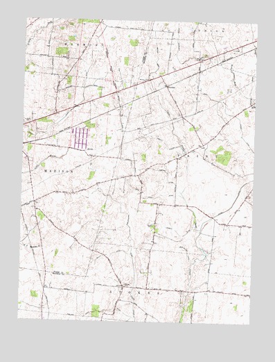
Florence, OH USGS Topographic Map
Click on map above to begin viewing in our Map Viewer.

This topographic map contains these locations and features:
Feature Name Type Latitude Longitude GNIS ID View Map
Aaron FarmsLocaleN39.8291°W83.5177°2729980View Map
Bonner DitchCanalN39.8601°W83.5524°1038192View Map
Corbitt DitchCanalN39.7878°W83.5402°1039367View Map
Cordle Mobile Home ParkPopulated PlaceN39.8639°W83.5175°2630806View Map
Correll CemeteryCemeteryN39.7903°W83.5538°1039382View Map
Davison FarmsLocaleN39.7850°W83.5479°2729986View Map
Dunn School (historical)SchoolN39.8731°W83.5846°1051373View Map
Eachus School (historical)SchoolN39.8231°W83.5288°1071026View Map
East Fork Walnut RunStreamN39.8445°W83.5024°1039990View Map
Finney FarmsLocaleN39.8478°W83.5466°2729990View Map
FlorencePopulated PlaceN39.8478°W83.5471°1062768View Map
Gilroy DitchCanalN39.8348°W83.6027°1040870View Map
Gordin Airport (historical)AirportN39.8328°W83.5671°1083021View Map
Hertenstein DitchCanalN39.7845°W83.5652°1041508View Map
Infirmary CemeteryCemeteryN39.8626°W83.5119°1068818View Map
Jones DitchCanalN39.8434°W83.5219°1042140View Map
Madison County HomeBuildingN39.8634°W83.5099°1079769View Map
Maxie School (historical)SchoolN39.8059°W83.5599°1054075View Map
Nagle DitchCanalN39.7548°W83.5791°1043770View Map
Pancake CemeteryCemeteryN39.7656°W83.5677°1070888View Map
Pancake Chapel (historical)ChurchN39.7651°W83.5685°1054076View Map
Pancake School (historical)SchoolN39.7648°W83.5680°1068991View Map
Pleasant View Stock FarmLocaleN39.8152°W83.5660°2729998View Map
Roberts DitchCanalN39.8106°W83.5460°1045091View Map
Saint Charles CemeteryCemeteryN39.8319°W83.6244°1045428View Map
Sexton DitchCanalN39.7781°W83.5755°1046101View Map
Township of PaintCivilN39.8156°W83.5118°1086548View Map
Waters Christmas Tree FarmLocaleN39.7589°W83.6111°2650311View Map
West Fork Walnut RunStreamN39.8442°W83.5019°1047756View Map
Westwater DitchCanalN39.7792°W83.5346°1058133View Map
Williams Chapel CemeteryCemeteryN39.8498°W83.5602°1047923View Map
Wilson Nicholson DitchCanalN39.8601°W83.5413°1047986View Map
Woosley DitchCanalN39.8253°W83.5483°1048134View Map

Note: Coordinates in the location and feature list above are referenced to NAD83 datum.


Copyright (C) 2008-2024 Ryan Niemi / Sunset Dynamics ... All Rights Reserved