TopoQuest Logo
Do you find TopoQuest useful?
Help keep TopoQuest running and adding new maps/features by donating!
Bitcoin:  19c7KJd3qBynnjoSw5npx9KScwjBe4ifkT
Litecoin:  LXs6TkuXGGXo1vDsWCkWVdjQX94eUKd6ui
Home View Maps Find Maps Find Places Resources & Links


Jamestown, Ohio Topographic Map

USGS Map Title: Jamestown, OH
USGS Map MRC: 39083F6
DRG (GeoTIFF) Download: o39083f6.tif


Neighboring USGS Topographic Map Quads:


  Clifton, OH  
39083G7
 

  South Charleston, OH  
39083G6
 

  Florence, OH  
39083G5
 

  Cedarville, OH  
39083F7
 

  Jamestown, OH  
39083F6
 

  Jeffersonville, OH  
39083F5
 

  Port William, OH  
39083E7
 

  Bowersville, OH  
39083E6
 

  Milledgeville, OH  
39083E5


Map MRC Location:

N40°
W84°
N40°
W83°
H8 H7 H6 H5 H4 H3 H2 H1
G8 G7 G6 G5 G4 G3 G2 G1
F8 F7 F6 F5 F4 F3 F2 F1
E8 E7 E6 E5 E4 E3 E2 E1
D8 D7 D6 D5 D4 D3 D2 D1
C8 C7 C6 C5 C4 C3 C2 C1
B8 B7 B6 B5 B4 B3 B2 B1
A8 A7 A6 A5 A4 A3 A2 A1
N39°
W84°
N39°
W83°

Jamestown, OH USGS 1:24K Topographic Map Preview:
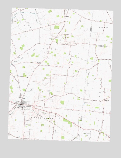
Jamestown, OH USGS Topographic Map
Click on map above to begin viewing in our Map Viewer.

This topographic map contains these locations and features:
Feature Name Type Latitude Longitude GNIS ID View Map
Aerodrome Les NoyersAirportN39.6799°W83.7457°2717247View Map
Bell CenterLocaleN39.6976°W83.7135°1037820View Map
Bethel School (historical)SchoolN39.7264°W83.6921°1080527View Map
Bloom Airport (historical)AirportN39.6342°W83.7493°1082754View Map
Camstra Airport (historical)AirportN39.6389°W83.6324°1082756View Map
Church of Christ in Christian UnionChurchN39.6598°W83.7402°1963068View Map
College Hill School (historical)SchoolN39.6412°W83.7299°1080534View Map
GladstonePopulated PlaceN39.7437°W83.6849°1048787View Map
Gladstone Post Office (historical)Post OfficeN39.7431°W83.6844°1988644View Map
Grape GrovePopulated PlaceN39.7164°W83.6816°1061110View Map
Grape Grove CemeteryCemeteryN39.7184°W83.6685°1041055View Map
Grape Grove ChurchChurchN39.7164°W83.6805°1963070View Map
Grapegrove Post Office (historical)Post OfficeN39.7167°W83.6819°1988646View Map
Greenview High SchoolSchoolN39.6645°W83.7344°1050900View Map
Griffin School (historical)SchoolN39.7284°W83.6374°1054044View Map
Hickory Grove School (historical)SchoolN39.6831°W83.7016°1080528View Map
International Pentecostal ChurchChurchN39.6612°W83.7352°1963071View Map
JamestownPopulated PlaceN39.6581°W83.7349°1064900View Map
Jamestown Friends Meeting HouseChurchN39.6576°W83.7302°1963072View Map
Jamestown Police DepartmentBuildingN39.6580°W83.7438°2732885View Map
Jamestown Post OfficePost OfficeN39.6584°W83.7346°1988635View Map
Locust Grove School (historical)SchoolN39.6542°W83.6727°1080530View Map
Maple Grove School (historical)SchoolN39.6342°W83.6369°1080796View Map
Mechanicsville (historical)Populated PlaceN39.6259°W83.7313°1067585View Map
Mills - McKillip CemeteryCemeteryN39.6623°W83.6532°1043386View Map
Oak Grove School (historical)SchoolN39.6903°W83.7416°1080533View Map
Old Silver Creek CemeteryCemeteryN39.6542°W83.7319°1044134View Map
Pleasant ViewPopulated PlaceN39.6651°W83.6333°1061556View Map
Pleasant View Church of ChristChurchN39.6653°W83.6330°1071581View Map
Pleasant View School (historical)SchoolN39.6667°W83.6330°1071582View Map
Quaker CemeteryCemeteryN39.6442°W83.7213°1963028View Map
RosemoorPopulated PlaceN39.6278°W83.6669°1062993View Map
Saint Augustine Catholic ChurchChurchN39.6576°W83.7308°1963076View Map
Shady GrovePopulated PlaceN39.7034°W83.6421°1063009View Map
Shady Grove School (historical)SchoolN39.7031°W83.6427°1080797View Map
Sheeley CemeteryCemeteryN39.6487°W83.7489°1046165View Map
Shiloh School (historical)SchoolN39.7276°W83.7341°1080532View Map
Silver Creek CemeteryCemeteryN39.6439°W83.7294°1046277View Map
Silver Ridge School (historical)SchoolN39.6431°W83.6938°1080531View Map
Silvercreek Township Fire DepartmentBuildingN39.6587°W83.7318°2549516View Map
Sugar Grove School (historical)SchoolN39.6862°W83.6741°1080529View Map
Township of RossCivilN39.7192°W83.7019°1086171View Map
Township of SilvercreekCivilN39.6422°W83.7214°1086172View Map
Velesky Airport (historical)AirportN39.6584°W83.6752°1082755View Map
Village of JamestownCivilN39.6598°W83.7430°2398290View Map

Note: Coordinates in the location and feature list above are referenced to NAD83 datum.


Copyright (C) 2008-2024 Ryan Niemi / Sunset Dynamics ... All Rights Reserved