TopoQuest Logo
Do you find TopoQuest useful?
Help keep TopoQuest running and adding new maps/features by donating!
Bitcoin:  19c7KJd3qBynnjoSw5npx9KScwjBe4ifkT
Litecoin:  LXs6TkuXGGXo1vDsWCkWVdjQX94eUKd6ui
Home View Maps Find Maps Find Places Resources & Links


First Fork, Pennsylvania Topographic Map

USGS Map Title: First Fork, PA
USGS Map MRC: 41078D1
DRG (GeoTIFF) Download: o41078d1.tif


Neighboring USGS Topographic Map Quads:


  Emporium, PA  
41078E2
 

  Wharton, PA  
41078E1
 

  Conrad, PA  
41077E8
 

  Cameron, PA  
41078D2
 

  First Fork, PA  
41078D1
 

  Hammersley Fork, PA  
41077D8
 

  Driftwood, PA  
41078C2
 

  Sinnemahoning, PA  
41078C1
 

  Keating, PA  
41077C8


Map MRC Location:

N42°
W79°
N42°
W78°
H8 H7 H6 H5 H4 H3 H2 H1
G8 G7 G6 G5 G4 G3 G2 G1
F8 F7 F6 F5 F4 F3 F2 F1
E8 E7 E6 E5 E4 E3 E2 E1
D8 D7 D6 D5 D4 D3 D2 D1
C8 C7 C6 C5 C4 C3 C2 C1
B8 B7 B6 B5 B4 B3 B2 B1
A8 A7 A6 A5 A4 A3 A2 A1
N41°
W79°
N41°
W78°

First Fork, PA USGS 1:24K Topographic Map Preview:
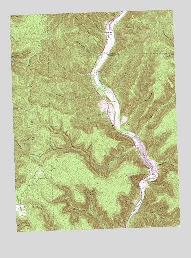
First Fork, PA USGS Topographic Map
Click on map above to begin viewing in our Map Viewer.

This topographic map contains these locations and features:
Feature Name Type Latitude Longitude GNIS ID View Map
Barrett SlideValleyN41.4964°W78.0433°1198363View Map
Bear Trap HollowValleyN41.4484°W78.0248°1198382View Map
Berge RunPopulated PlaceN41.4884°W78.0517°1198417View Map
Berge RunStreamN41.4801°W78.0472°1198418View Map
Bronson RunStreamN41.3842°W78.0328°1198478View Map
Brooks FiretowerTowerN41.4290°W78.1083°1206709View Map
Brooks RunStreamN41.4226°W78.0294°1198480View Map
First ForkPopulated PlaceN41.4534°W78.0492°1203570View Map
First Fork School (historical)SchoolN41.4059°W78.0189°1200821View Map
George B Stevenson DamDamN41.4076°W78.0178°1198791View Map
George B Stevenson ReservoirReservoirN41.4175°W78.0256°1934793View Map
Gilmore CemeteryCemeteryN41.4549°W78.0522°1198802View Map
Gravelly RunStreamN41.3856°W78.0681°1198825View Map
Joes RunStreamN41.3823°W78.0369°1198945View Map
Kephart HollowValleyN41.3832°W78.0196°1198969View Map
Left Fork Brooks RunStreamN41.4226°W78.0800°1199023View Map
Little Bailey RunStreamN41.4170°W78.0242°1199045View Map
Logue RunStreamN41.4634°W78.0592°1199073View Map
LushbaughPopulated PlaceN41.4231°W78.0314°1204078View Map
Lushbaugh RunStreamN41.4270°W78.0294°1199098View Map
Mahon RunStreamN41.4942°W78.0428°1199103View Map
Mill RunStreamN41.4326°W78.0436°1199161View Map
Muley RunStreamN41.4342°W78.0433°1199211View Map
Norcross RunStreamN41.4567°W78.0556°1199227View Map
Owl HollowValleyN41.4628°W78.0577°1199262View Map
Owl RunStreamN41.4628°W78.0586°1212764View Map
Rattlesnake RunStreamN41.4551°W78.0486°1199356View Map
Right Fork Brooks RunStreamN41.4226°W78.0803°1199383View Map
Roaring RunStreamN41.4015°W78.0294°1199391View Map
Short Bend RunStreamN41.4101°W78.0178°1199532View Map
Sinnemahoning State ParkParkN41.4484°W78.0492°1196537View Map
Smith CemeteryCemeteryN41.4028°W78.0182°1199551View Map
Township of GroveCivilN41.3838°W78.0507°1216103View Map
Upper Logue HollowValleyN41.4728°W78.0578°1199718View Map
Upper Logue RunStreamN41.4709°W78.0556°1212765View Map
Woodrock RunStreamN41.4012°W78.0225°1199814View Map

Note: Coordinates in the location and feature list above are referenced to NAD83 datum.


Copyright (C) 2008-2024 Ryan Niemi / Sunset Dynamics ... All Rights Reserved