TopoQuest Logo
Do you find TopoQuest useful?
Help keep TopoQuest running and adding new maps/features by donating!
Bitcoin:  19c7KJd3qBynnjoSw5npx9KScwjBe4ifkT
Litecoin:  LXs6TkuXGGXo1vDsWCkWVdjQX94eUKd6ui
Home View Maps Find Maps Find Places Resources & Links


Farmington, Maine Topographic Map

USGS Map Title: Farmington, ME
USGS Map MRC: 44070F2
DRG (GeoTIFF) Download: o44070f2.tif


Neighboring USGS Topographic Map Quads:


  Phillips, ME  
44070G3
 

  Strong, ME  
44070G2
 

  New Vineyard, ME  
44070G1
 

  Mount Blue, ME  
44070F3
 

  Farmington, ME  
44070F2
 

  New Sharon, ME  
44070F1
 

  East Dixfield, ME  
44070E3
 

  Wilton, ME  
44070E2
 

  Farmington Falls, ME  
44070E1


Map MRC Location:

N45°
W71°
N45°
W70°
H8 H7 H6 H5 H4 H3 H2 H1
G8 G7 G6 G5 G4 G3 G2 G1
F8 F7 F6 F5 F4 F3 F2 F1
E8 E7 E6 E5 E4 E3 E2 E1
D8 D7 D6 D5 D4 D3 D2 D1
C8 C7 C6 C5 C4 C3 C2 C1
B8 B7 B6 B5 B4 B3 B2 B1
A8 A7 A6 A5 A4 A3 A2 A1
N44°
W71°
N44°
W70°

Farmington, ME USGS 1:24K Topographic Map Preview:
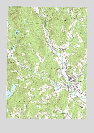
Farmington, ME USGS Topographic Map
Click on map above to begin viewing in our Map Viewer.

This topographic map contains these locations and features:
Feature Name Type Latitude Longitude GNIS ID View Map
Adams BrookStreamN44.7259°W70.1448°561084View Map
Ballard PondLakeN44.7185°W70.2266°561550View Map
Barker StreamStreamN44.6953°W70.1659°561609View Map
Beaver BrookStreamN44.6628°W70.1509°561897View Map
Belcher CemeteryCemeteryN44.6743°W70.1508°2736272View Map
Butterfield CemeteryCemeteryN44.6520°W70.1511°1908286View Map
Cascade BrookStreamN44.6492°W70.1262°563657View Map
Cascade Brook SchoolSchoolN44.6749°W70.1270°1908293View Map
Center Burying GroundCemeteryN44.6717°W70.1513°2725006View Map
Cowen HillSummitN44.7351°W70.1623°564430View Map
Drury PondLakeN44.7042°W70.2405°565306View Map
FairbanksPopulated PlaceN44.7031°W70.1628°565989View Map
Fairbanks Union ChurchChurchN44.7042°W70.1662°1908322View Map
Fairview CemeteryCemeteryN44.6579°W70.1383°566005View Map
FarmingtonPopulated PlaceN44.6706°W70.1512°566054View Map
Farmington Census Designated PlaceCensusN44.6681°W70.1459°2377909View Map
Farmington FairgroundsLocaleN44.6620°W70.1384°1908323View Map
Farmington Fire and Rescue Station 1BuildingN44.6600°W70.1460°2552804View Map
Farmington Police DepartmentBuildingN44.6601°W70.1463°2735923View Map
Farmington Post OfficePost OfficeN44.6699°W70.1503°1908326View Map
Farmington Public LibraryBuildingN44.6694°W70.1482°1908327View Map
First Congregational ChurchChurchN44.6684°W70.1484°1908329View Map
Foster Regional Applied Technical Center SchoolSchoolN44.6386°W70.1317°2738137View Map
Franklin County CourthouseBuildingN44.6714°W70.1520°1908332View Map
Franklin County JailBuildingN44.6971°W70.1575°2735818View Map
Franklin County Law LibraryBuildingN44.6715°W70.1517°2738458View Map
Franklin County Sheriffs DepartmentBuildingN44.6971°W70.1575°2735881View Map
Franklin Memorial HospitalHospitalN44.6265°W70.1629°2655126View Map
Franklin Memorial Hospital Ben Franklin Center LibraryBuildingN44.6263°W70.1632°2738338View Map
Friends of Jesus ChurchChurchN44.6689°W70.1495°1908334View Map
Gay CemeteryCemeteryN44.7109°W70.1776°1908335View Map
Gus Mitchell BrookStreamN44.6951°W70.2423°567403View Map
Hardy BrookStreamN44.6267°W70.1542°567631View Map
Hardy CemeteryCemeteryN44.7470°W70.1481°567633View Map
Henderson Memorial Baptist ChurchChurchN44.6692°W70.1481°1908342View Map
Henry Mitchell BrookStreamN44.6892°W70.2342°567947View Map
Holley CemeteryCemeteryN44.7178°W70.1367°568192View Map
Merrill HallBuildingN44.6692°W70.1659°1908363View Map
Mitchell CemeteryCemeteryN44.6925°W70.2426°1908366View Map
Mount Blue High SchoolSchoolN44.6386°W70.1316°571754View Map
Mount Blue Middle SchoolSchoolN44.6746°W70.1321°1908369View Map
Mud PondLakeN44.7111°W70.2331°571899View Map
New Hope Baptist ChurchChurchN44.6751°W70.1376°1908372View Map
Nor 40 CampgroundLocaleN44.6348°W70.1662°1908377View Map
North Star Emergency Medical Ambulance ServicesBuildingN44.6266°W70.1630°2666792View Map
Open Bible Baptist Christian SchoolSchoolN44.7467°W70.1494°2737990View Map
Patriots PeakSummitN44.7365°W70.2399°2747977View Map
Porter HillSummitN44.7081°W70.2142°573685View Map
Powderhouse HillSummitN44.6831°W70.1479°573745View Map
Red SchoolhouseSchoolN44.6312°W70.1539°574101View Map
Red Schoolhouse CemeteryCemeteryN44.6317°W70.1592°574102View Map
Red Schoolhouse MuseumBuildingN44.6312°W70.1539°1908410View Map
Riverside CemeteryCemeteryN44.6578°W70.1423°574258View Map
Russell CemeteryCemeteryN44.6694°W70.1945°2736308View Map
Savage CemeteryCemeteryN44.6709°W70.2306°1908427View Map
Smith CemeteryCemeteryN44.6981°W70.1790°575617View Map
Staples CemeteryCemeteryN44.7181°W70.2498°576254View Map
Staples PondReservoirN44.7206°W70.2353°576260View Map
Staples Pond DamDamN44.7176°W70.2384°1774541View Map
TemplePopulated PlaceN44.6851°W70.2265°576711View Map
Temple Fire DepartmentBuildingN44.6868°W70.2262°2552734View Map
Temple Post OfficePost OfficeN44.6844°W70.2272°1908447View Map
Temple StreamStreamN44.6551°W70.1459°576717View Map
Temple Stream DamDamN44.6602°W70.1658°1773733View Map
Temple Stream ReservoirReservoirN44.6602°W70.1658°1773734View Map
Titcomb HillSummitN44.6949°W70.1359°577132View Map
Titcomb Mountain Ski AreaLocaleN44.6487°W70.1712°1908449View Map
Town of FarmingtonCivilN44.6760°W70.1410°582474View Map
Twin Pond CampgroundLocaleN44.6359°W70.1523°1908452View Map
University of Maine at FarmingtonSchoolN44.6679°W70.1485°566056View Map
University of Maine at Farmington Art GalleryBuildingN44.6673°W70.1481°1908454View Map
University of Maine Farmington Campus PoliceBuildingN44.6694°W70.1459°2735977View Map
University of Maine Farmington Mantor LibraryBuildingN44.6679°W70.1471°1908362View Map
Varnum PondLakeN44.6549°W70.2456°577700View Map
Village CemeteryCemeteryN44.6833°W70.2204°577727View Map
Voter HillSummitN44.6567°W70.1970°577748View Map
W G Mallett SchoolSchoolN44.6711°W70.1469°1908457View Map
West FarmingtonPopulated PlaceN44.6628°W70.1553°578136View Map
West Farmington Post OfficePost OfficeN44.6619°W70.1545°2768990View Map
Winter BrookStreamN44.7373°W70.1906°578602View Map
WKTJ-AM (Farmington-West Farm)TowerN44.6584°W70.1726°582015View Map
WKTJ-FM (Farmington)TowerN44.6562°W70.1962°582055View Map
WUMF-FM (Farmington)TowerN44.6673°W70.1476°582053View Map

Note: Coordinates in the location and feature list above are referenced to NAD83 datum.


Copyright (C) 2008-2024 Ryan Niemi / Sunset Dynamics ... All Rights Reserved