TopoQuest Logo
Do you find TopoQuest useful?
Help keep TopoQuest running and adding new maps/features by donating!
Bitcoin:  19c7KJd3qBynnjoSw5npx9KScwjBe4ifkT
Litecoin:  LXs6TkuXGGXo1vDsWCkWVdjQX94eUKd6ui
Home View Maps Find Maps Find Places Resources & Links


Ellis Mills, Tennessee Topographic Map

USGS Map Title: Ellis Mills, TN
USGS Map MRC: 36087C5
DRG (GeoTIFF) Download: o36087c5.tif


Neighboring USGS Topographic Map Quads:


  Cumberland City, TN  
36087D6
 

  Needmore, TN  
36087D5
 

  Palmyra, TN  
36087D4
 

  Erin, TN  
36087C6
 

  Ellis Mills, TN  
36087C5
 

  Slayden, TN  
36087C4
 

  Woolworth, TN  
36087B6
 

  Ruskin, TN  
36087B5
 

  Vanleer, TN  
36087B4


Map MRC Location:

N37°
W88°
N37°
W87°
H8 H7 H6 H5 H4 H3 H2 H1
G8 G7 G6 G5 G4 G3 G2 G1
F8 F7 F6 F5 F4 F3 F2 F1
E8 E7 E6 E5 E4 E3 E2 E1
D8 D7 D6 D5 D4 D3 D2 D1
C8 C7 C6 C5 C4 C3 C2 C1
B8 B7 B6 B5 B4 B3 B2 B1
A8 A7 A6 A5 A4 A3 A2 A1
N36°
W88°
N36°
W87°

Ellis Mills, TN USGS 1:24K Topographic Map Preview:
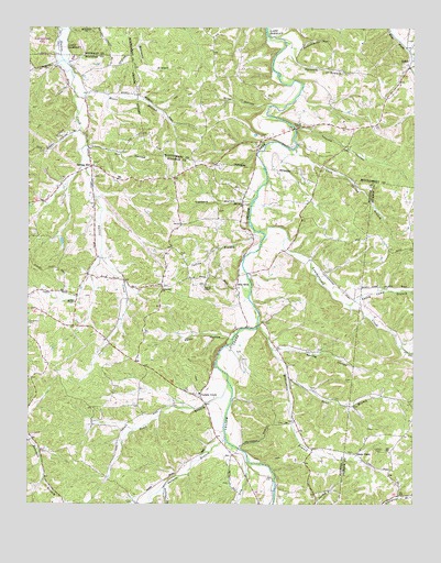
Ellis Mills, TN USGS Topographic Map
Click on map above to begin viewing in our Map Viewer.

This topographic map contains these locations and features:
Feature Name Type Latitude Longitude GNIS ID View Map
Adams CemeteryCemeteryN36.3287°W87.6033°1309094View Map
Adkins BranchStreamN36.2548°W87.5806°1275480View Map
Allbright CemeteryCemeteryN36.2506°W87.5100°1652616View Map
Averitt CemeteryCemeteryN36.2556°W87.5058°1324001View Map
Baggett BranchStreamN36.3692°W87.5020°1276077View Map
Bailey HollowValleyN36.2690°W87.5924°1309090View Map
Beech Grove Church (historical)ChurchN36.2528°W87.5042°1324005View Map
Boaz BranchStreamN36.2834°W87.5403°1277856View Map
Bushwhacker HollowValleyN36.3700°W87.5366°1279151View Map
Cave SpringSpringN36.3120°W87.5133°1652285View Map
Cave Spring BranchStreamN36.3437°W87.5386°1279964View Map
Cave Spring School (historical)SchoolN36.3114°W87.5133°1324025View Map
Commissioner District 7CivilN36.3059°W87.5709°2464619View Map
Coon HollowValleyN36.2942°W87.5597°1281175View Map
Crossroad ChurchChurchN36.3070°W87.5814°1281718View Map
District 20 (historical)CivilN36.3667°W87.5125°1325944View Map
Dortch ChapelChurchN36.3076°W87.5675°1306387View Map
Dry BranchStreamN36.2614°W87.5536°1282888View Map
Dunbar School (historical)SchoolN36.3498°W87.5564°1319621View Map
Ellis MillsPopulated PlaceN36.3067°W87.5575°1315015View Map
Ellis Mills CemeteryCemeteryN36.3284°W87.5550°1316120View Map
Ellis Mills ChurchChurchN36.3287°W87.5550°1283692View Map
Gin HollowValleyN36.3437°W87.6054°1285449View Map
Griffin ChapelChurchN36.3031°W87.6097°1286268View Map
Houston County Fire Department Erin StationBuildingN36.2859°W87.5866°2654067View Map
Indian BranchStreamN36.3223°W87.5517°1288933View Map
Leatherwood CreekStreamN36.3214°W87.5489°1290890View Map
Lyle CemeteryCemeteryN36.3270°W87.5633°1309093View Map
Mint HollowValleyN36.3547°W87.5475°1294064View Map
Moore BranchStreamN36.3576°W87.6097°1294245View Map
Moore CemeteryCemeteryN36.3164°W87.5833°1647123View Map
Opossum BranchStreamN36.3712°W87.5400°1296452View Map
Oppossum HollowValleyN36.3682°W87.5398°1311536View Map
Parchman CemeteryCemeteryN36.3039°W87.6053°1309091View Map
Patterson Chapel (historical)ChurchN36.2912°W87.5453°1309092View Map
Raney Camp BranchStreamN36.3037°W87.5236°1306941View Map
Raney Camp HollowValleyN36.3035°W87.5180°1647707View Map
Sailors Rest (historical)Populated PlaceN36.3442°W87.5389°1311553View Map
Sailors Rest Furnace (historical)LocaleN36.3442°W87.5400°1319704View Map
Salmon BranchStreamN36.2673°W87.5606°1300585View Map
Shelton CemeteryCemeteryN36.3289°W87.5150°1647122View Map
ShilohPopulated PlaceN36.3648°W87.5014°1270070View Map
Shiloh School (historical)SchoolN36.3698°W87.5020°1319713View Map
Spring HillPopulated PlaceN36.3384°W87.6047°1314326View Map
Spring Hill ChurchChurchN36.3431°W87.6053°1309095View Map
Spring HollowValleyN36.2902°W87.5444°1303772View Map
Stony PointPopulated PlaceN36.2637°W87.5189°1314343View Map
Stony Point School (historical)SchoolN36.2642°W87.5167°1324212View Map
Story Point ChurchChurchN36.2645°W87.5170°1324210View Map
Sullivan BranchStreamN36.3684°W87.5008°1271748View Map
Tanbark HollowValleyN36.3300°W87.5525°1272075View Map
Thorne HollowValleyN36.3488°W87.5382°1304090View Map
Town BranchStreamN36.2823°W87.5600°1272797View Map
Wallace HollowValleyN36.2616°W87.5540°1647128View Map
Williamson BranchStreamN36.2967°W87.5503°1274720View Map
Yellow CreekPopulated PlaceN36.2787°W87.5686°1314547View Map
Yellow Creek High School (historical)SchoolN36.2789°W87.5692°1649803View Map

Note: Coordinates in the location and feature list above are referenced to NAD83 datum.


Copyright (C) 2008-2024 Ryan Niemi / Sunset Dynamics ... All Rights Reserved