TopoQuest Logo
Do you find TopoQuest useful?
Help keep TopoQuest running and adding new maps/features by donating!
Bitcoin:  19c7KJd3qBynnjoSw5npx9KScwjBe4ifkT
Litecoin:  LXs6TkuXGGXo1vDsWCkWVdjQX94eUKd6ui
Home View Maps Find Maps Find Places Resources & Links


Edgar, Nebraska Topographic Map

USGS Map Title: Edgar, NE
USGS Map MRC: 40097C8
DRG (GeoTIFF) Download: o40097c8.tif


Neighboring USGS Topographic Map Quads:


  Fairfield, NE  
40098D1
 

  Edgar NW, NE  
40097D8
 

  Ong, NE  
40097D7
 

  Fairfield SE, NE  
40098C1
 

  Edgar, NE  
40097C8
 

  Davenport, NE  
40097C7
 

  Nelson, NE  
40098B1
 

  Oak, NE  
40097B8
 

  Ruskin, NE  
40097B7


Map MRC Location:

N41°
W98°
N41°
W97°
H8 H7 H6 H5 H4 H3 H2 H1
G8 G7 G6 G5 G4 G3 G2 G1
F8 F7 F6 F5 F4 F3 F2 F1
E8 E7 E6 E5 E4 E3 E2 E1
D8 D7 D6 D5 D4 D3 D2 D1
C8 C7 C6 C5 C4 C3 C2 C1
B8 B7 B6 B5 B4 B3 B2 B1
A8 A7 A6 A5 A4 A3 A2 A1
N40°
W98°
N40°
W97°

Edgar, NE USGS 1:24K Topographic Map Preview:
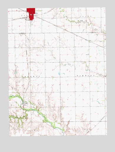
Edgar, NE USGS Topographic Map
Click on map above to begin viewing in our Map Viewer.

This topographic map contains these locations and features:
Feature Name Type Latitude Longitude GNIS ID View Map
AngusPopulated PlaceN40.2822°W97.9795°827000View Map
Angus (historical)LocaleN40.2820°W97.9814°1882647View Map
Angus Post Office (historical)Post OfficeN40.2822°W97.9795°1882648View Map
Aurora Cooperative Elevator Company ElevatorLocaleN40.3722°W97.9714°1882415View Map
Church of the PlainsChurchN40.3720°W97.9709°1882421View Map
City of EdgarCivilN40.3683°W97.9710°2394616View Map
Community Care of EdgarHospitalN40.3722°W97.9714°1882410View Map
Drohman Dam-1 DamDamN40.2789°W97.9600°1767426View Map
Drohman ReservoirReservoirN40.2795°W97.9601°1767427View Map
EdgarLocaleN40.3667°W97.9706°1882414View Map
EdgarPopulated PlaceN40.3722°W97.9714°829025View Map
Edgar CemeteryCemeteryN40.3586°W97.9698°1882424View Map
Edgar Christian ChurchChurchN40.3736°W97.9692°1882420View Map
Edgar Grain and Supply Company ElevatorLocaleN40.3722°W97.9714°1882418View Map
Edgar Lutheran ChurchChurchN40.3722°W97.9714°1882419View Map
Edgar Police DepartmentBuildingN40.3703°W97.9700°1882411View Map
Edgar Post OfficePost OfficeN40.3708°W97.9698°1882413View Map
Edgar Volunteer Fire and RescueBuildingN40.3720°W97.9647°2553274View Map
Elk Election PrecinctCivilN40.2779°W97.9154°1928851View Map
Jensen DamDamN40.2632°W97.9568°1767204View Map
Jensen ReservoirReservoirN40.2623°W97.9578°1767205View Map
Mazour-Schroeder DamDamN40.2654°W97.9226°1767234View Map
Mazour-Schroeder ReservoirReservoirN40.2662°W97.9217°1767235View Map
Mountford DamDamN40.2791°W97.9489°1767190View Map
Mountford LakeReservoirN40.2808°W97.9491°1767191View Map
Oxbow CreekStreamN40.2750°W97.9770°831940View Map
Pioneer SchoolSchoolN40.3222°W97.9720°832127View Map
SedanPopulated PlaceN40.3425°W97.8973°835445View Map
SedanLocaleN40.3425°W97.8973°1882640View Map
Sedan Post Office (historical)Post OfficeN40.3425°W97.8973°1882639View Map
Sedan SchoolSchoolN40.3289°W97.8973°833334View Map
Sherman Election Precinct (historical)CivilN40.3092°W97.9906°1929278View Map
South ParkParkN40.3625°W97.9698°1882422View Map
Standpipe ParkParkN40.3686°W97.9709°1882423View Map
Sugden Health CenterHospitalN40.3717°W97.9723°1882412View Map
Township of ShermanCivilN40.3056°W97.9892°1882653View Map

Note: Coordinates in the location and feature list above are referenced to NAD83 datum.


Copyright (C) 2008-2024 Ryan Niemi / Sunset Dynamics ... All Rights Reserved