TopoQuest Logo
Do you find TopoQuest useful?
Help keep TopoQuest running and adding new maps/features by donating!
Bitcoin:  19c7KJd3qBynnjoSw5npx9KScwjBe4ifkT
Litecoin:  LXs6TkuXGGXo1vDsWCkWVdjQX94eUKd6ui
Home View Maps Find Maps Find Places Resources & Links


East Bernard, Texas Topographic Map

USGS Map Title: East Bernard, TX
USGS Map MRC: 29096E1
DRG (GeoTIFF) Download: o29096e1.tif


Neighboring USGS Topographic Map Quads:


  Rexville, TX  
29096F2
 

  Wallis, TX  
29096F1
 

  Fulshear, TX  
29095F8
 

  Lissie, TX  
29096E2
 

  East Bernard, TX  
29096E1
 

  Orchard, TX  
29095E8
 

  Egypt, TX  
29096D2
 

  Hungerford, TX  
29096D1
 

  Kendleton, TX  
29095D8


Map MRC Location:

N30°
W97°
N30°
W96°
H8 H7 H6 H5 H4 H3 H2 H1
G8 G7 G6 G5 G4 G3 G2 G1
F8 F7 F6 F5 F4 F3 F2 F1
E8 E7 E6 E5 E4 E3 E2 E1
D8 D7 D6 D5 D4 D3 D2 D1
C8 C7 C6 C5 C4 C3 C2 C1
B8 B7 B6 B5 B4 B3 B2 B1
A8 A7 A6 A5 A4 A3 A2 A1
N29°
W97°
N29°
W96°

East Bernard, TX USGS 1:24K Topographic Map Preview:
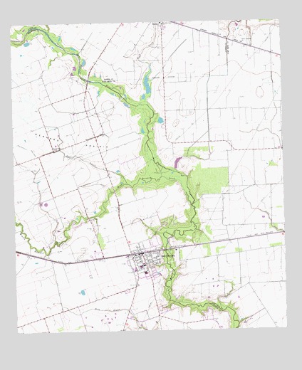
East Bernard, TX USGS Topographic Map
Click on map above to begin viewing in our Map Viewer.

This topographic map contains these locations and features:
Feature Name Type Latitude Longitude GNIS ID View Map
Bernard PrairieFlatN29.5811°W96.1155°1372502View Map
Bernard Prairie SchoolSchoolN29.5741°W96.1050°1330443View Map
Brazos High SchoolSchoolN29.6196°W96.0354°2002970View Map
City of East BernardCivilN29.5241°W96.0622°2410385View Map
Czech National CemeteryCemeteryN29.5455°W96.0891°1342375View Map
Eagle BranchStreamN29.5597°W96.0722°1334834View Map
East BernardPopulated PlaceN29.5311°W96.0711°1334880View Map
East Bernard City HallBuildingN29.5301°W96.0663°2753668View Map
East Bernard Elementary SchoolSchoolN29.5266°W96.0657°2434344View Map
East Bernard Emergency Medical ServicesBuildingN29.5323°W96.0585°2655846View Map
East Bernard High SchoolSchoolN29.5234°W96.0650°2434474View Map
East Bernard Junior High SchoolSchoolN29.5262°W96.0669°2434524View Map
East Bernard Post OfficePost OfficeN29.5293°W96.0659°2731724View Map
East Bernard Volunteer Fire DepartmentBuildingN29.5227°W96.0634°2334470View Map
Elm SloughStreamN29.5919°W96.0619°1335398View Map
Guardian Angel CemeteryCemeteryN29.6150°W96.0555°1337090View Map
Guradian Angel ChurchChurchN29.6247°W96.0547°1337138View Map
Krasna CemeteryCemeteryN29.5891°W96.0427°1339233View Map
Middle Bernard CemeteryCemeteryN29.5366°W96.1069°1341471View Map
Middle Bernard CreekStreamN29.5508°W96.0427°1341472View Map
Penny LakeReservoirN29.5682°W96.0494°1864902View Map
Penny Lake DamDamN29.5669°W96.0502°1864901View Map
Sweet Coneville ChurchChurchN29.6163°W96.0177°1348128View Map
Wharton County Constable's Office Precinct 2BuildingN29.5223°W96.0645°2739478View Map

Note: Coordinates in the location and feature list above are referenced to NAD83 datum.


Copyright (C) 2008-2024 Ryan Niemi / Sunset Dynamics ... All Rights Reserved