TopoQuest Logo
Do you find TopoQuest useful?
Help keep TopoQuest running and adding new maps/features by donating!
Bitcoin:  19c7KJd3qBynnjoSw5npx9KScwjBe4ifkT
Litecoin:  LXs6TkuXGGXo1vDsWCkWVdjQX94eUKd6ui
Home View Maps Find Maps Find Places Resources & Links


Dumont Creek, Oregon Topographic Map

USGS Map Title: Dumont Creek, OR
USGS Map MRC: 43122A7
DRG (GeoTIFF) Download: o43122a7.tif


Neighboring USGS Topographic Map Quads:


  Red Butte, OR  
43122B8
 

  Taft Mountain, OR  
43122B7
 

  Quartz Mountain, OR  
43122B6
 

  Deadman Mountain, OR  
43122A8
 

  Dumont Creek, OR  
43122A7
 

  Acker Rock, OR  
43122A6
 

  Tiller, OR  
42122H8
 

  Pickett Butte, OR  
42122H7
 

  Butler Butte, OR  
42122H6


Map MRC Location:

N44°
W123°
N44°
W122°
H8 H7 H6 H5 H4 H3 H2 H1
G8 G7 G6 G5 G4 G3 G2 G1
F8 F7 F6 F5 F4 F3 F2 F1
E8 E7 E6 E5 E4 E3 E2 E1
D8 D7 D6 D5 D4 D3 D2 D1
C8 C7 C6 C5 C4 C3 C2 C1
B8 B7 B6 B5 B4 B3 B2 B1
A8 A7 A6 A5 A4 A3 A2 A1
N43°
W123°
N43°
W122°

Dumont Creek, OR USGS 1:24K Topographic Map Preview:
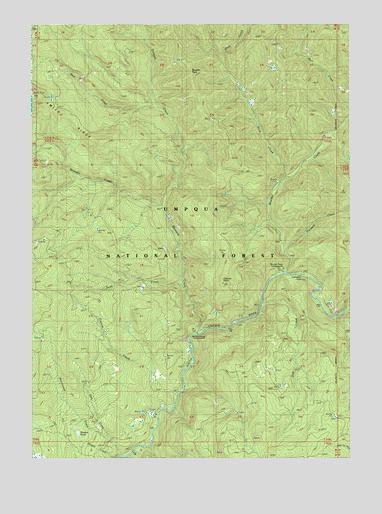
Dumont Creek, OR USGS Topographic Map
Click on map above to begin viewing in our Map Viewer.

This topographic map contains these locations and features:
Feature Name Type Latitude Longitude GNIS ID View Map
Boulder Annex Recreation SiteLocaleN43.0537°W122.7770°1952967View Map
Boulder CreekStreamN43.0529°W122.7775°1138472View Map
Boulder Creek Recreation SiteLocaleN43.0540°W122.7775°1155219View Map
Boulder Creek Umpqua National Forest Boat LaunchLocaleN43.0528°W122.7782°2668547View Map
Boulder RockPillarN43.1121°W122.8145°1138492View Map
Budd CreekStreamN43.0498°W122.8159°1138877View Map
Campbell FallsFallsN43.0518°W122.7809°1139284View Map
Clayton CreekStreamN43.0332°W122.7984°1132895View Map
Clayton PointSummitN43.0514°W122.8013°1118989View Map
Dry CreekStreamN43.0026°W122.8345°1155215View Map
Dumont CreekStreamN43.0362°W122.8101°1141394View Map
Dumont Creek Recreation SiteLocaleN43.0360°W122.8095°1155218View Map
Francis CreekStreamN43.0185°W122.8178°1142404View Map
Hob KnobSummitN43.0413°W122.8350°1155217View Map
Hutchinson CreekStreamN43.0040°W122.8428°1155214View Map
Radford CreekStreamN43.0137°W122.8220°1155216View Map
Sam CreekStreamN43.0007°W122.8398°1149008View Map
Slick CreekStreamN43.0804°W122.7767°1149679View Map
Smith RidgeRidgeN43.1046°W122.8745°1149762View Map
Straight CreekStreamN43.0712°W122.8248°1150465View Map
Straight Creek TrailTrailN43.0901°W122.8409°1150468View Map
West CreekStreamN43.1004°W122.8262°1152041View Map
Zinc CreekStreamN43.0446°W122.7845°1152784View Map

Note: Coordinates in the location and feature list above are referenced to NAD83 datum.


Copyright (C) 2008-2024 Ryan Niemi / Sunset Dynamics ... All Rights Reserved