TopoQuest Logo
Do you find TopoQuest useful?
Help keep TopoQuest running and adding new maps/features by donating!
Bitcoin:  19c7KJd3qBynnjoSw5npx9KScwjBe4ifkT
Litecoin:  LXs6TkuXGGXo1vDsWCkWVdjQX94eUKd6ui
Home View Maps Find Maps Find Places Resources & Links


Quartz Mountain, Oregon Topographic Map

USGS Map Title: Quartz Mountain, OR
USGS Map MRC: 43122B6
DRG (GeoTIFF) Download: o43122b6.tif


Neighboring USGS Topographic Map Quads:


  Mace Mountain, OR  
43122C7
 

  Steamboat, OR  
43122C6
 

  Illahee Rock, OR  
43122C5
 

  Taft Mountain, OR  
43122B7
 

  Quartz Mountain, OR  
43122B6
 

  Twin Lakes Mountain, OR  
43122B5
 

  Dumont Creek, OR  
43122A7
 

  Acker Rock, OR  
43122A6
 

  Buckeye Lake, OR  
43122A5


Map MRC Location:

N44°
W123°
N44°
W122°
H8 H7 H6 H5 H4 H3 H2 H1
G8 G7 G6 G5 G4 G3 G2 G1
F8 F7 F6 F5 F4 F3 F2 F1
E8 E7 E6 E5 E4 E3 E2 E1
D8 D7 D6 D5 D4 D3 D2 D1
C8 C7 C6 C5 C4 C3 C2 C1
B8 B7 B6 B5 B4 B3 B2 B1
A8 A7 A6 A5 A4 A3 A2 A1
N43°
W123°
N43°
W122°

Quartz Mountain, OR USGS 1:24K Topographic Map Preview:
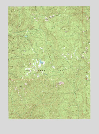
Quartz Mountain, OR USGS Topographic Map
Click on map above to begin viewing in our Map Viewer.

This topographic map contains these locations and features:
Feature Name Type Latitude Longitude GNIS ID View Map
Buck PrairieFlatN43.1993°W122.6348°1138817View Map
Buckhead Mountain CampgroundLocaleN43.1748°W122.6262°1155285View Map
Buckhead TrailTrailN43.1568°W122.6300°1138852View Map
Cavitt MountainSummitN43.1607°W122.7345°1139480View Map
Cinderella SpringSpringN43.2392°W122.6744°1139731View Map
Clover ButteSummitN43.2008°W122.7466°1139845View Map
Clover FallsFallsN43.2060°W122.7158°2576278View Map
Dead Cow LakeLakeN43.1743°W122.6937°1156904View Map
Flat RockPillarN43.1860°W122.7187°1142240View Map
Harpham LakeLakeN43.2040°W122.7012°1155289View Map
Hemlock CreekStreamN43.2201°W122.7370°1143476View Map
Hemlock FallsFallsN43.2163°W122.7286°1158880View Map
Hemlock LakeReservoirN43.1878°W122.7013°1156665View Map
Hemlock Lake Boat RampLocaleN43.1883°W122.6978°2668605View Map
Hemlock Lake Recreation SiteLocaleN43.1915°W122.7039°1155290View Map
Hemlock Meadows DamDamN43.1899°W122.7027°1155575View Map
Hemlock Meadows Recreation SiteLocaleN43.1887°W122.6967°1167101View Map
Horn PrairieFlatN43.1735°W122.7067°1135785View Map
Horse PrairieFlatN43.2029°W122.6309°1143780View Map
Junction CreekStreamN43.2204°W122.7392°1144430View Map
Lake in the WoodsLakeN43.2167°W122.7240°1152643View Map
Lake in the Woods Boat RampLocaleN43.2170°W122.7252°2668497View Map
Lake in the Woods Recreation SiteLocaleN43.2165°W122.7289°1155288View Map
Limpy MountainSummitN43.2370°W122.6857°1145030View Map
Limpy PrairieFlatN43.2385°W122.6870°1158322View Map
OK ButteSummitN43.2246°W122.6668°1147099View Map
Pinnacle CreekStreamN43.2210°W122.7437°1147744View Map
Quartz MountainSummitN43.1637°W122.6716°1148093View Map
Quartz Mountain Guard StationLocaleN43.1893°W122.7067°1148095View Map
Snowbird MountainSummitN43.1932°W122.6352°1149824View Map
Snowbird ShelterLocaleN43.1965°W122.6600°1149825View Map
South Limpy PrairieFlatN43.2362°W122.6917°1158498View Map
Twin Lake CreekStreamN43.2462°W122.6292°1151562View Map
Yakso FallsFallsN43.2246°W122.7153°1158952View Map
Yellow Jacket GladeFlatN43.1785°W122.7173°1152706View Map
Youtlkut PillarsPillarN43.2256°W122.6695°1135784View Map

Note: Coordinates in the location and feature list above are referenced to NAD83 datum.


Copyright (C) 2008-2024 Ryan Niemi / Sunset Dynamics ... All Rights Reserved