TopoQuest Logo
Do you find TopoQuest useful?
Help keep TopoQuest running and adding new maps/features by donating!
Bitcoin:  19c7KJd3qBynnjoSw5npx9KScwjBe4ifkT
Litecoin:  LXs6TkuXGGXo1vDsWCkWVdjQX94eUKd6ui
Home View Maps Find Maps Find Places Resources & Links


David, Kentucky Topographic Map

USGS Map Title: David, KY
USGS Map MRC: 37082E8
DRG (GeoTIFF) Download: o37082e8.tif


Neighboring USGS Topographic Map Quads:


  Salyersville South, KY  
37083F1
 

  Ivyton, KY  
37082F8
 

  Prestonsburg, KY  
37082F7
 

  Tiptop, KY  
37083E1
 

  David, KY  
37082E8
 

  Martin, KY  
37082E7
 

  Vest, KY  
37083D1
 

  Handshoe, KY  
37082D8
 

  Wayland, KY  
37082D7


Map MRC Location:

N38°
W83°
N38°
W82°
H8 H7 H6 H5 H4 H3 H2 H1
G8 G7 G6 G5 G4 G3 G2 G1
F8 F7 F6 F5 F4 F3 F2 F1
E8 E7 E6 E5 E4 E3 E2 E1
D8 D7 D6 D5 D4 D3 D2 D1
C8 C7 C6 C5 C4 C3 C2 C1
B8 B7 B6 B5 B4 B3 B2 B1
A8 A7 A6 A5 A4 A3 A2 A1
N37°
W83°
N37°
W82°

David, KY USGS 1:24K Topographic Map Preview:
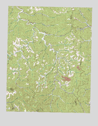
David, KY USGS Topographic Map
Click on map above to begin viewing in our Map Viewer.

This topographic map contains these locations and features:
Feature Name Type Latitude Longitude GNIS ID View Map
Albert Shepherd CemeteryCemeteryN37.5304°W82.9203°2338981View Map
Allen CemeteryCemeteryN37.6154°W82.9477°485861View Map
Allen SchoolSchoolN37.6129°W82.9377°510052View Map
Allen Wireman BranchStreamN37.5779°W82.9702°485873View Map
Alum Cave CreekStreamN37.5162°W82.9193°485906View Map
ArthurmabelPopulated PlaceN37.5951°W82.9474°507418View Map
Ashlog BranchStreamN37.5282°W82.9732°486104View Map
Bailey CemeteryCemeteryN37.5212°W82.9354°486217View Map
Barb ForkStreamN37.5493°W82.9632°486324View Map
Bate Lick BranchStreamN37.5609°W82.9707°486463View Map
Bear BranchStreamN37.5912°W82.9282°486528View Map
Becky BranchStreamN37.5545°W82.9188°486652View Map
Beetree BranchStreamN37.5779°W82.9413°486766View Map
Big BranchStreamN37.5570°W82.9846°487111View Map
Big BranchStreamN37.5718°W82.9232°487113View Map
Big BranchStreamN37.5679°W82.9932°487138View Map
Bone BranchStreamN37.5829°W82.9627°487660View Map
Brushy ForkStreamN37.5640°W82.9232°488119View Map
Brushy Fork ChurchChurchN37.5645°W82.9166°509930View Map
Brushy Fork SchoolSchoolN37.5504°W82.9013°488142View Map
Buck BranchStreamN37.6098°W82.9846°488200View Map
Buck School (historical)SchoolN37.6084°W82.9877°488244View Map
Bull CreekStreamN37.5632°W82.9260°488351View Map
Colt HollowValleyN37.5702°W82.9252°2126236View Map
Crager BranchStreamN37.5340°W82.9291°490261View Map
Dan Shepherd CemeteryCemeteryN37.5734°W82.9327°2339023View Map
DavidPopulated PlaceN37.5995°W82.8907°490621View Map
Dona Howard CemeteryCemeteryN37.5908°W82.9281°2339026View Map
Ella HollowValleyN37.6058°W82.9500°2126228View Map
Forks of Trace School (historical)SchoolN37.5709°W82.9777°510090View Map
FredvillePopulated PlaceN37.6054°W82.9646°508035View Map
Gard ForkStreamN37.6007°W82.9838°492687View Map
Goldie Johnson CemeteryCemeteryN37.5724°W82.9057°2339047View Map
Grassy BranchStreamN37.5401°W82.9829°493143View Map
Grassy CreekStreamN37.5390°W82.9274°493150View Map
Grassy Creek School (historical)SchoolN37.5301°W82.9191°510095View Map
GunlockPopulated PlaceN37.5476°W82.9260°508149View Map
Gypsy Post Office (historical)Post OfficeN37.6121°W82.9632°2339052View Map
Hale CemeteryCemeteryN37.5415°W82.8957°493552View Map
Happy Hollow (historical)ValleyN37.6018°W82.8751°2097309View Map
Head of Licking School (historical)SchoolN37.5168°W82.9313°510100View Map
Head of Trace School (historical)SchoolN37.5357°W82.9874°510104View Map
Howard BranchStreamN37.5926°W82.9446°494651View Map
Howard Branch SchoolSchoolN37.5901°W82.9224°510110View Map
Howard ForkStreamN37.5195°W82.9302°494671View Map
Indian Grave ForkStreamN37.5409°W82.8943°494950View Map
Ivy ForkStreamN37.5365°W82.9432°495067View Map
Jake Wiremen ForkStreamN37.5651°W82.9774°506964View Map
Jeff Shepherd CemeteryCemeteryN37.5701°W82.9239°2339070View Map
Jim Buck CemeteryCemeteryN37.5236°W82.9119°2339072View Map
Jimmie Shepherd CemeteryCemeteryN37.5328°W82.9168°2339073View Map
John Arnett SchoolSchoolN37.5948°W82.9435°509929View Map
John B Shepard CemeteryCemeteryN37.5477°W82.9237°2339074View Map
John Joy Howard CemeteryCemeteryN37.5223°W82.9864°2339077View Map
Joseph CemeteryCemeteryN37.5219°W82.9023°2339078View Map
Laurel ForkStreamN37.5123°W82.9882°496034View Map
Left Fork Beetree BranchStreamN37.5707°W82.9427°496195View Map
Left Fork Brushy ForkStreamN37.5598°W82.9085°496201View Map
Left Fork Grassy CreekStreamN37.5323°W82.9182°496217View Map
Lick BranchStreamN37.5429°W82.9816°496421View Map
Lick BranchStreamN37.5554°W82.9299°496423View Map
Lick Fork School (historical)SchoolN37.6115°W82.8841°510122View Map
Licking BranchStreamN37.5504°W82.9043°496522View Map
Licking Rockhouse BranchStreamN37.5504°W82.9218°496526View Map
Little Rachael United Baptist ChurchChurchN37.5829°W82.9618°509928View Map
Little Rachel ChurchChurchN37.5618°W82.9963°509931View Map
Long BranchStreamN37.6187°W82.9782°497039View Map
Long ForkStreamN37.5365°W82.9432°497100View Map
Lovely HollowValleyN37.5730°W82.9304°2126235View Map
Low Gap ForkStreamN37.5334°W82.9513°497238View Map
Mid Post Office (historical)Post OfficeN37.5703°W82.9257°2339091View Map
Mile BranchStreamN37.5654°W82.9957°498180View Map
Minnix BranchStreamN37.5501°W82.9829°498415View Map
Molly BranchStreamN37.5790°W82.9346°498475View Map
Molly Branch SchoolSchoolN37.5812°W82.9354°510133View Map
Mort Arnett CemeteryCemeteryN37.5912°W82.9156°2339095View Map
Mouth Of Salt Lick School (historical)SchoolN37.6231°W82.9837°2339098View Map
Mouth of Trace School (historical)SchoolN37.6022°W82.9599°2339099View Map
Nelvin Wireman BranchStreamN37.5820°W82.9685°499262View Map
Open ForkStreamN37.5920°W82.9985°499951View Map
Orchard Post Office (historical)Post OfficeN37.5640°W82.9227°2339108View Map
Ordway Post Office (historical)Post OfficeN37.6079°W82.9604°2339109View Map
Pond BranchStreamN37.5962°W82.9921°501030View Map
Quicksand ForkStreamN37.5212°W82.9318°501482View Map
Raleigh Shepherd Senior CemeteryCemeteryN37.5318°W82.9205°2339118View Map
Right Fork Beetree BranchStreamN37.5732°W82.9441°501864View Map
Right Fork Buck BranchStreamN37.6076°W82.9852°501870View Map
Right Fork Trace ForkStreamN37.5723°W82.9799°501932View Map
Rockhouse BranchStreamN37.5515°W82.9057°502176View Map
Rough and Tough CreekStreamN37.6032°W82.8799°502374View Map
Royalton DivisionCivilN37.6006°W82.9658°1937227View Map
Rye BranchStreamN37.5757°W82.9799°502538View Map
Sallie Allen BranchStreamN37.5970°W82.9627°502807View Map
Seals BranchStreamN37.5859°W82.9477°503132View Map
Shepherd BranchStreamN37.5365°W82.9296°503344View Map
Shepherd SchoolSchoolN37.5093°W82.8757°503349View Map
Sprucepine BranchStreamN37.5232°W82.9016°504183View Map
Sprucepine ForkStreamN37.5207°W82.9352°504184View Map
Stay CreekStreamN37.5862°W82.8777°504291View Map
Stillhouse HollowValleyN37.5859°W82.8845°504422View Map
Straight ForkStreamN37.5212°W82.9318°504558View Map
Straight Fork School (historical)SchoolN37.5202°W82.9301°2339137View Map
Sulfer Springs HollowValleyN37.5939°W82.9092°2126233View Map
Sulfur SpringsSpringN37.5941°W82.9102°2339139View Map
Sulphur Spring BranchStreamN37.5490°W82.8966°504752View Map
Sycamore BranchStreamN37.5476°W82.8954°504866View Map
Trace ForkStreamN37.6007°W82.9607°505437View Map
Vanderpool CemeteryCemeteryN37.5636°W82.9113°2339146View Map
Vic BranchStreamN37.5870°W82.9646°506034View Map
WaldoPopulated PlaceN37.5759°W82.9777°509304View Map
Waldo Post Office (historical)Post OfficeN37.5769°W82.9780°2339147View Map
Waldo Wayside ChurchChurchN37.5637°W82.9971°506109View Map
White BridgeBridgeN37.5731°W82.9287°2339151View Map
Whitley BranchStreamN37.6051°W82.9593°506685View Map
Wild Cat BranchStreamN37.5900°W82.9236°2126231View Map
Will BranchStreamN37.5454°W82.9238°506768View Map
Willburn Shepherd CemeteryCemeteryN37.5340°W82.9145°2339153View Map
Wireman CemeteryCemeteryN37.5645°W82.9252°506962View Map
Wolfpen BranchStreamN37.5420°W82.9416°507042View Map

Note: Coordinates in the location and feature list above are referenced to NAD83 datum.


Copyright (C) 2008-2024 Ryan Niemi / Sunset Dynamics ... All Rights Reserved