TopoQuest Logo
Do you find TopoQuest useful?
Help keep TopoQuest running and adding new maps/features by donating!
Bitcoin:  19c7KJd3qBynnjoSw5npx9KScwjBe4ifkT
Litecoin:  LXs6TkuXGGXo1vDsWCkWVdjQX94eUKd6ui
Home View Maps Find Maps Find Places Resources & Links


Cripple Creek, Virginia Topographic Map

USGS Map Title: Cripple Creek, VA
USGS Map MRC: 36081G1
DRG (GeoTIFF) Download: o36081g1.tif


Neighboring USGS Topographic Map Quads:


  Crockett, VA  
36081H2
 

  Wytheville, VA  
36081H1
 

  Max Meadows, VA  
36080H8
 

  Speedwell, VA  
36081G2
 

  Cripple Creek, VA  
36081G1
 

  Austinville, VA  
36080G8
 

  Elk Creek, VA  
36081F2
 

  Brierpatch Mountain, VA  
36081F1
 

  Galax, VA  
36080F8


Map MRC Location:

N37°
W82°
N37°
W81°
H8 H7 H6 H5 H4 H3 H2 H1
G8 G7 G6 G5 G4 G3 G2 G1
F8 F7 F6 F5 F4 F3 F2 F1
E8 E7 E6 E5 E4 E3 E2 E1
D8 D7 D6 D5 D4 D3 D2 D1
C8 C7 C6 C5 C4 C3 C2 C1
B8 B7 B6 B5 B4 B3 B2 B1
A8 A7 A6 A5 A4 A3 A2 A1
N36°
W82°
N36°
W81°

Cripple Creek, VA USGS 1:24K Topographic Map Preview:
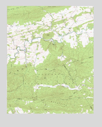
Cripple Creek, VA USGS Topographic Map
Click on map above to begin viewing in our Map Viewer.

This topographic map contains these locations and features:
Feature Name Type Latitude Longitude GNIS ID View Map
Bethany ChurchChurchN36.8518°W81.1173°1481650View Map
Bournes BranchStreamN36.7693°W81.0079°1481942View Map
Bournes Branch TrailTrailN36.7665°W81.0415°1481943View Map
Brush Creek MissionChurchN36.7832°W81.0129°1482057View Map
Brush Creek School (historical)SchoolN36.7812°W81.0548°1501162View Map
Calvary ChurchChurchN36.8543°W81.0859°1482235View Map
Catron (historical)Populated PlaceN36.8454°W81.0329°1501278View Map
Chestnut KnobSummitN36.8090°W81.0190°1482482View Map
Cliff Branch TrailTrailN36.8065°W81.0365°1488654View Map
Cold RunStreamN36.8371°W81.0804°1482620View Map
Cold Springs ChurchChurchN36.7812°W81.0418°1482634View Map
Collins CoveBayN36.8168°W81.0456°1482654View Map
Cook BranchStreamN36.8454°W81.0165°1482685View Map
Coon BranchStreamN36.7835°W81.0501°1482693View Map
Cove BranchStreamN36.8332°W81.0459°1482732View Map
Cove Branch School (historical)SchoolN36.8218°W81.0440°1501290View Map
Cripple CreekPopulated PlaceN36.8210°W81.0984°1492826View Map
Crockett ChapelChurchN36.8246°W81.0979°1482842View Map
Davis CemeteryCemeteryN36.8565°W81.0751°1482934View Map
Devils DenSummitN36.7915°W81.0715°1492865View Map
Eagle (historical)Populated PlaceN36.8365°W81.0454°1501292View Map
Eagle CliffCliffN36.8421°W81.0470°1483191View Map
Eagle FurnacePopulated PlaceN36.8398°W81.0484°1492894View Map
Ewing MountainSummitN36.7996°W81.0523°1483322View Map
Faith ChurchChurchN36.7812°W81.0362°1483339View Map
Francis Mill CreekStreamN36.8232°W81.0993°1483524View Map
Fry HillSummitN36.8062°W81.0920°1492982View Map
Gleaves KnobSummitN36.8412°W81.0670°1483666View Map
HenleyPopulated PlaceN36.8521°W81.1129°1493071View Map
Henley CreekStreamN36.8340°W81.0943°1484038View Map
Henley MountainSummitN36.8643°W81.1068°1484040View Map
Henley School (historical)SchoolN36.8512°W81.1181°1501313View Map
High PointCapeN36.7998°W81.1106°1484084View Map
HuddlePopulated PlaceN36.8487°W81.0362°1493113View Map
Hussy MountainSummitN36.8018°W81.1037°1493119View Map
Jones BranchStreamN36.7823°W81.0393°1484492View Map
Jones KnobSummitN36.7660°W81.0726°1493148View Map
Laurel HollowValleyN36.8134°W81.1247°1484713View Map
Lick CreekStreamN36.7773°W81.0223°1484813View Map
Little Horse HeavenSummitN36.7965°W81.1148°1484916View Map
Long RidgeRidgeN36.7723°W81.0540°1485063View Map
Matney FlatFlatN36.8704°W81.1201°1485223View Map
Memorial ChurchChurchN36.8493°W81.0351°1485351View Map
Mikes GapGapN36.8018°W81.0662°1485393View Map
Miles Gap TrailTrailN36.7982°W81.0545°1488653View Map
Mill BranchStreamN36.8276°W81.1084°1485398View Map
Mountain TrailTrailN36.7662°W81.1081°1485692View Map
Mountain View School (historical)SchoolN36.7657°W81.0851°1501228View Map
New Hope ChurchChurchN36.8579°W81.0798°1501351View Map
New Hope School (historical)SchoolN36.8532°W81.1131°1501352View Map
Noble FurnacePopulated PlaceN36.8093°W81.0968°1493350View Map
Penn BranchStreamN36.8371°W81.0837°1486131View Map
Raven CliffCliffN36.8304°W81.0573°1486519View Map
Raven Cliff CampgroundLocaleN36.8368°W81.0698°1488657View Map
Raven Cliff FurnaceLocaleN36.8343°W81.0584°1486520View Map
Raven Cliff Horse CampLocaleN36.8335°W81.0426°1488652View Map
Rock CreekStreamN36.8337°W81.0579°1486693View Map
Rocky HollowValleyN36.8145°W81.1195°1486742View Map
Saint Peters ChurchChurchN36.8254°W81.1151°1486883View Map
ShilohPopulated PlaceN36.8012°W81.0834°1493582View Map
Slate Spring BranchStreamN36.8410°W81.0498°1487300View Map
Slate Spring School (historical)SchoolN36.8532°W81.0737°1501368View Map
The FallsFallsN36.7568°W81.0912°1501182View Map
Thorn BranchStreamN36.8443°W81.0320°1487889View Map
Thorn CreekStreamN36.8148°W81.1248°1487890View Map
Yellow BranchStreamN36.7773°W81.0220°1487113View Map
Yellow Branch TrailTrailN36.7746°W81.0243°1487114View Map

Note: Coordinates in the location and feature list above are referenced to NAD83 datum.


Copyright (C) 2008-2024 Ryan Niemi / Sunset Dynamics ... All Rights Reserved