TopoQuest Logo
Do you find TopoQuest useful?
Help keep TopoQuest running and adding new maps/features by donating!
Bitcoin:  19c7KJd3qBynnjoSw5npx9KScwjBe4ifkT
Litecoin:  LXs6TkuXGGXo1vDsWCkWVdjQX94eUKd6ui
Home View Maps Find Maps Find Places Resources & Links


Bloomfield, Indiana Topographic Map

USGS Map Title: Bloomfield, IN
USGS Map MRC: 39086A8
DRG (GeoTIFF) Download: o39086a8.tif


Neighboring USGS Topographic Map Quads:


  Coal City, IN  
39087B1
 

  Arney, IN  
39086B8
 

  Freedom, IN  
39086B7
 

  Switz City, IN  
39087A1
 

  Bloomfield, IN  
39086A8
 

  Solsberry, IN  
39086A7
 

  Lyons, IN  
38087H1
 

  Scotland, IN  
38086H8
 

  Koleen, IN  
38086H7


Map MRC Location:

N40°
W87°
N40°
W86°
H8 H7 H6 H5 H4 H3 H2 H1
G8 G7 G6 G5 G4 G3 G2 G1
F8 F7 F6 F5 F4 F3 F2 F1
E8 E7 E6 E5 E4 E3 E2 E1
D8 D7 D6 D5 D4 D3 D2 D1
C8 C7 C6 C5 C4 C3 C2 C1
B8 B7 B6 B5 B4 B3 B2 B1
A8 A7 A6 A5 A4 A3 A2 A1
N39°
W87°
N39°
W86°

Bloomfield, IN USGS 1:24K Topographic Map Preview:
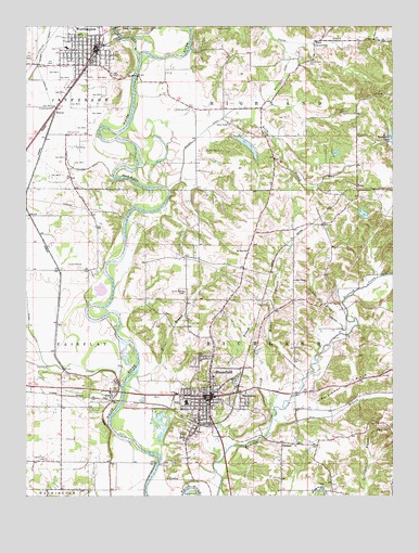
Bloomfield, IN USGS Topographic Map
Click on map above to begin viewing in our Map Viewer.

This topographic map contains these locations and features:
Feature Name Type Latitude Longitude GNIS ID View Map
Allen ChapelChurchN39.0575°W86.9089°430087View Map
Beechwood LakeReservoirN39.0955°W86.8752°430737View Map
Bloom Volunteer Fire DepartmentBuildingN39.0203°W86.9397°2701369View Map
BloomfieldPopulated PlaceN39.0270°W86.9375°431200View Map
Bloomfield Elementary SchoolSchoolN39.0250°W86.9458°446966View Map
Bloomfield High SchoolSchoolN39.0250°W86.9458°446967View Map
Bloomfield Police DepartmentBuildingN39.0269°W86.9382°2758086View Map
Bloomfield Volunteer Fire DepartmentBuildingN39.0203°W86.9396°2625851View Map
Bucher CemeteryCemeteryN39.0920°W86.9389°431709View Map
Bullock DitchCanalN39.1128°W86.9120°431804View Map
CalvertvillePopulated PlaceN39.1164°W86.9039°431992View Map
Calvertville CemeteryCemeteryN39.1161°W86.9037°431993View Map
Castle Hill CemeteryCemeteryN39.0098°W86.9933°432228View Map
Clark CreekStreamN39.1239°W86.9439°432557View Map
Dayhoff DitchCanalN39.0875°W86.9783°433367View Map
Dead Horse BranchStreamN39.1245°W86.9175°433386View Map
Dixon CemeteryCemeteryN39.0970°W86.9856°433578View Map
Eel RiverStreamN39.1178°W86.9620°434036View Map
EllistonPopulated PlaceN39.0278°W86.9708°434112View Map
Fairplay MoundSummitN39.0603°W86.9856°449058View Map
Faulk Lake DamDamN39.0767°W86.9317°447623View Map
Flater CemeteryCemeteryN39.0178°W86.8764°434571View Map
FurnacePopulated PlaceN39.0142°W86.9131°434906View Map
Goodwin CemeteryCemeteryN39.1019°W86.8914°435175View Map
Greene CountyCivilN39.0363°W86.9620°451676View Map
Greene County Ambulance ServiceBuildingN39.0256°W86.9363°2719298View Map
Greene County Sheriff DepartmentBuildingN39.0246°W86.9283°2758477View Map
HashtownPopulated PlaceN39.0250°W86.9245°435859View Map
Hayes CemeteryCemeteryN39.1247°W86.9575°435919View Map
Highland Township Volunteer Fire DepartmentBuildingN39.1236°W86.8972°2626233View Map
Jackson LakeReservoirN39.0752°W86.8851°448490View Map
Jackson Lake DamDamN39.0717°W86.8833°448489View Map
Kelly BranchStreamN39.1017°W86.9322°437221View Map
Lattas CreekStreamN39.0298°W86.9675°437643View Map
Miller BranchStreamN39.0295°W86.9664°439181View Map
Moses LakeReservoirN39.0932°W86.9245°447079View Map
Moses Lake DamDamN39.0956°W86.9295°447080View Map
Mount Zion ChurchChurchN39.0653°W86.9250°439758View Map
Ore BranchStreamN39.0206°W86.9161°440690View Map
Owens CemeteryCemeteryN39.1245°W86.9306°440797View Map
Persimmon RidgeRidgeN39.0303°W86.8886°441041View Map
Richland Township Fire and RescueBuildingN39.0156°W86.9323°2626422View Map
RinconPopulated PlaceN39.1025°W86.9903°442045View Map
Ritter BranchStreamN39.0217°W86.9161°442066View Map
Rock RiffleRapidsN39.0848°W86.9650°442208View Map
Skinner BranchStreamN39.0437°W86.8933°443579View Map
Stalcup CemeteryCemeteryN39.1028°W86.9492°444053View Map
Town of BloomfieldCivilN39.0263°W86.9373°2396592View Map
Town of WorthingtonCivilN39.1185°W86.9793°2397756View Map
Township of HighlandCivilN39.1177°W86.8870°453411View Map
Township of RichlandCivilN39.0382°W86.8977°453794View Map
TulipPopulated PlaceN39.0820°W86.8867°444945View Map
Tulip ChurchChurchN39.0723°W86.8989°444946View Map
Union Bethel CemeteryCemeteryN39.0545°W86.9458°445047View Map
Union Valley ChurchChurchN39.0995°W86.9314°445133View Map
Wall CemeteryCemeteryN39.1070°W86.8814°445384View Map
Wildcat BranchStreamN39.0314°W86.9050°446014View Map
Worthington - Jefferson Volunteer Fire DepartmentBuildingN39.1186°W86.9768°2626526View Map
Worthington City Police DepartmentBuildingN39.1184°W86.9768°2758431View Map
Worthington Elementary SchoolSchoolN39.1023°W86.9861°446964View Map

Note: Coordinates in the location and feature list above are referenced to NAD83 datum.


Copyright (C) 2008-2024 Ryan Niemi / Sunset Dynamics ... All Rights Reserved