TopoQuest Logo
Do you find TopoQuest useful?
Help keep TopoQuest running and adding new maps/features by donating!
Bitcoin:  19c7KJd3qBynnjoSw5npx9KScwjBe4ifkT
Litecoin:  LXs6TkuXGGXo1vDsWCkWVdjQX94eUKd6ui
Home View Maps Find Maps Find Places Resources & Links


Powellton, West Virginia Topographic Map

USGS Map Title: Powellton, WV
USGS Map MRC: 38081A3
DRG (GeoTIFF) Download: o38081a3.tif


Neighboring USGS Topographic Map Quads:


  Cedar Grove, WV  
38081B4
 

  Montgomery, WV  
38081B3
 

  Gauley Bridge, WV  
38081B2
 

  Eskdale, WV  
38081A4
 

  Powellton, WV  
38081A3
 

  Beckwith, WV  
38081A2
 

  Dorothy, WV  
37081H4
 

  Pax, WV  
37081H3
 

  Oak Hill, WV  
37081H2


Map MRC Location:

N39°
W82°
N39°
W81°
H8 H7 H6 H5 H4 H3 H2 H1
G8 G7 G6 G5 G4 G3 G2 G1
F8 F7 F6 F5 F4 F3 F2 F1
E8 E7 E6 E5 E4 E3 E2 E1
D8 D7 D6 D5 D4 D3 D2 D1
C8 C7 C6 C5 C4 C3 C2 C1
B8 B7 B6 B5 B4 B3 B2 B1
A8 A7 A6 A5 A4 A3 A2 A1
N38°
W82°
N38°
W81°

Powellton, WV USGS 1:24K Topographic Map Preview:
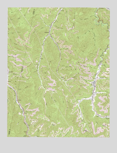
Powellton, WV USGS Topographic Map
Click on map above to begin viewing in our Map Viewer.

This topographic map contains these locations and features:
Feature Name Type Latitude Longitude GNIS ID View Map
Armstrong Creek Volunteer Fire DepartmentBuildingN38.1054°W81.3221°2577962View Map
Armstrong MountainSummitN38.0982°W81.3040°1535014View Map
Big Righthand ForkStreamN38.1090°W81.2676°1535897View Map
Big RunStreamN38.0421°W81.2704°1556054View Map
Black Gum HollowValleyN38.0846°W81.3109°1536050View Map
Blake CemeteryCemeteryN38.1229°W81.2515°1536080View Map
Camp BranchStreamN38.0229°W81.2662°1536897View Map
Cedar CreekStreamN38.0187°W81.3532°1537126View Map
CoalfieldPopulated PlaceN38.0046°W81.3504°1554165View Map
Cokeoven HollowValleyN38.0573°W81.2634°1537500View Map
CollinsdalePopulated PlaceN38.0359°W81.3634°1554180View Map
ColumbiaPopulated PlaceN38.1229°W81.3109°1537540View Map
Craig CemeteriesCemeteryN38.1076°W81.3243°1537776View Map
Craig HollowValleyN38.1079°W81.3276°1537780View Map
Deep Water Census Designated PlaceCensusN38.1217°W81.2528°2586797View Map
ElkridgePopulated PlaceN38.0804°W81.3340°1538663View Map
Fifteenmile CreekStreamN38.0026°W81.3504°1538955View Map
Glenco HollowValleyN38.0423°W81.2673°1539459View Map
GreencastlePopulated PlaceN38.0634°W81.3729°1554608View Map
Greencastle CemeteryCemeteryN38.0607°W81.3727°2727544View Map
HamiltonPopulated PlaceN38.0215°W81.2632°1554630View Map
Hickory CampLocaleN38.0476°W81.3701°1540204View Map
Hickory Camp BranchStreamN38.0243°W81.3548°1540205View Map
Hygeia HeliportAirportN38.0001°W81.3340°1558862View Map
Interchange 66CrossingN38.0293°W81.3601°1556126View Map
Jenkins ForkStreamN38.1062°W81.3212°1540859View Map
Johnson CemeteryCemeteryN38.0359°W81.2871°1540970View Map
Johnson ForkStreamN38.0396°W81.2709°1540979View Map
KincaidPopulated PlaceN38.0407°W81.2701°1554877View Map
Kincaid Census Designated PlaceCensusN38.0381°W81.2759°2586838View Map
Kincaid Post OfficePost OfficeN38.0369°W81.2705°2774644View Map
Kingston MountainSummitN38.0051°W81.2787°1554885View Map
Laurel BranchStreamN38.0446°W81.3648°1541380View Map
Laurel BranchStreamN38.0498°W81.3323°1541381View Map
Laurel BranchStreamN38.0696°W81.3121°1541382View Map
Laurel BranchStreamN38.0446°W81.3207°1556134View Map
Left Fork Armstrong CreekStreamN38.0459°W81.3287°1541621View Map
Left Fork Ash BranchStreamN38.0979°W81.3748°1541623View Map
Little Righthand ForkStreamN38.1171°W81.2684°1542194View Map
Little Stop HollowValleyN38.1090°W81.3193°1542232View Map
Loup Creek Volunteer Fire DepartmentBuildingN38.0580°W81.2653°2577879View Map
Loup Creek Volunteer Fire Department Robson StationBuildingN38.0963°W81.2510°2578051View Map
MahanPopulated PlaceN38.0229°W81.3551°1555024View Map
McDunnPopulated PlaceN38.0571°W81.3090°1555084View Map
Meadow Haven Memorial ParkCemeteryN38.0198°W81.2507°1543069View Map
Molly Kincaid BranchStreamN38.0532°W81.2673°1543489View Map
North PagePopulated PlaceN38.0709°W81.2609°1544230View Map
PagePopulated PlaceN38.0529°W81.2698°1555292View Map
Page Census Designated PlaceCensusN38.0506°W81.2718°2586862View Map
Page Elementary School (historical)SchoolN38.0468°W81.2679°1556170View Map
Page Tabernackle CemeteryCemeteryN38.0483°W81.2668°2586287View Map
Payne KnobSummitN38.0118°W81.3171°1544660View Map
PowelltonPopulated PlaceN38.0990°W81.3240°1545222View Map
Powellton Census Designated PlaceCensusN38.0941°W81.3220°2389704View Map
Powellton Elementary School (historical)SchoolN38.0951°W81.3290°1556179View Map
Powellton ForkStreamN38.0998°W81.3237°1545223View Map
Powellton Post OfficePost OfficeN38.0909°W81.3163°2780335View Map
Press Kincaid BranchStreamN38.0582°W81.2668°1556180View Map
Right Fork Armstrong CreekStreamN38.0459°W81.3290°1545605View Map
Right Fork Big Righthand ForkStreamN38.1043°W81.2718°1545611View Map
Robinson BranchStreamN38.0629°W81.2626°1545860View Map
Robson Post OfficePost OfficeN38.1052°W81.2512°2774637View Map
Spring BranchStreamN38.0004°W81.3398°1547166View Map
Stover HollowValleyN38.0437°W81.3198°1547538View Map
Sycamore BranchStreamN38.0615°W81.3737°1547817View Map
Sycamore Branch CemeteryCemeteryN38.0606°W81.3729°2586357View Map
Unknown BranchStreamN38.0271°W81.3562°1548498View Map
Woodrum BranchStreamN38.0537°W81.3037°1549382View Map

Note: Coordinates in the location and feature list above are referenced to NAD83 datum.


Copyright (C) 2008-2024 Ryan Niemi / Sunset Dynamics ... All Rights Reserved