TopoQuest Logo
Do you find TopoQuest useful?
Help keep TopoQuest running and adding new maps/features by donating!
Bitcoin:  19c7KJd3qBynnjoSw5npx9KScwjBe4ifkT
Litecoin:  LXs6TkuXGGXo1vDsWCkWVdjQX94eUKd6ui
Home View Maps Find Maps Find Places Resources & Links


Beckwith, West Virginia Topographic Map

USGS Map Title: Beckwith, WV
USGS Map MRC: 38081A2
DRG (GeoTIFF) Download: o38081a2.tif


Neighboring USGS Topographic Map Quads:


  Montgomery, WV  
38081B3
 

  Gauley Bridge, WV  
38081B2
 

  Ansted, WV  
38081B1
 

  Powellton, WV  
38081A3
 

  Beckwith, WV  
38081A2
 

  Fayetteville, WV  
38081A1
 

  Pax, WV  
37081H3
 

  Oak Hill, WV  
37081H2
 

  Thurmond, WV  
37081H1


Map MRC Location:

N39°
W82°
N39°
W81°
H8 H7 H6 H5 H4 H3 H2 H1
G8 G7 G6 G5 G4 G3 G2 G1
F8 F7 F6 F5 F4 F3 F2 F1
E8 E7 E6 E5 E4 E3 E2 E1
D8 D7 D6 D5 D4 D3 D2 D1
C8 C7 C6 C5 C4 C3 C2 C1
B8 B7 B6 B5 B4 B3 B2 B1
A8 A7 A6 A5 A4 A3 A2 A1
N38°
W82°
N38°
W81°

Beckwith, WV USGS 1:24K Topographic Map Preview:
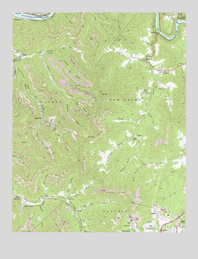
Beckwith, WV USGS Topographic Map
Click on map above to begin viewing in our Map Viewer.

This topographic map contains these locations and features:
Feature Name Type Latitude Longitude GNIS ID View Map
Abbot CemeteryCemeteryN38.0833°W81.1493°2586285View Map
Beards ForkStreamN38.0940°W81.2487°1535411View Map
Beards ForkPopulated PlaceN38.0637°W81.2273°1553820View Map
Beards Fork Census Designated PlaceCensusN38.0646°W81.2278°2586759View Map
Beards Fork Elementary School (historical)SchoolN38.0743°W81.2315°1556051View Map
BeckwithPopulated PlaceN38.0979°W81.1534°1549584View Map
Beckwith School (historical)SchoolN38.0959°W81.1265°1535467View Map
Bethel Baptist ChurchChurchN38.0029°W81.1487°1535691View Map
Big RockSummitN38.0787°W81.1857°1553901View Map
Camp Beckwith 4-H CampLocaleN38.0793°W81.1518°1556060View Map
Carter BranchStreamN38.0198°W81.2112°1537070View Map
Carter BranchStreamN38.0443°W81.1623°1537071View Map
Cassidy BranchStreamN38.0629°W81.1598°1537087View Map
Charles C Rogers BridgeBridgeN38.1139°W81.1437°2635392View Map
Charlton HeightsPopulated PlaceN38.1237°W81.2340°1537222View Map
Charlton Heights Post OfficePost OfficeN38.1239°W81.2341°2774651View Map
Coalmans BranchStreamN38.0684°W81.1526°1537478View Map
Coleman BranchStreamN38.1026°W81.2218°1537512View Map
Cotton HillSummitN38.1107°W81.1782°1537699View Map
Cotton HillPopulated PlaceN38.1134°W81.1448°1549643View Map
DempseyPopulated PlaceN38.0540°W81.1626°1554288View Map
Dempsey BranchStreamN38.0551°W81.1620°1538120View Map
Dempsey BranchStreamN38.1007°W81.2429°1538121View Map
Doggett Missionary Baptist ChurchChurchN38.0534°W81.1632°1538246View Map
Fairview School (historical)SchoolN38.1234°W81.1368°1556088View Map
Fayette Square Shooping CenterLocaleN38.0104°W81.1298°1556092View Map
Ford KnobSummitN38.0546°W81.1957°1554483View Map
Gauley Junction DamDamN38.1191°W81.1308°1557428View Map
General Ambulance Service Station 5BuildingN38.0633°W81.2266°2581029View Map
Hamilton (historical)Populated PlaceN38.0207°W81.2484°1556115View Map
Hamilton BranchStreamN38.0159°W81.2304°1539874View Map
Hawk LakeReservoirN38.1184°W81.1315°1557429View Map
Hillcrest ChurchChurchN38.0148°W81.1457°1540300View Map
Ingram BranchPopulated PlaceN38.0179°W81.2390°1540707View Map
Jenkins BranchStreamN38.0984°W81.1543°1540856View Map
John Nugen CemeteryCemeteryN38.0669°W81.1562°2586165View Map
Laurel CreekStreamN38.1143°W81.1445°1541420View Map
Lick ForkStreamN38.0068°W81.2004°1541891View Map
Lick ForkPopulated PlaceN38.0065°W81.2004°1556137View Map
LochgellyPopulated PlaceN38.0107°W81.1451°1554981View Map
Lochgelly Census Designated PlaceCensusN38.0105°W81.1409°2586847View Map
Lochgelly Post OfficePost OfficeN38.0106°W81.1453°2774658View Map
Loop Creek ChurchChurchN38.0190°W81.2104°1542454View Map
MidwayPopulated PlaceN38.0029°W81.1482°1555117View Map
Mulberry ForkStreamN38.1012°W81.2298°1543979View Map
Oakville School (historical)SchoolN38.0034°W81.1259°1544319View Map
Open ForkStreamN38.0201°W81.2254°1544415View Map
Orchard BranchStreamN38.0757°W81.1534°1544433View Map
Paddy BranchStreamN38.1240°W81.2434°1544514View Map
Right Fork Beards ForkStreamN38.0646°W81.2273°1545607View Map
RobsonPopulated PlaceN38.1018°W81.2437°1555495View Map
Robson CemeteryCemeteryN38.1023°W81.2306°1545885View Map
Seng BranchStreamN38.0768°W81.2068°1546566View Map
Skyline Shopping CenterLocaleN38.0048°W81.1295°1556200View Map
Sugar BranchStreamN38.0379°W81.1557°1547621View Map
Sugar CreekStreamN38.0834°W81.1459°1547627View Map
Sugarcamp BranchStreamN38.0782°W81.2098°1547663View Map
SummerleePopulated PlaceN38.0029°W81.1601°1555743View Map
Summerlee Gifted Center (historical)SchoolN38.0034°W81.1598°1556203View Map
Summerlee SpringSpringN38.0062°W81.1659°1960215View Map
Taylor BranchStreamN38.0193°W81.2115°1547920View Map
Turkey CreekStreamN38.1212°W81.1301°1548334View Map
Valley DistrictCivilN38.0755°W81.2375°1928396View Map
White Oak ForkStreamN38.0129°W81.2034°1549056View Map
Wilson BranchStreamN38.0998°W81.1615°1549207View Map
WristonPopulated PlaceN38.0132°W81.2034°1556028View Map
YoungstownPopulated PlaceN38.0921°W81.1440°1556044View Map

Note: Coordinates in the location and feature list above are referenced to NAD83 datum.


Copyright (C) 2008-2024 Ryan Niemi / Sunset Dynamics ... All Rights Reserved