TopoQuest Logo
Do you find TopoQuest useful?
Help keep TopoQuest running and adding new maps/features by donating!
Bitcoin:  19c7KJd3qBynnjoSw5npx9KScwjBe4ifkT
Litecoin:  LXs6TkuXGGXo1vDsWCkWVdjQX94eUKd6ui
Home View Maps Find Maps Find Places Resources & Links


Powder Mill Ferry, Missouri Topographic Map

USGS Map Title: Powder Mill Ferry, MO
USGS Map MRC: 37091B2
DRG (GeoTIFF) Download: o37091b2.tif


Neighboring USGS Topographic Map Quads:


  The Sinks, MO  
37091C3
 

  Midridge, MO  
37091C2
 

  Corridon SE, MO  
37091C1
 

  Eminence, MO  
37091B3
 

  Powder Mill Ferry, MO  
37091B2
 

  Exchange, MO  
37091B1
 

  Winona, MO  
37091A3
 

  Stegall Mountain, MO  
37091A2
 

  Van Buren North, MO  
37091A1


Map MRC Location:

N38°
W92°
N38°
W91°
H8 H7 H6 H5 H4 H3 H2 H1
G8 G7 G6 G5 G4 G3 G2 G1
F8 F7 F6 F5 F4 F3 F2 F1
E8 E7 E6 E5 E4 E3 E2 E1
D8 D7 D6 D5 D4 D3 D2 D1
C8 C7 C6 C5 C4 C3 C2 C1
B8 B7 B6 B5 B4 B3 B2 B1
A8 A7 A6 A5 A4 A3 A2 A1
N37°
W92°
N37°
W91°

Powder Mill Ferry, MO USGS 1:24K Topographic Map Preview:
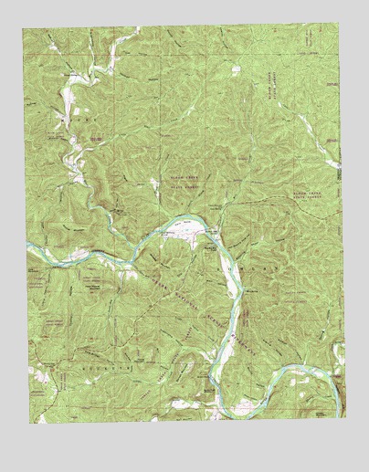
Powder Mill Ferry, MO USGS Topographic Map
Click on map above to begin viewing in our Map Viewer.

This topographic map contains these locations and features:
Feature Name Type Latitude Longitude GNIS ID View Map
Angling HollowValleyN37.1414°W91.1504°713300View Map
Barnett MountainSummitN37.1420°W91.1874°713682View Map
Blair CreekStreamN37.1800°W91.2071°748902View Map
Blair Creek State ForestForestN37.2150°W91.2362°742925View Map
Bloom CreekStreamN37.1889°W91.1915°714377View Map
Bloom Creek State ForestForestN37.2092°W91.1546°753461View Map
Blue SpringSpringN37.1660°W91.1632°714427View Map
Booming Shoal Ford (historical)LocaleN37.1712°W91.1693°747808View Map
Booming Shoal HollowValleyN37.1745°W91.1679°714530View Map
Brawley HollowValleyN37.2128°W91.2310°714654View Map
Buttin RockCliffN37.1395°W91.1810°715134View Map
Buttin Rock MountainSummitN37.1345°W91.1815°715136View Map
Buttin Rock SchoolSchoolN37.1531°W91.1693°736239View Map
Buttin School (historical)SchoolN37.1453°W91.1699°747810View Map
Cardareva BluffCliffN37.1312°W91.1271°715389View Map
Cardareva State ForestForestN37.1370°W91.1257°742924View Map
Carr CreekStreamN37.1478°W91.1251°715425View Map
Carr Creek Ford (historical)LocaleN37.1378°W91.1315°747812View Map
Carrs Creek State ForestForestN37.1634°W91.1312°742923View Map
Clint Williams SpringSpringN37.1845°W91.1971°715996View Map
Coot HollowValleyN37.1789°W91.2432°716291View Map
Cove SpringSpringN37.1920°W91.1726°716397View Map
Dee HollowValleyN37.2403°W91.2129°716783View Map
Dry HollowValleyN37.1809°W91.1754°717121View Map
GangPopulated PlaceN37.2067°W91.2307°740527View Map
Goose BayBayN37.1753°W91.2085°736237View Map
Goose Bay CreekStreamN37.1750°W91.2132°718581View Map
Goose Bay Ford (historical)LocaleN37.1756°W91.2121°747805View Map
Holmes HollowValleyN37.2362°W91.2146°719730View Map
Indian CreekStreamN37.1434°W91.1768°720107View Map
Indian Creek State ForestForestN37.1331°W91.2085°753462View Map
Larkin Ford (historical)LocaleN37.1637°W91.1668°747809View Map
Little Blair CreekStreamN37.2042°W91.2285°721157View Map
Little Bloom CreekStreamN37.1900°W91.1854°721158View Map
Little Booming Shoal HollowValleyN37.1787°W91.1710°721164View Map
Little Goose Bay CreekStreamN37.1748°W91.2087°721238View Map
Little Indian CreekStreamN37.1475°W91.1746°721254View Map
Little Thorny HollowValleyN37.1750°W91.2404°721341View Map
Martin BluffCliffN37.1784°W91.2176°736236View Map
Martin HollowValleyN37.1309°W91.1596°721931View Map
Marvel Cave HollowValleyN37.1912°W91.2168°721943View Map
Mill HollowValleyN37.1409°W91.1949°722349View Map
Mooney HollowValleyN37.2220°W91.2332°722560View Map
Nichols Pond (historical)LakeN37.2359°W91.1668°739900View Map
Owls BendPopulated PlaceN37.1845°W91.1874°739898View Map
Owls BendBendN37.1870°W91.1868°723928View Map
Owls Bend SchoolSchoolN37.1792°W91.1751°747806View Map
Ozark National Scenic RiverwayParkN37.1472°W91.1960°751466View Map
Peter Mooney MountainSummitN37.1678°W91.2201°724254View Map
Pogue HollowValleyN37.1981°W91.1990°724687View Map
Pole Bridge HollowValleyN37.1414°W91.2165°724698View Map
Polecat HollowValleyN37.1423°W91.1421°724708View Map
Poplar School (historical)SchoolN37.2448°W91.2126°747801View Map
Powder Mill CampgroundLocaleN37.1812°W91.1729°736240View Map
Powder Mill CreekStreamN37.1814°W91.1746°724802View Map
Powder Mill FerryLocaleN37.1800°W91.1749°724804View Map
Powder Mill Ford (historical)LocaleN37.1806°W91.1740°747807View Map
Powder Mill River AccessLocaleN37.1812°W91.1729°736238View Map
Powder Mill SpringSpringN37.1842°W91.1743°724806View Map
Powder Mill State ForestForestN37.2425°W91.1340°753460View Map
Red RockCliffN37.1742°W91.2379°725161View Map
Reeves Cox HollowValleyN37.2353°W91.2312°751848View Map
Roberts Field CampsiteParkN37.1262°W91.1718°741404View Map
Roberts Field River AccessLocaleN37.1262°W91.1718°741410View Map
Rocky CreekStreamN37.1264°W91.1718°751939View Map
Rocky Creek Ford (historical)LocaleN37.1281°W91.1732°747813View Map
Round HollowValleyN37.1353°W91.1565°725603View Map
Russell MountainSummitN37.1259°W91.1379°751990View Map
Sandfield Ford (historical)LocaleN37.1403°W91.1499°747811View Map
Simpson School (historical)SchoolN37.2081°W91.2337°747802View Map
Slick Rock HollowValleyN37.1400°W91.2099°726547View Map
Spring HollowValleyN37.1423°W91.1410°726937View Map
Stroup SpringSpringN37.2350°W91.2285°727189View Map
Sugarcamp HollowValleyN37.2381°W91.2224°752421View Map
Sugarcamp HollowValleyN37.1481°W91.1887°727257View Map
Thorny CreekStreamN37.1756°W91.2301°739899View Map
Thorny CreekStreamN37.1317°W91.1293°752539View Map
Thorny GapGapN37.1431°W91.2418°727618View Map
Thorny HollowValleyN37.1748°W91.2310°727619View Map
Township of Bowlan (historical)CivilN37.2162°W91.1615°767395View Map
Vance MountainSummitN37.1448°W91.2040°728130View Map
Well HollowValleyN37.1628°W91.1685°728492View Map
Whitehall School (historical)SchoolN37.1767°W91.2296°747804View Map
Wildcat HollowValleyN37.2012°W91.2282°728838View Map
Wildcat MountainSummitN37.1870°W91.2332°728843View Map
Williams Ford (historical)LocaleN37.1839°W91.2012°747803View Map
Williams MountainSummitN37.1739°W91.1990°728899View Map

Note: Coordinates in the location and feature list above are referenced to NAD83 datum.


Copyright (C) 2008-2024 Ryan Niemi / Sunset Dynamics ... All Rights Reserved