TopoQuest Logo
Do you find TopoQuest useful?
Help keep TopoQuest running and adding new maps/features by donating!
Bitcoin:  19c7KJd3qBynnjoSw5npx9KScwjBe4ifkT
Litecoin:  LXs6TkuXGGXo1vDsWCkWVdjQX94eUKd6ui
Home View Maps Find Maps Find Places Resources & Links


Corridon SE, Missouri Topographic Map

USGS Map Title: Corridon SE, MO
USGS Map MRC: 37091C1
DRG (GeoTIFF) Download: o37091c1.tif


Neighboring USGS Topographic Map Quads:


  Bunker, MO  
37091D2
 

  Corridon, MO  
37091D1
 

  Centerville, MO  
37090D8
 

  Midridge, MO  
37091C2
 

  Corridon SE, MO  
37091C1
 

  Redford, MO  
37090C8
 

  Powder Mill Ferry, MO  
37091B2
 

  Exchange, MO  
37091B1
 

  Ellington, MO  
37090B8


Map MRC Location:

N38°
W92°
N38°
W91°
H8 H7 H6 H5 H4 H3 H2 H1
G8 G7 G6 G5 G4 G3 G2 G1
F8 F7 F6 F5 F4 F3 F2 F1
E8 E7 E6 E5 E4 E3 E2 E1
D8 D7 D6 D5 D4 D3 D2 D1
C8 C7 C6 C5 C4 C3 C2 C1
B8 B7 B6 B5 B4 B3 B2 B1
A8 A7 A6 A5 A4 A3 A2 A1
N37°
W92°
N37°
W91°

Corridon SE, MO USGS 1:24K Topographic Map Preview:
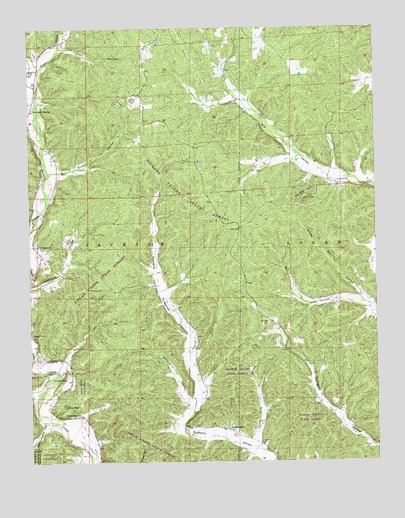
Corridon SE, MO USGS Topographic Map
Click on map above to begin viewing in our Map Viewer.

This topographic map contains these locations and features:
Feature Name Type Latitude Longitude GNIS ID View Map
Adair CreekStreamN37.3573°W91.1221°748556View Map
BedwellPopulated PlaceN37.2684°W91.0193°739920View Map
Buzzard HillSummitN37.3123°W91.0421°730443View Map
Buzzard HillLocaleN37.2773°W91.0257°740341View Map
Callahan HollowValleyN37.2709°W91.1235°749162View Map
Chitwood CemeteryCemeteryN37.2739°W91.1121°715799View Map
Crabtree HollowValleyN37.3006°W91.1249°716449View Map
DagoniaPopulated PlaceN37.3123°W91.1224°739917View Map
Dagonia ChurchChurchN37.3125°W91.1212°716633View Map
Dagonia School (historical)SchoolN37.3120°W91.1243°730444View Map
Dairyville (historical)Populated PlaceN37.3487°W91.0832°739919View Map
DaleyLocaleN37.3170°W91.0493°740089View Map
Dickens School (historical)SchoolN37.2750°W91.0632°747891View Map
Dickens Valley ChurchChurchN37.2592°W91.0537°716882View Map
Dickens Valley State ForestForestN37.3250°W91.0593°742716View Map
Dixon HollowValleyN37.3337°W91.1151°716925View Map
Fruit CityPopulated PlaceN37.2906°W91.0390°740129View Map
Fruit City HollowValleyN37.2551°W91.0443°718266View Map
Fruit City School (historical)SchoolN37.2814°W91.0198°730445View Map
George Spring (historical)SpringN37.2506°W91.1085°739918View Map
Joe Beck SpringSpringN37.3520°W91.1229°720331View Map
John Beck Spring (historical)SpringN37.3312°W91.1210°739916View Map
Logan Creek State ForestForestN37.2648°W91.0929°742922View Map
Lone Cedar SchoolSchoolN37.2648°W91.1185°747890View Map
McDoe Post Office (historical)Post OfficeN37.3703°W91.1179°759760View Map
Nuckols CemeteryCemeteryN37.2870°W91.1248°751364View Map
Oakdale (historical)Populated PlaceN37.3406°W91.0651°740340View Map
Panther HillSummitN37.3259°W91.0268°723995View Map
Radford School (historical)SchoolN37.3709°W91.1149°747889View Map
Rosa PondLakeN37.2664°W91.1129°725554View Map
Santhuff CemeteryCemeteryN37.3309°W91.0140°726053View Map
Schrum HollowValleyN37.2675°W91.0679°726123View Map
Scott PondLakeN37.2642°W91.1085°726152View Map
Snake Den HollowValleyN37.2959°W91.0046°726655View Map
Stall HollowValleyN37.3695°W91.1124°726995View Map
Sutterfield CemeteryCemeteryN37.3628°W91.1246°727346View Map
Sweetwater CreekStreamN37.3184°W91.1249°752465View Map
Township of JacksonCivilN37.3329°W91.1080°767278View Map
Which Church HollowValleyN37.2609°W91.1207°752844View Map

Note: Coordinates in the location and feature list above are referenced to NAD83 datum.


Copyright (C) 2008-2024 Ryan Niemi / Sunset Dynamics ... All Rights Reserved